
Urban sustainability

Discover strategies for sustainable urban development that focus on eco-friendly solutions for cities to thrive while minimizing environmental impact. Most humans now live in cities. The quality of urban life therefore considerably defines the quality of human life. It is predicted that by 2050 about 64% of the developing world and 86% of the developed world will be urbanized.
Today, in Asia the urban agglomerations of Osaka, Karachi, Jakarta, Mumbai, Shanghai, Manila, Seoul, and Beijing are each already home to over 20 million people, while the Pearl River Delta, Delhi and Tokyo are forecast to approach or exceed 40 million people each within the coming decade. Outside Asia, Mexico City, São Paulo, New York City, Lagos, Los Angeles, and Cairo are fast approaching being, or are already, home to over 20 million people. W
News
[edit | edit source] How Paris transformed 300 school streets: a step-by-step guide [Cities4Children], Daily Alternative (Jun 29, 2026)
 - We Don’t Have a Housing Crisis. We Have Something Worse, digbyhall.substack.com (Jun 28, 2026) — The way we’re solving the housing crisis will become our future cities crisis, Digby Hall
- Adapting to the heat: four ideas from European cities, theguardian.com (Jun 26, 2026) — From checking on older neighbours to greening spaces, some cities are stepping up efforts to keep people safe
Video
[edit | edit source]
more video: How to make a Food Forest Suburb Trailer - Guerilla Bench: "Beziehungskiste" - Los Angeles: A History of the Future - Transform Space into Place
Events
[edit | edit source] Sep 19, 2025 (Fri) — Park(ing) day, global, public, participatory project where people across the world temporarily repurpose curbside parking spaces and convert them into public parks and social spaces to advocate for safer, greener, and more equitable streets for people, myparkingday.org
- May 1 - 3, 2026 (Fri - Sun) first weekend of May every year — Jane's Walk, How to Lead a Jane's Walk, Video, janeswalk.org
Community action projects
[edit | edit source]- develop community, town or city wide sustainability groups, which might develop an interest in any sustainable community action topic. Use the Sustainable Comunity Action wiki as a collaborative web page, or pages, for your group.
some more specific examples:
- community steet audits
- community art
- conservation
- develop cohousing schemes
- develop community land trusts
- Ecosystem restoration, see separate article
- encourage rainwater harvesting
- footpath conservation
- Guerilla Bench, intervention to intensify neighbourly relationships, see video below
- if there are tower blocks encourage them to become sustainable tower blocks
- promote Cittaslow, or slow cities
- promote Ecovillages or eco districts
- promote or develop land recycling projects
- promote shared space projects
- promote walkability and walkable comunities
- restoration projects
- self-build
- support city farms
- Transforming derelict buildings
- windmill preservation
- Green roofs
- Green walls
Walkability
[edit | edit source]
Walkability is a measure of how friendly an area is to walking. Walkability has many health, environmental, and economic benefits. Factors influencing walkability include the presence or absence and quality of footpaths, sidewalks or other pedestrian rights-of-way, traffic and road conditions, land use patterns, building accessibility, and safety, among others. Walkability is an important concept in sustainable urban design. W
Benefits of walkable communties
Increased walkability has proven to have many individual and community health benefits, such as opportunities for increased social interaction, an increase in the average number of friends and associates where people live, reduced crime (with more people walking and watching over neighborhoods, open space and main streets), increased sense of pride, and increased volunteerism. One of most important benefits of walkability is the decrease of the automobile footprint in the community. Carbon emissions can be reduced if more people choose to walk rather than drive.
Walkability has also been found to have many economic benefits, including accessibility, cost savings both to individuals and to the public, increased efficiency of land use, increased livability, economic benefits from improved public health, and economic development, among others. The benefits of walkability are best guaranteed if the entire system of public corridors is walkable - not limited to certain specialized routes. The World Cancer Research Fund and American Institute for Cancer Research released a report that new developments should be designed to encourage walking, on the grounds that walking contributes to a reduction of cancer. W
Pedestrian Village

A neighborhood or new town utilizing NP (New pedestrianism) is called a Pedestrian Village. Pedestrian Villages can range from being nearly car-free to having automobile access behind nearly every house and business, but pedestrian lanes are always in front.
To a large extent New Urbanism is a revival of traditional street patterns and urban design. New Pedestrianism also respects traditional town design, but seeks to further reduce the negative impact of the automobile. By eliminating the front street and replacing it with a tree-lined pedestrian lane, emphasis is placed on low-impact alternative travel such as walking and cycling. Eliminating the automobile street from the front allows for intimate scale plazas, fountains, pocket parks, as well as an unspoiled connection to natural features such as lakes, streams, and forests that may border or be included in a Pedestrian Village. A vast public realm is created that is free from the sight, smell, and sound of automobiles, yet automobiles are still served on a separate network. W
Land recycling
[edit | edit source]Land recycling is the reuse of abandoned, vacant, or underused properties for redevelopment or repurposing.
Land recycling aims to ensure the reuse of developed land as part of: new developments; cleaning up contaminated properties; reuse and/or making use of used land surrounded by development or nearby infrastructure. End-uses from land recycling may include: mixed-use, residential, commercial, or industrial developments; and/or public open space such as urban open space use by urban parks, community gardens; or larger open space reserves such as regional parks.
Since many abandoned and underutilized properties lie within economically distressed and disadvantaged communities, land recycling often benefits and stimulates re-investment in historically under-served areas. The real or perceived presence of xenobiotic hazardous substances from historical previous uses or in situ land pollution, causing soil contamination and groundwater pollution, may complicate the redevelopment of such properties. Such environmentally distressed properties, with site cleanup and mitigation considerations, are commonly referred to as brownfields. W
Benefits of land recycling
The social, economic, environmental, and other benefits of land recycling include:
- Social and economic revitalization
- Sustainability
- An alternative to sprawl
- Direction of development to urban cores
- Addressing climate change
Land recycling expresses an inherently sustainable idea, based on the same common-sense as recycling an aluminum can. Like other natural resources, land represents a shared investment that should be reused and recycled, rather than consumed and abandoned after use. Recycling paper saves trees, reusing land saves land.
By encouraging the recycling rather than the consumption of land, land recycling promotes smart growth and responsible, sustainable patterns of development. A 2001 study by George Washington University shows that for every acre of brownfield redeveloped, 4.5 acres (18,000 m2) of undeveloped land is conserved. Public Policies and Private Decisions Affecting the Redevelopment of Brownfields: An Analysis of Critical Factors, Relative Weights and Areal Differentials. As most brownfields and other abandoned sites are typically situated in urban areas, they tap into existing nearby infrastructure, limiting the need to build new roads, gridlines, and amenities, thereby reducing further land consumption. Each infill development prevents sprawl into open space, forests and agricultural land, preserving acres of undeveloped land. W
see also: Ecosystem restoration
Cittaslow
[edit | edit source]Cittaslow is a movement founded in Italy and inspired by the Slow Food organization. Cittaslow's goals include improving the quality of life in towns by slowing down its overall pace, especially in a city's use of spaces and the flow of life and traffic through them. Cittaslow is part of a cultural trend known as the Slow movement. W
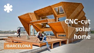
Fab City
[edit | edit source]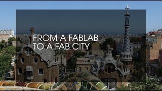
Fab City has been set up to explore innovative ways of creating the city of the future. It focuses on transforming and shaping the way how materials are sourced and used. This transformation should lead to a shift in the urban model from 'PITO to DIDO' that is, 'product-in, trash-out' to, data-in, data-out'. This can eventually transform cities into self-sufficient entities in 2054; in line with the pledge that Barcelona has made.The Fab City links to the fab lab movement, because they make use of the same human capital. The Fab cities make use of the innovative spirit of the users of the fab labs.
Self-build
[edit | edit source]"Self-build" is the practice of creating an individual home for yourself through a variety of different methods. The self-builder's input into this process varies from doing undertaking the actual building work to contracting out all the work to an architect or building package company. The term self build in the UK and Ireland is expressly used when an individual obtains a building plot and then builds his/her own home on that plot. W
Wikihouse
[edit | edit source]WikiHouse is an open-source project for designing and building houses. It endeavours to democratise and simplify the construction of sustainable, resource-light dwellings. The project was initiated in the summer of 2011 by Alastair Parvin and Nick Ierodiaconou of 00, a London-based strategy and design practice, in collaboration with Tav of Espians, James Arthur now with 00 and Steve Fisher of Momentum Engineering. It was launched at the Gwangju Design Biennale in Gwangju, South Korea. The project has since grown to become a worldwide community of contributors. W See also: Urban sustainability UK
Resources
[edit | edit source]Apps for sustainability
[edit | edit source]Walkonomics, maps and rates city streets and neighbourhoods for key walkability factors
Citizens data initiative
[edit | edit source]- Where could a parklet be installed to improve access to green space and give streets back to people and nature? Parklet Plotter from wearepossible.org, added 09:32, 23 September 2022 (UTC)
- According to UN statistics, about 50 per cent of the world’s population is living in cities today,(2007). By 2030 this percentage will be over 60 per cent.[1]
- Of the 3 billion urban dwellers today, 1 billion live in "slums," defined as areas where people cannot secure key necessities such as clean water, a nearby toilet, or durable housing.[2]
- Cement making is responsible for about 7% of annual CO₂ emissions.[3]
Inspiration
[edit | edit source]urb-i, ideas and inspiration for better cities
Quotes
[edit | edit source]Jane Jacobs W, writer and activist
"We need places where we sit on the edges of the public realm and look in the mirror, to be reminded of who we really are." Chuck[4]
"A great high wall there, it tried to stop me
A great big sign there, said ‘private property’
But on the other side, it didn’t say nothing
That side was made for you and me."
Woody Guthrie, This Land Is Your Land
“The freedom to make and remake our cities and ourselves is one of the most precious yet most neglected of our human rights.” David Harvey, The Right to the City[5]
"the habits of urban dwellers will largely determine the health of our ecosystems and the survival of biodiversity"
United Nations Environment Programe[6]Research
[edit | edit source]Eco-Cities, multi-national research network co-ordinated by scholars at the University of Westminster (London), the Johns Hopkins University (Baltimore), and the Lemelson Center for the Study of Invention and Innovation at the Smithsonian Institution (Washington DC).
Other resources
[edit | edit source]

- 101 small ways you can improve your city, Sep 22, 2016 curbed.com
- Being Somewhere - Low Impact Living
- Bioregions: Notes On A Design Agenda, April 23, 2015 thackara.com
- "In myriad projects around the world, a new economy is emerging whose core value is stewardship, not extraction. Growth, in this new story, means soils, biodiversity and watersheds getting healthier, and communities more resilient. These seedlings are cheering, but when it comes to binding diverse groups together around a common agenda, something more is needed. We need a compelling story, and a shared purpose, that people can relate to, and support, whatever their other differences.
- For me, a strong candidate for that connective idea is the bioregion. Beginning with a short reflection on the power of such a story, and what’s already out there, this text describes what the elements of a design agenda for bioregions might be."
- Build the City: perspectives on commons and culture
- City2.0 Resources
- communityplanning.net
- Enabling City, organization that works to advance social innovation as a form of active citizenship, particularly in the areas of urban sustainability and participatory governance.
- Los Angeles: A History of the Future is the first attempt to systematically describe how a metropolitan area could be rebuilt, over decades, toward balance with nature.
- How to Start a Community Land Trust, Shareable, Oct 2013
- Open Building Institute, open source, collaborative and distributed. "Our focus is on low cost and rapidly-built structures that are modular, ecological, and energy efficient."
- Future State of the World 2007: Our Urban Future, Worldwatch Institute, January 2007
- Tactical Urbanism, by the Street Plans Collaborative
- Walkable Communities
- Wikiblock, an open-source toolkit for urban furniture
Past events
[edit | edit source]2015
_Day_Seattle_2009_-_01.jpg)
September 18 - Park(ing) Day
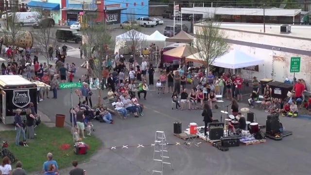
Annual worldwide event where artists, designers and citizens transform metered parking spots into temporary public parks. Always the third Friday in September. Global “open source” project, which has been adapted to address social issues in urban contexts around the world. PARK(ing) Day has expanded to include interventions ranging from free health clinics, urban farming and ecology demonstrations, political seminars, art installations, and free bike repair shops. In 2009 more than 700 Park(ing) Day events were organized 140 cities, in 21 countries on 6 continents. W / parkingday.org
Models and theories of planning and urbanism
[edit | edit source]Although these may be of interest to community groups, much material on these topics, for example on Wikipedia, is often written from the perspective of some 'authority' eg local government, rather than from the perspective of communities and community groups.
Advocacy planning
[edit | edit source]
Advocacy planning is a radical departure from past theoretical models. This model takes the perspective that there are large inequalities in the political system and in the bargaining process between groups that result in large numbers of people unorganized and unrepresented in the process. It concerns itself with ensuring that all people are equally represented in the planning process by advocating for the interests of the underprivileged and seeking social change. Public participation is a central tenet of this model. A plurality of public interests is assumed, and the role of planner is essentially the one as a facilitator who either advocates directly for underrepresented groups directly or encourages them to become part of the process. W
Built environment
[edit | edit source]The "built environment encompasses places and spaces created or modified by people including buildings, parks, and transportation systems." It can also include their supporting infrastructure, such as water supply or energy networks. In recent years, public health research has expanded the definition of "built environment" to include healthy food access, community gardens, "walkability" and "bikability." W
Participatory planning
[edit | edit source]Participatory planning is an urban planning paradigm that emphasizes involving the entire community in the strategic and management processes of urban planning; or, community-level planning processes, urban or rural. It is often considered as part of community development. Participatory planning aims to harmonize views among all of its participants as well as prevent conflict between opposing parties. In addition, marginalized groups have an opportunity to participate in the planning process. W
Placemaking
[edit | edit source]Placemaking is a multi-disciplinary approach to the planning, design and management of public spaces that emphasizes community engagement, human-centered design, and the creation of meaningful, functional, and attractive environments. While placemaking encompasses a variety of methods and scales, it is characterized by improving urban vitality and strengthening place identity through a focus on people above physical structures or buildings.
The term originated in the late 20th century and gained prominence through the work of the nonprofit Project for Public Spaces and their multiple published guidelines and recommendations.
Sustainable urbanism
[edit | edit source]
Sustainable urbanism aims to close the loop by eliminating environmental impact of urban development by providing all resources locally. It looks at the full life cycle of the products to make sure that everything is made sustainably, and sustainable urbanism also brings things like electricity and food production into the city. This means that literally everything that the town or city needs is right there making it truly self-sufficient and sustainable. W
Transactive planning
[edit | edit source]Transactive planning was a radical break from previous models. Instead of considering public participation as method that would be used in addition to the normal training planning process, participation was a central goal. For the first time, the public was encouraged to take on an active role in the policy setting process, while the planner took on the role of a distributor of information and a feedback source. Transactive planning focuses on interpersonal dialogue that develops ideas, which will be turned into action. One of the central goals is mutual learning where the planner gets more information on the community and citizens become more educated about planning issues. W
Urban acupuncture
[edit | edit source]Urban acupuncture is a socio-environmental theory that combines contemporary urban design with the traditional Chinese acupuncture; it uses small-scale interventions to transform the larger urban context. Sites are selected through analysis of aggregate social, economic and ecological factors, and are developed through a dialogue between designers and the community. Just as the practice of acupuncture is aimed at relieving stress in the human body, the goal of urban acupuncture is to relieve stress in the built environment. Urban acupuncture is intended to produce small-scale but socially catalytic interventions in the urban fabric. W
Cities, informal settlements and climate change
[edit | edit source]
Campaigns
[edit | edit source]Earth Day Network's Green Cities campaign
See also Arts, sport and culture, Community involvement, Food activism, Localism, Sharing, for example Sharing#Sharing cities, Livable neighborhoods, Sustainable cities, Commons, Community resources, Community land trust, Urban sustainability by location (category), Category:Living roofs
local information and news can be found, or shared, via our many location pages
External links
- Wikipedia: Built environment, Cittaslow, City region, Green belt, Green roof, Green urbanism, Land recycling, New pedestrianism, New Urbanism, Passive solar building design, Permeability (spatial and transport planning), Right to the city, Spatial planning, Sustainable drainage system, Sustainable urbanism (includes criticism section), Theories and process of urban planning, Urban acupuncture, Urban design, Urbanism, Urbanization, Urban studies and planning (category)
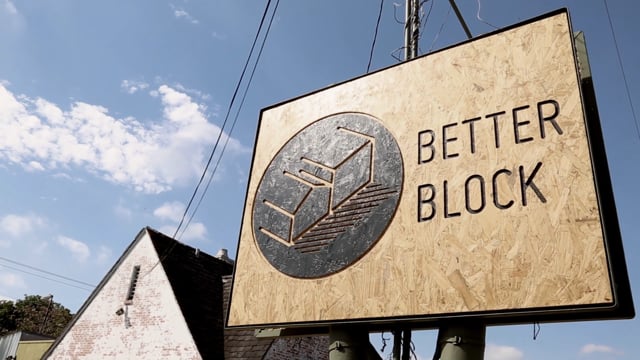
- The Better Block
- Cities for People
- Clear Village, London-based charity that helps communities build a better future through creative regeneration.
- Congress for the New Urbanism, organizing body for New Urbanism W
- Open Building Institute The OBI system is open source, collaborative and distributed. "Our focus is on low cost and rapidly-built structures that are modular, ecological, and energy efficient."
References
- ↑ UN news centre, 23 April 2007
- ↑ Worldwatch Institute, 2007
- ↑ theconversation.com, Mar 22, 2022
- ↑ confronting the urban mirror, August 27, 2011
- ↑ Build the City: perspectives on commons and culture
- ↑ unep.org, October 2013
| Authors | |
|---|---|
| License | CC-BY-SA-3.0 |
| Cite as | Philralph (2010–2025). "Urban sustainability". Appropedia. Retrieved July 21, 2026. |