


Community action/California/Community climate action and ecological restoration

This article is the beginnings of a page for Community action/California in response to Climate emergency and Ecological emergency. The first part focuses on climate action and other sustainability topics with high relevance to carbon reduction for communities. The second part covers environment and ecological restoration topics.
Video
[edit | edit source]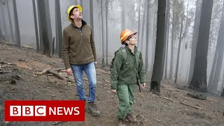

Climate action
[edit | edit source]
CoolCalifornia.org is a website for Californians with resources to help them reduce their impact on the environment and combat climate change. The website is geared towards different audiences, including: individuals, small businesses, local government, youth, community organizations, and schools. The website currently features two carbon footprint calculators. One is for individuals and households and one is for small businesses; a similar tool for local governments is under development.
California has taken a number of legislative steps and extensive measures and initiatives targeted at the broader issue of climate effects seeking to prevent and minimize the risks of possible effects of climate change by a wide variety of incentives, measures and comprehensive plans for clean cars, renewable energy, and pollution controls on industry with overall high environmental standards. California is known for its leading role in the realm of ecoconscious legislature not just on a national level but also globally.
In 2007, the California Legislature enacted AB 32, the Global Warming Solutions Act of 2006, which required the state to reduce greenhouse-gas emissions to 1990 levels by 2020. It tasked the California Air Resources Board (CARB) with developing a Scoping Plan to implement the statute. AB 32 was consistent with Governor Arnold Schwartznegger's 2005 Executive Order S-03-05, which, in addition, required California to reduce its emissions to 80% below 1990 levels by 2050. CARB updated the Scoping Plan in 2014. SB 32, enacted in 2016, set the State's climate goals beyond 2020, requiring a 40% reduction below 1990 levels by 2030 and an 80% reduction by 2050. The CARB 2017 Scoping Plan, detailing how the State will implement SB 32, sets statewide goals for per-capita GHG emissions: they must be reduced to 6 MTCO2e (metric tonnes of carbon-dioxide equivalent) by 2030, and 2 MTCO2e by 2050. CARB's 2022 Scoping Plan continues the implementation of SB 32. W
Sustainable transport activism
[edit | edit source]High Speed Rail: The California High-Speed Rail Authority was created in 1996 by the state to implement an extensive 700 mile (1127 km) rail system. It would provide a TGV-style high-speed link between the state's four major metropolitan areas, and would allow travel between Los Angeles' Union Station and the San Francisco Transbay Terminal in two and a half hours. Voters approved Proposition 1A in November 2008, approving a $9 billion state bond to finance the project. Then in 2012, the California legislature and Governor Jerry Brown approved construction financing for an initial stage of the project. However, the High Speed Rail Authority still estimates that the initial stages will not be completed until 2021. W
Plug-in electric vehicles in California
The stock of plug-in electric vehicles in California is the largest in the United States, and as of December 2023, cumulative plug-in car registrations in the state since 2010 totaled 1.77 million units. Between November 2016 and until 2020, China was the only country market that exceeded California in terms of cumulative plug-in electric car sales.
Hiking trails: Wikipedia:Category:Hiking trails in California (category)
Cycling activism
[edit | edit source]- California Bicycle Coalition
- Davis Bicycles!, 501(c)(3) nonprofit citizen group dedicated to promoting bicycling in Davis, California
- Wikipedia: Bike paths in California (category), Bike paths in Orange County, California (category)
Urban sustainability
[edit | edit source]Biodiversity
[edit | edit source]The ecology of California can be understood by dividing the state into a number of ecoregions, which contain distinct ecological communities of plants and animals in a contiguous region. The ecoregions of California can be grouped into four major groups: desert ecoregions (such as the Mojave Desert), Mediterranean ecoregions (such as the Central Valley), forested mountains (such as the Sierra Nevada), and coastal forests.
- Redwood Coast Land Conservancy, 501(c)(3) California non-profit organization founded in 1992, preserving the natural coastal landscapes and wildlife habitats of southern Mendocino and northern Sonoma counties for the benefit of our community and future generations. added 12:33, 25 January 2024 (UTC)
Deserts
California's high mountains block most moisture from reaching the eastern parts of the state, which are home to California's desert and xeric shrub ecoregions. The low desert of southeastern California is part of the Sonoran desert ecoregion, which extends into Arizona and parts of northern Mexico. California has two high deserts: the Mojave desert and the Great Basin Desert. The Mojave desert ecoregion is marked by the presence of Joshua trees. The dry cold Great Basin desert of California consists of the Owens Valley, and is classified into Great Basin shrub steppe by the WWF, and into the Central Basin and Range ecoregion by the EPA.
The deserts in California receive between 2 and 10 inches (51 and 254 mm) of rain per year. Plants in these deserts are brush and scrub, adapted to the low rainfall. Common plant species include creosote bush, blackbrush, greasewood, saltbush, big sagebrush, low sagebrush, and shadscale. Higher elevations have more precipitation, which allows drought-resistant trees to grow, such as western juniper and pinyon pine. W
Mediterranean ecoregions
The coast of California from Monterey Bay south to the Mexican border, and inland from San Francisco Bay Area to the Sierra Nevada foothills contain California's Mediterranean ecoregions. This region is divided by the WWF into three California chaparral and woodlands ecoregions, plus the Central Valley grasslands. The EPA divides the region between the Central Valley (ecoregion 7), the Southern California chaparral (ecoregion 6), the Southern California mountains (ecoregion 8), and the Southern California coast (ecoregion 85).
The WWF distinguishes between different chaparral ecoregions based on species endemism. In the south, the California coastal sage and chaparral extends across the Mexican border into northwestern Baja California and Los Angeles. The coastal sage ecoregion is notable for having the highest number of native bees in the United States, although much of the ecoregion is now urbanized. The California montane chaparral and woodlands include the Transverse Ranges north of Los Angeles as well as the Santa Lucia Range on the Central Coast. The montane chaparral consists of a mosaic of sage scrub, chaparral, and montane species, depending on altitude. The California interior chaparral and woodlands form a ring around the Central Valley, covering the hills around the Bay Area as well as the foothills of the Sierra Nevada. The interior woodland ecoregion contains several endemic species, due to unique soil types such as serpentine.
These chaparral ecoregions contain numerous plant communities, including oak savanna, oak woodland, conifer woodlands, chamise chaparral, coastal sage scrub, and coastal grassland. These plant communities often occur as a mosaic, caused by fire.
California's Central Valley was once a large temperate grassland containing native bunchgrasses and vernal pools. Grizzly bear, gray wolf, tule elk, and pronghorn antelope used to inhabit the grasslands. The native grasslands and pools have now been largely replaced by livestock ranches and farms. The Carrizo Plain, where the native grass is preserved, is referred to as the "Serengeti of California". W
see also: Trees, woodland and forest
Environment quality
[edit | edit source]Pollution in California relates to the degree of pollution in the air, water, and land of the U.S. state of California. Pollution is defined as the addition of any substance (solid, liquid, or gas) or any form of energy (such as heat, sound, or radioactivity) to the environment at a faster rate than it can be dispersed, diluted, decomposed, recycled, or stored in some harmless form. The combination of three main factors is the cause of notable unhealthy levels of air pollution in California: the activities of over 39 million people, a mountainous terrain that traps pollution, and a warm climate that helps form ozone and other pollutants. Eight of the ten cities in the US with the highest year-round concentration of particulate matter between 2013 and 2015 were in California, and seven out of the ten cities in the US with the worst ozone pollution were also in California. Studies show that pollutants prevalent in California are linked to several health issues, including asthma, lung cancer, birth complications, and premature death. In 2016, Bakersfield, California recorded the highest level of airborne pollutants of any city in the United States.
The Federal Clean Water Act defines water pollution as "dredge spoil, solid waste, incinerator residue, sewage, garbage, sewage sludge, munitions, chemical wastes, biological materials, heat, wrecked or discarded equipment, rock, sand, cellar dirt, and industrial, municipal, and agricultural waste discharged into water." In 2011, an Environmental Protection Agency (EPA) study showed that water quality standards were not met on 1.6 million acres of California's 3 million acres of lakes, bays, wetlands, and estuaries. The Porter-Cologne Water Quality Control Act governs the water quality regulation in California.
There is also an effect on agricultural sector of extreme weather, sea level rise, and wildfires. After the 2024 election there was a change of government interaction with global climate policies. Now in 2025 president Donald Trump withdrew the United States from the Paris Agreement. With Clean Air Act (CAA) there is a limit of certain containment pollutions in efforts to help clean the air. This limits many industrial and chemical plants in the amount of releasing chemical pollutants.
Water purity
Water purity has been an emerging issue in California, especially in communities with low-income residents. Ageing infrastructure, coupled with a lack of research on the topic, has exacerbated this issue, with water health violations occurring in 7–8% of water systems a year. The San Joaquin Valley, a largely rural and agricultural area with 65% residents being people of color, is registered with the most water quality violations. Tulare, a city within San Joaquin Valley, has 99% of its residents relying on compromised groundwater, contrasted with Los Angeles County, with 11% of residents relying only on a contaminated water supply. These water violations often lead to purchased water sources and private ownership of water distribution, as private utilities appear to have larger bandwidth to serve a large population. Trade-offs often include greater inequity in water access, as private utilities face higher repercussions for delivering unsafe water and often decide to opt-out from serving under-resourced populations.
The U.S. Geological Survey analyzed the results of a 2002 study of 10 streams in California and discovered that the Sacramento River had the highest traces of acetaminophen, cholesterol and birth control hormones of any water source in the nation.[citation needed] Pharmaceutical discharge polluted by drug companies are relatively common in California water, with Southern California water tables especially susceptible to contamination. W
Instances of environmental injustice
Instances of environmental injustice include:
- Diabetes in Los Angeles County Latino children
- Proximity of schools to vehicle traffic in Culver City
- Fracking violations in Kern County school zones
- Inequalities in cumulative environmental burdens among three urbanized counties
and
Proposed coal terminal in West Oakland
In February 2016, the city of Oakland publicly announced construction plans for the Oakland Bulk and Oversized Terminal, a bulk exporting facility in West Oakland. As a predominantly Latino and African-American community, the residents of West Oakland live in a community that suffers from dangerous levels of air pollution. The construction of this port and its proposed partnership with Utah's coal-mining counties would rank the city as the lead coal exporter on the West Coast. To fund such a goliath project in the face of strong resistance from city councils fighting to protect their local communities from drastically increasing pollution emissions, Utah state and county officials arranged a controversial $53 million loan. The fund, composed of taxpayer dollars intended for local projects, would allow for the annual shipping of 9 million tons of coal through Oakland and an increase in national coal exports by 19%. A movement by environmental advocates quickly grew, citing that exposure to toxic coal dust would also subject the city's residents to increased risks of bronchitis, pneumonia, heart disease, emphysema, and more.
In response, thousands of Oakland residents and environmental rights activists worked together to prevent the construction of the coal terminal at the former Oakland Army Base. In July 2016, Oakland City Council voted to ban coal from being handled and stored in the City of Oakland. The decision marked a large victory for the newly established Department of Race and Equity, an organization designed to protect Oakland's predominantly African-American community from social and racial disparities. According to the "Toxic Wastes and Race in the United States" report issued by the East Bay Community Foundation, those living in West Oakland already encounter five times more toxic pollution per person than residents of the city of Oakland, and children living in West Oakland are seven times more likely to be hospitalized for asthma than the average child in California. The residents of West Oakland are more likely to face both decreased life expectancy and asthma-related emergency room visits. For a city already bearing a disproportionate amount of environmental burdens, the fight for a coal-free Oakland was a success for proponents of environmental justice. W
Open spaces
[edit | edit source]- Ulistac Natural Area, the only dedicated natural open space in the City of Santa Clara. UNA's 40 acres of undeveloped land along the Guadalupe River, not far from the largest nearby city, San Jose, is a tiny oasis of natural beauty in a giant suburban desert. It's also a work in progress as UNA and its many volunteers attempt to return the tract to pre-colonial condition. The Ohlone, various indigenous peoples, tended the land in the area for up to 3,000 years before European colonization. The name of the preserve is derived from their language. It refers to one past use of the area — a place to weave baskets. "A paradise made even more bountiful by the Ohlone's land management practices." An unrestrained river fed fertile bottom land. Herds of tule elk, pronghorn, and mule deer roamed the grasslands and forests. Streams teemed with salmon, perch, and stickleback. Waterfowl were plentiful and a key Ohlone food source. As is the case today, man and beast enjoyed one of the most hospitable climates on the continent...shareable.net, Neal Gorenflo, November 28, 2020, added 22:10, 1 December 2020 (UTC)
- Greenbelt Alliance
- Pogo Park, Bay Area
Trees, woodland and forest
[edit | edit source]- Sonoma Resource Conservation District, Fire Mitigation and Post-Fire Recovery, information from sonomarcd.org, added 17:43, 15 January 2025 (UTC)
- Friends of Carmel Forest
The Monterey County reforestation refers to efforts in Monterey County, California, to preserve the county's pine forests and urban environment. This one county boasts the native Monterey Pine ecosystem; one of the rarest forest ecosystems in the world. Only a few thousand acres of these endemic trees exist in four locations along the Pacific Ocean on the Central Coast of California. The city of Monterey itself maintains more than 19,000 trees in parks and along streets, as well as about 300 acres (1.2 km2) of Monterey Pine forests.
Forested mountains
The cooler and wetter mountains of northern California are covered by forest ecoregions. Both the WWF and the EPA divide the mountains into three ecoregions: the Sierra Nevada, the Klamath Mountains, and the Eastern Cascades Slopes and Foothills (occurring on the Modoc Plateau).
The Sierra Nevada are home to half of the vascular plant species of California, with 400 species that are endemic to the region.[16] Like many mountain ranges, the plant communities of the Sierra group into biotic zones by altitude, because of the increasingly harsh climate as elevation increases. These biotic zones include montane forest dominated by conifers such as Jeffrey pine and Lodgepole pine, subalpine forest dominated by whitebark pine, up to alpine tundra which cannot support trees. The Sierra are also notable for giant sequoia trees: the most massive on earth.
The Klamath and Siskiyou Mountains are a notable biodiversity hotspot, containing one of the four most biodiverse temperate forests in the world. The diversity is caused by the ecoregion being adjacent to a number of other ecoregions, diverse soil, and having refugia caused by isolation in the last ice age. Some endemic species in the Klamath mountains are limited to only one mountain or valley.
The Eastern Cascades slopes of the Modoc Plateau are characterized by a mosaic of open ponderosa pine forest, grasslands, and shrublands. Although high, these slopes and mountains are in the rain shadow of the Cascade Range, and hence are drier and more open. W
Coastal forests
The coast of California north of San Francisco contains the Northern California coastal forests (as defined by the WWF) and the southern section of the Coast Range ecoregion (as defined by the EPA). This ecoregion is dominated by redwood forest, containing the tallest and some of the oldest trees in the world.
The redwood forests thrive in a thin belt up to 35 miles (56 km) wide next to the coast, where the trees are kept moist by winter rains and summer fog. The redwood forests are also notable for having the highest forest productivity in the world. W
Wetlands
[edit | edit source]

A saltwater marsh is a specific ecosystem with benefits to humans and the environment. A low-lying, nearly level coastal grassland governed by the seasons and the tides, saltwater marshes are one of the most productive areas in the world. They are found on the edges of estuaries which, unlike swamps, are more shallow. Estuaries are the places where rivers meet oceans, and are enjoyed by people for homes, fishing, hunting, swimming, and for wildlife observation. Saltwater marshes have the benefits of filtering estuary water of sediment and toxins and acting as storm surge protection for more diverse upland regions.[1][2]
Arcata's saltwater marshes have been restored so they are not naturally-occurring. However, Arcata's saltwater marsh does contain typical grasses and organisms. Also typical is this ecosystems original destruction by human settlement. Unlike many saltwater marshes, the Arcata/Eureka saltwater marshes aren't used as protection for the inland areas from storm surges because of the protection provided by Humboldt Bay.[3]
References
- ↑ New Hampshire Department of Environmental Services- Coastal Program. Document number WMB-CP-06, 2004. “What is a Salt Marsh?” Weblink: http://web.archive.org/web/20070714015736/http://www.des.state.nh.us/factsheets/cp/cp-06.html
- ↑ Defenders of Wildlife © Copyright 2008. Webpage: Wildlife and Habitat. “Wetlands Factsheet.” Weblink: http://web.archive.org/web/20120226084631/http://www.defenders.org:80/wildlife_and_habitat/habitat/wetlands.php
- ↑ Wikipedia.com: Humboldt Bay http://en.wikipedia.org/wiki/Humboldt_Bay_(United_States)
News and comment
[edit | edit source]2021
The Healing Work of Returning Stolen Lands, PennElys Droz, Nov 15, yesmagazine.org
| Authors | Phil Green |
|---|---|
| License | CC-BY-SA-3.0 |
| Cite as | Phil Green (2021–2026). "Community action/California/Community climate action and ecological restoration". Appropedia. Retrieved November 6, 2026. |