
Community action/South West England

| Map | |
|---|---|
| Location | South West England, United Kingdom |
| Coordinates | 51° 2' 2.40" N, 2° 56' 56.44" W |
The aim of this page is to recognise, celebrate and encourage the self-empowerment of community agency networks (CANs) and community groups' activism for climate, environment and many other sustainability topics across South West England.
News
[edit | edit source] White storks: why introducing non‑native species in rewilding projects can be a good idea, theconversation.com (Jun 05, 2026)
 - Citizens’ Assembly to invest £100,000 in West’s culture, westofengland-ca.gov.uk (Jan 16, 2026)
- ‘We found 23,000 worms!’ The soil project bringing life back to the land, positive.news (Oct 22, 2025)
- May and June heatwaves killed about 2,700 people in England and Wales, data suggests, theguardian.com (Jul 13, 2026) — Extreme heat led to 440 deaths a day during June peak, say scientists, with climate crisis ramping up temperatures
- MPs call on UK government to host televised emergency briefing on climate crisis, theguardian.com (Jul 10, 2026) — As UK swelters in another heatwave, 50-minute Chris Packham film outlines threats to security, economy and health
- Homes need more renewable energy tech – here’s how to make sure retrofits avoid creating e‑waste, theconversation.com (Jul 08, 2026)
- May and June heatwaves killed about 2,700 people in England and Wales, data suggests, theguardian.com (Jul 13, 2026) — Extreme heat led to 440 deaths a day during June peak, say scientists, with climate crisis ramping up temperatures
- Amsterdam, along with other major European cities, bans public adverts for meat and fossil fuels [BBC], Daily Alternative (May 22, 2026)
- How reindeer herds, nature and Sámi culture can thrive when forests are restored across northern Europe, theconversation.com (May 15, 2026)
- As food shocks spread, citizens are showing more leadership than governments, climatechangenews.com (Jul 03, 2026) — People support efforts to protect forests and curb industrial food production, the results of the latest Global Citizens’ Assembly show – but politicians have been slow to act
- Trapped by floods and fearing death in the heat: the Australians taking legal action over the climate crisis, theguardian.com (Jun 22, 2026)
- ‘The sea took everything away’: how Nigeria’s ‘Happy City’ is disappearing beneath the waves, theguardian.com (Jun 18, 2026)
Video
[edit | edit source]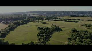
Localism
[edit | edit source]Supporting community business in the South West, powertochange.org.uk, added 10:59, 12 November 2021 (UTC)
Food activism
[edit | edit source]
- Good Food Loop, not-for-profit online wholesale market connecting sustainable producers with like-minded business customers.
- FareShare South West, on facebook, charity working with the food industry, to distribute good quality food, that would have been wasted, to projects involved with vulnerable people across the region...Fareshare Southwest Press Release.
- Surplus Supper Club
Community energy
[edit | edit source]Regen SW, not for profit company working to enable business, local authorities community groups and other organizations to deliver renewable energy and energy efficiency and build a prosperous low-carbon economy in the south west of England.
Towards sustainable economies
[edit | edit source]Social inclusion
[edit | edit source]As measured by the English Indices of Deprivation 2007, the region shows similarities with Southern England in having more Lower Layer Super Output Areas in the 20% least multiple deprived districts than the 20% most deprived. The relative amount of deprivation is similar to the East Midlands, except the South West has many fewer deprived areas. According to the LSOA data in 2007, the most deprived districts (before Cornwall became a unitary authority) were, in descending order: Bristol (64th in England), Torbay (71st), Plymouth (77th), Kerrier (86th), Restormel (89th), North Cornwall (96th), and West Somerset (106th). At county level, the deprived areas are City of Bristol (49th in England), Torbay (55th), Plymouth (58th), and Cornwall and the Isles of Scilly (69th).
The least deprived council districts are, in descending order: East Dorset, North Wiltshire, South Gloucestershire, Cotswold, Kennet, Stroud, Tewkesbury, West Wiltshire, Salisbury, and Bath and North East Somerset. At county level, the least deprived areas, in descending order, are South Gloucestershire, Wiltshire, Bath and North East Somerset, Dorset, Gloucestershire, Poole, North Somerset, and Somerset. For smaller areas, the least-deprived in the region are E01015563 (139th in England) – Shaw and Nine Elms ward, in north Swindon; E01014791 (163rd in England) – Portishead East ward, in North Somerset off the A369 in Portishead and North Weston; E01020377 (184th in England) – Colehill East ward, in East Dorset, east of Wimborne Minster.
In March 2011, the region had the second-lowest unemployment claimant count in England, second to South East England, with 2.7%. Inside the region, Torbay has the highest rate with 4.5%, followed by Bristol and Plymouth with 3.8%. East Dorset has the lowest rate with 1.4%. W
Sustainable transport activism
[edit | edit source]The Kennet and Avon Canal is a waterway in southern England with an overall length of 87 miles (140 km), made up of two lengths of navigable river linked by a canal. The name is used to refer to the entire length of the navigation rather than solely to the central canal section. From Bristol to Bath the waterway follows the natural course of the River Avon before the canal links it to the River Kennet at Newbury, and from there to Reading on the River Thames. In all, the waterway incorporates 105 locks.
The two river stretches were made navigable in the early 18th century, and the 57-mile (92 km) canal section was constructed between 1794 and 1810. In the late 19th and early 20th centuries, the canal gradually fell into disuse after the opening of the Great Western Railway. In the latter half of the 20th century the canal was restored in stages, largely by volunteers. After decades of dereliction and much restoration work, it was fully reopened in 1990. The Kennet and Avon Canal has been developed as a popular heritage tourism destination for boating, canoeing, fishing, walking and cycling, and is also important for wildlife conservation.
Education for sustainability
[edit | edit source]South West Learning for Sustainability Coalition
Trees, woodland and forest
[edit | edit source]The Forest of Avon Trust is the local charity for trees and woodlands in the former county of Avon, which now comprises Bristol, North Somerset, South Gloucestershire, and Bath & North East Somerset.
The Trust's ethos is to deliver the benefits of trees and woodlands to as many people as possible in the Avon area to benefit people and wildlife. It runs wellbeing activities for people with learning disabilities, mental health needs or dementia; it works with schools to plant trees and engage children in the natural world; it supports community groups and young people to improve their local environment; and it works with land owners to care for woodlands and plant new ones. The charity also champions the Forest of Avon Community Forest, working with partners to safeguard existing trees and plant new woodland as part of this.
The Forest of Avon Trust provides accredited Forest School training and has trained 185 Forest School leaders since 2010.
The Forest of Avon Trust currently manages a community woodland near Upton Cheney, South Gloucestershire.
News archive
[edit | edit source]2022-2023
- ‘We can’t afford to wait’: a Cornish town faces climate threat head on, theguardian.com (Dec 14, 2023)
- ‘Dead storage’ and ‘imminent risk to supplies’: documents reveal how England’s water companies struggled in last summer’s heatwaves, unearthed.greenpeace.org (Aug 23, 2023) — Internal briefings expose Environment Agency concerns that reservoir levels could drop so low the water would be untreatable and that companies might break the law
- The Tories are tearing themselves apart over housing – but this is another crisis of their own making, John Harris, The Guardian (Nov 27, 2022)
- Hundreds march in Dorchester in protest at housing plans, BBC News (Apr 03, 2022) — protest at plans to build 4,000 houses on open land and "desecrate" the Thomas Hardy countryside
About South West England
[edit | edit source]Campaigns
- saveyourgreenbelt.co.uk, added 15:04, 25 September 2023 (UTC)
Past events
- Jun 11 - 25, 2016, Festival of Nature, Bristol to Bath
South West England, or the South West of England, is one of the nine official regions of England in the United Kingdom. Additionally, it is one of four regions that altogether make up Southern England. South West England consists of the counties of Cornwall (including the Isles of Scilly), Dorset, Devon, Bristol, Gloucestershire, Somerset and Wiltshire. Cities and large towns in the region include Bath, Bristol, Bournemouth, Cheltenham, Exeter, Gloucester, Plymouth and Swindon. It is geographically the largest of the nine regions of England with a land area of 9,203 square miles (23,836 km2), but the third-least populous, with an estimated 5,889,695 residents in 2024.
The region includes the West Country and much of the ancient kingdom of Wessex. It includes two entire national parks, Dartmoor and Exmoor (a small part of the New Forest is also within the region); and four World Heritage Sites: Stonehenge, the Cornwall and West Devon Mining Landscape, the Jurassic Coast and the City of Bath. The northern part of Gloucestershire, near Chipping Campden, is as close to the Scottish border as it is to the tip of Cornwall. The region has by far the longest coastline of any English region.
Near you
[edit | edit source]Bristol - Bath - Frome - Plymouth - Totnes / Cornwall - Devon - Dorset - Gloucestershire - Somerset - Wiltshire
| Authors | Phil Green |
|---|---|
| License | CC-BY-SA-3.0 |
| Cite as | Philralph (2014–2025). "Community action/South West England". Appropedia. Retrieved July 15, 2026. |