
Community action/Dumfries and Galloway

| Map | |
|---|---|
| Location | Dumfries and Galloway, Scotland |
| Coordinates | 55° 5' 0.00" N, 3° 50' 0.00" W |
The aim of this page is to recognise, celebrate and encourage the self-empowerment of community agency networks (CANs) and community groups' activism for climate, environment and many other sustainability topics across Dumfries and Galloway.
News
[edit | edit source] 'We saved a 200-year-old pub in a forgotten part of Scotland', BBC News (Apr 13, 2025)
- A mecca for rewilders: the community-led project restoring Scotland’s southern uplands, theguardian.com (Mar 20, 2024)
- The Scottish Gaelic concept of Dúthchas urges that people and nature are deeply entangled. Let it guide the path to land reform, Daily Alternative (Feb 25, 2024)
Video
[edit | edit source]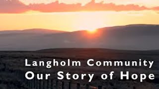
Food activism
[edit | edit source]- Galloway Food Hub, local, producer-led, online farmers marketplace. added 16:01, 31 March 2025 (UTC)
Arts, sport and culture
[edit | edit source]Dumfries and Galloway is well known for its arts and cultural activities as well as its natural environment. The major festivals include the region-wide Dumfries & Galloway Arts Festival, and Spring Fling Open Studios. Other festivals include Big Burns Supper in Dumfries and the Wigtown Book Festival in Wigtown – Scotland's national book town.
Walking and cycling
[edit | edit source]There are five 7Stanes mountain biking centres in Dumfries and Galloway at Dalbeattie, Mabie, Ae, Glentrool and Kirroughtree. The Sustrans Route 7 long distance cycle route also runs through the region. There is excellent hill walking in the Moffat Hills, Lowther Hills the Carsphairn and Scaur Hills and Galloway Hills. The Southern Upland Way coast to coast walk passes through Dumfries and Galloway and the 53-mile long Annandale Way travels from the Solway Firth into the Moffat hills near the Devil's Beef Tub. There is also fresh water sailing on Castle Loch at Lochmaben and at various places on Loch Ken Loch Ken also offers waterskiing and wakeboarding. The Solway Firth coastline offers fishing, caravaning and camping, walking and sailing.
Urban sustainability
[edit | edit source]- Midsteeple Quarter, added 16:44, 26 February 2021 (UTC)
Biodiversity
[edit | edit source]The region is known as a stronghold for several rare and protected species of amphibian, such as the Natterjack toad and the Great crested newt. There are also RSPB Nature Reserves at the Mull of Galloway, Wood of Cree (Galloway Forest Park), Ken Dee Marshes (near Loch Ken) and Mereshead (near Dalbeattie on the Solway Firth)
Rewilding
[edit | edit source]- Carrifran Wildwood, bordersforesttrust.org, one of the UK’s first community-led rewilding projects. First trees were planted on 1 January 2000. Patches of habitat resembling Scotland’s primeval forest are staging a comeback, showing what large parts of this land could be: a sink for climate-heating carbon, a flood-mitigating sponge for freshwater; a generator of biodiversity, and a source of wonder, identity and hope for people, locally and globally...theguardian.com, 20 March, 2024; Carrifran Wildwood W, added 11:12, 29 March 2024 (UTC)
- Tarras Valley Nature Reserve
- Langholm Initiative, one of south Scotland's earliest development trusts and community anchor organisation for Eskdale, added 08:59, 28 December 2023 (UTC)
Rivers
[edit | edit source]Dumfries and Galloway (Scots: Dumfries an Gallowa; Scottish Gaelic: Dùn Phris is Gall-Ghàidhealaibh) is one of the 32 unitary council areas of Scotland, situated in the western part of the Southern Uplands. It is bordered by East Ayrshire, South Ayrshire, and South Lanarkshire to the north; the Scottish Borders to the northeast; and the English county of Cumbria, the Solway Firth, and the Irish Sea to the south. To the west, it faces the North Channel.
News archive
[edit | edit source]- A community-buyout in the South of Scotland has taken land from the Duke of Buccleuch, and pointed it towards rewilding, The Daily Alternative (Oct 17, 2022)
- Hazel Sheffield tells stories of communities ambitiously owning their own assets, like Portpatrick Harbour in Scotland, Daily Alternative (Jul 30, 2019)
About Dumfries and Galloway
[edit | edit source]Dumfries and Galloway (Scots: Dumfries an Gallowa; Scottish Gaelic: Dùn Phris is Gall-Ghàidhealaibh) is one of the 32 unitary council areas of Scotland, situated in the western part of the Southern Uplands. It is bordered by East Ayrshire, South Ayrshire, and South Lanarkshire to the north; the Scottish Borders to the northeast; and the English county of Cumbria, the Solway Firth, and the Irish Sea to the south. To the west, it faces the North Channel.
| Authors | Phil Green |
|---|---|
| License | CC-BY-SA-3.0 |
| Cite as | Philralph (2024–2026). "Community action/Dumfries and Galloway". Appropedia. Retrieved July 10, 2026. |