
Community action/Swale

The aim of this page is to recognise, celebrate and encourage the self-empowerment of community agency networks (CANs) and community groups' activism for climate, environment and many other sustainability topics across Swale.
News
[edit | edit source]- Mum's war on plastic waste, Jan 25, 2018...kentonline.co.uk
 Hedgerows the 'unsung heroes of the countryside', BBC News (Feb 16, 2026) — A group of Kent volunteers is aiming to provide vital habitat for wildlife by planting about 3,800 yards (3,500m) of hedgerows in the countryside this year.
- ‘To live a normal life again, it’s a dream come true’: UK’s first climate evacuees can cast off their homes and trauma, theguardian.com (Feb 09, 2026)
- Behind the scenes as GPs face 'tidal wave of demand', BBC News (Jan 22, 2026)
- May and June heatwaves killed about 2,700 people in England and Wales, data suggests, theguardian.com (Jul 13, 2026) — Extreme heat led to 440 deaths a day during June peak, say scientists, with climate crisis ramping up temperatures
- MPs call on UK government to host televised emergency briefing on climate crisis, theguardian.com (Jul 10, 2026) — As UK swelters in another heatwave, 50-minute Chris Packham film outlines threats to security, economy and health
- Homes need more renewable energy tech – here’s how to make sure retrofits avoid creating e‑waste, theconversation.com (Jul 08, 2026)
- May and June heatwaves killed about 2,700 people in England and Wales, data suggests, theguardian.com (Jul 13, 2026) — Extreme heat led to 440 deaths a day during June peak, say scientists, with climate crisis ramping up temperatures
- Amsterdam, along with other major European cities, bans public adverts for meat and fossil fuels [BBC], Daily Alternative (May 22, 2026)
- How reindeer herds, nature and Sámi culture can thrive when forests are restored across northern Europe, theconversation.com (May 15, 2026)
- As food shocks spread, citizens are showing more leadership than governments, climatechangenews.com (Jul 03, 2026) — People support efforts to protect forests and curb industrial food production, the results of the latest Global Citizens’ Assembly show – but politicians have been slow to act
- Trapped by floods and fearing death in the heat: the Australians taking legal action over the climate crisis, theguardian.com (Jun 22, 2026)
- ‘The sea took everything away’: how Nigeria’s ‘Happy City’ is disappearing beneath the waves, theguardian.com (Jun 18, 2026)
Video
[edit | edit source]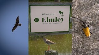
Networks and sustainability initiatives
[edit | edit source]- Sheppey is Ours!, a Citizens Action Network (CAN) designed to bring the local community together. added 17:01, 14 December 2020 (UTC), link checked 09:46, 30 January 2022 (UTC)
Communities online
[edit | edit source]- Sittingbourne.Me, added 16:17, 21 May 2021 (UTC)
Food
[edit | edit source]Brogdale Farm is home to the National Fruit Collection, one of the largest collections of fruit trees and plants in the world. Spread over 150-acre (61 ha) it hosts the collection since it moved from Wisley in 1952. In the 1980s, the Government cut funding to the site, with closure threatened by March 1990. In response, the Brogdale Horticultural Trust took over co-ownership of the farm with Wye College. It has been the home of Faversham miniature railway since 2001.
The farm runs regular fruit-themed festivals throughout the summer and autumn:
- the Cherry Festival in July
- the Cider Festival in August
- the Apple Festival in October.
During the fairs, visitors can explore the orchards and several experts give talks on the produce.
Community resources
[edit | edit source]Climate action
[edit | edit source]- Swale Friends of the Earth
- Faversham Youth Climate Panel, added 21:31, 18 October 2021 (UTC)
Sustainable transport
[edit | edit source]Maps
- Explore The Isle of Sheppey Walking & Cycling Map, explorekent.org
Cycling
[edit | edit source]National Cycle Route 1 passes through Faversham, en route from Whitstable to Sittingbourne. W
Biodiversity
[edit | edit source]- Sheppey Wildlife on facebook.com
- elmleynaturereserve.co.uk
Environment quality
[edit | edit source]- Plastic Free Faversham, community group run by volunteers with the aim of raising awareness about the overuse of single-use plastic and other ecological issues.
Wetlands
[edit | edit source]The North Kent Marshes have been recognised as one of the most important natural wetlands in northern Europe, and they are monitored by local landowners and wildlife custodians. According to the RSPB, up to 300,000 migrant birds use the mudflats of the Thames marshes as a haven each year in their migratory journeys between the Arctic and Africa. The marshes serve as emergency natural flood protection for London. W
Oare Marshes is a 71.4-hectare (176-acre) Local Nature Reserve north of Faversham in Kent. It is owned and managed by Kent Wildlife Trust. It is part of The Swale Nature Conservation Review site, Grade I, National Nature Reserve, Ramsar internationally important wetland site, Special Protection Area under the European Union Directive on the Conservation of Wild Birds, and Site of Special Scientific Interest.
South Swale is a 410.5-hectare (1,014-acre) Local Nature Reserve (as South Bank of the Swale) north of Faversham in Kent. It is owned by Kent County Council and managed by Kent Wildlife Trust. It is part of The Swale Ramsar site, Special Protection Area and Site of Special Scientific Interest
The Saxon Shore Way public footpath follows the top of the sea wall for the entire length of the reserve, around the village of Graveney, for about 3 miles in total.
Coasts
[edit | edit source]Medway Swale Estuary Partnership
About Swale
[edit | edit source]Campaigns
- Scheme for thousands of new houses near Sittingbourne would have devastating impact on countryside (and it's not even in the Local Plan), cprekent.org.uk, added 15:45, 24 September 2021 (UTC)
Swale is a local government district with borough status in Kent, England. The council is based in Sittingbourne, the borough's largest town. The borough also contains the towns of Faversham, Queenborough and Sheerness, along with numerous villages and surrounding rural areas. It includes the Isle of Sheppey and is named after The Swale, the narrow channel which separates Sheppey from the mainland part of the borough. Some southern parts of the borough lie within the Kent Downs, a designated Area of Outstanding Natural Beauty.
The borough borders the Medway unitary authority area to the west, the Borough of Maidstone to the south-west, the Borough of Ashford to the south-east, and the City of Canterbury to the east. Under proposed reorganisation in either April 2027 or 2028 the borough will face abolition and will join with one or more adjoining councils to form a new Unitary Authority. Details of such proposals are currently expected in Summer/Autumn 2026.
Near you
[edit | edit source]Ashford - Canterbury - Maidstone - Medway
See also
[edit | edit source]- Towards a more democratic and climate friendly way of meeting housing need across England
- London and South East England
- Saving water in South East England
| Authors | Phil Green |
|---|---|
| License | CC-BY-SA-3.0 |
| Cite as | Philralph (2022–2025). "Community action/Swale". Appropedia. Retrieved July 15, 2026. |