
Community action/Shropshire

| Map | |
|---|---|
| Location | Shropshire, West Midlands |
| Coordinates | 53° 0' 47.43" N, 2° 31' 29.08" W |
The aim of this page is to recognise, celebrate and encourage the self-empowerment of community agency networks (CANs) and community groups' activism for climate, environment and many other sustainability topics across Shropshire.
News
[edit | edit source] Community Covenants: Redefining local power in Market Drayton, right-here.org (May 01, 2026) — (date not found)
- ‘Fear of the next deluge’: flood-scarred Britons join forces to demand help, theguardian.com (Jan 12, 2026)
- How community projects are building a brighter future for British farms, wickedleeks.riverford.co.uk (Nov 11, 2025)
- Rights of Nature movement grows, with the Wye and Ouse subject to new protection charters, wickedleeks.riverford.co.uk (Jun 18, 2026) — Nature sits at the heart of several new sets of rights and charters; it’s even headlining a festival this summer. Is the way that we view and value Nature within our political and cultural frameworks at a turning point? asks Hannah Marsh
- The English community that brought its river back from the brink: ‘If we can get it right here, we can do it everywhere’, theguardian.com (May 20, 2026)
- How volunteers are saving the River Wye with citizen science, cpre.org.uk (Mar 30, 2026)
- Climate Change Advocacy in Libraries: Practices, Challenges and Future Research Directions, tandfonline.com (Jul 15, 2026) — libraries have significant potential to move beyond operational sustainability and become stronger agents of climate resilience and public climate action. Oladokun, B. D., Obim, I. E., Olatunbosun, I. E., Enakrire, R. T., Ajani, Y. A., & Ebhonu, S. I. (2026).
- England risks building new ‘death traps’ as experts warn of overheating crisis, theguardian.com (Jul 14, 2026) — Vulnerable people more at risk as research finds only half of local authority plans require cooling strategies
- May and June heatwaves killed about 2,700 people in England and Wales, data suggests, theguardian.com (Jul 13, 2026) — Extreme heat led to 440 deaths a day during June peak, say scientists, with climate crisis ramping up temperatures
- May and June heatwaves killed about 2,700 people in England and Wales, data suggests, theguardian.com (Jul 13, 2026) — Extreme heat led to 440 deaths a day during June peak, say scientists, with climate crisis ramping up temperatures
- Adapting to the heat: four ideas from European cities, theguardian.com (Jun 26, 2026) — From checking on older neighbours to greening spaces, some cities are stepping up efforts to keep people safe
- European heatwave is worst ever and impossible without climate crisis, scientists say, theguardian.com (Jun 26, 2026) — Study also finds high humidity means people in hundreds of cities are enduring their worst ever heat stress
- How can technology strengthen citizens’ capacities? By relating the "seven muscles of deliberation" to AI [DemocracyNext], Daily Alternative (Jul 06, 2026)
- As food shocks spread, citizens are showing more leadership than governments, climatechangenews.com (Jul 03, 2026) — People support efforts to protect forests and curb industrial food production, the results of the latest Global Citizens’ Assembly show – but politicians have been slow to act
- We Don’t Have a Housing Crisis. We Have Something Worse, digbyhall.substack.com (Jun 28, 2026) — The way we’re solving the housing crisis will become our future cities crisis, Digby Hall
Networks and sustainability initiatives
[edit | edit source]- Green Shropshire Xchange
- Newport 21, Action for a greener Newport Shropshire
UK and international events
[edit | edit source]UK events
 Jul 1 - 14, 2026 (Wed - Tue) — Community Energy Fortnight, communityenergyengland.org
- Jul 02, 2026 (Thu) — Cycle to Work Day, cyclescheme.co.uk
- Jul 17 - Aug 9, 2026 (Fri - Sun) — Big Butterfly Count, bigbutterflycount.butterfly-conservation.org
- Jul 19 - 25, 2026 (Sun - Sat), The theme for 2026 is JOY — Community Centre Week, octopuscommunities.org.uk
- Jul 24 - Aug 2, 2026 (Fri - Sun) — Love Parks Week, Keep Britain Tidy
Global or international events
- July 2026 — Plastic Free July, plasticfreejuly.org
- Jul 04, 2026 (Sat) — International Day of Cooperatives (CoopsDay), 1st Saturday of July. The celebration aims to showcase co-operatives’ role in building ‘inclusive, resilient, and sustainable communities’, coopsday.coop
- Jul 18, 2026 (Sat) — Mandela Day, global celebration 18 July annually, to honour the life and legacy of Nelson Mandela. A call to action for individuals, communities, and organisations to take time to reflect on Mandela's values and principles and to make a positive impact in their own communities, mandeladay.com
2021-2030, UN Decade on Ecosystem Restoration, International community action events
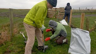
CDC videos
[edit | edit source]Each week 3 different short videos from across the UK or world.
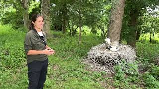
Community action/Essex, Community action/West Sussex, Community action/Argyll and Bute / ...This week's featured Global videos / ... read more about Cosmolocalism
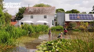
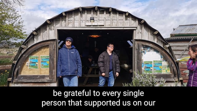
Shropshire video
[edit | edit source]

Localism
[edit | edit source]Food activism
[edit | edit source]- Shropshire Good Food Partnership, bring people together to create a local food system which is good for people, place and the planet. "Our Vision is for regenerative food, farming and land-use systems." "We provide a go to place for individuals and groups to access support and engage in networking on all aspects of setting up and managing community-based food growing, cooking and sharing initiatives." added 17:17, 22 March 2025 (UTC)
- Fordhall Organic Farm and Community Land Initiative
- Shropshire Food Poverty Alliance, consortium of organizations committed to working together to tackle food poverty in Shropshire. added 16:25, 9 April 2021 (UTC)
- Shrewsbury Food Hub added 16:25, 9 April 2021 (UTC)
- Slow Food Ludlow Marches
Community energy
[edit | edit source]Lightfoot Energy Service, Community Interest Company based in Bishops Castle
Community resources
[edit | edit source]Live Well Telford, [1], all age online community directory
Reduce, reuse, repair and recycle
[edit | edit source]Telford Repair Cafe, livewell.telford.gov.uk
Climate action
[edit | edit source]- Telford and-Wrekin Borough Climate Change Partnership, sustainabletelfordandwrekin.com, added 16:02, 16 September 2024 (UTC)
Sustainable transport activism
[edit | edit source]Three British Waterways canals run through Shropshire: the Shropshire Union Canal (from north of Adderley to near Knighton), the Llangollen Canal (from Chirk Aqueduct to Grindley Brook) and the Montgomery Canal (from its beginning at Frankton Junction to Llanymynech). In addition, the Shrewsbury and Newport Canal potentially could be restored in the future.W
Open spaces
[edit | edit source]The Shropshire Hills National Landscape is a designated National Landscape in Shropshire, England. It is located in the south of the county, extending to its border with Wales. Designated in 1958, the area encompasses 802 square kilometres (310 sq mi) of land primarily in south-west Shropshire, taking its name from the upland region of the Shropshire Hills. The A49 road and Welsh Marches Railway Line bisect the area north–south, passing through or near Shrewsbury, Church Stretton, Craven Arms and Ludlow.
News archive
[edit | edit source]- ‘No gear, all the ideas’: the farming collective offering up land to sustainable businesses, positive.news (Oct 28, 2024)
- 'Climate change goal will be met by 2030' says Telford and Wrekin Council concerning its target for its operations to become carbon neutral by 2030, BBC News (Sep 13, 2024)
- ‘Darwin’s oak’ to be felled to make way for Shrewsbury bypass, theguardian.com (Nov 01, 2023)
About Shropshire
[edit | edit source]Shropshire (; abbreviated Salop) is a ceremonial county in the West Midlands of England, on the border with Wales. It is bordered by Cheshire to the north-east, Staffordshire to the east, Worcestershire to the south-east, Herefordshire to the south, and the Welsh principal areas of Powys and Wrexham to the west and north-west respectively. The largest settlement is Telford, while Shrewsbury is the county town.
Shropshire has an area of 3,487 km2 (1,346 square miles) and had an estimated population of 528,407 in 2024. Telford in the east and Shrewsbury in the centre are the largest towns. Shropshire is otherwise rural, and contains market towns such as Oswestry in the north-west, Market Drayton in the north-east, Bridgnorth in the south-east, and Ludlow in the south. For local government purposes the county comprises the unitary authority areas of Shropshire and Telford and Wrekin. The county historically had a large exclave around Halesowen and Oldbury, which are now in the West Midlands county.
Shropshire is one of England's most rural and sparsely populated counties, with a population density of 136/km2 (350/sq mi).
| Authors | Phil Green |
|---|---|
| License | CC-BY-SA-3.0 |
| Cite as | Philralph (2014–2026). "Community action/Shropshire". Appropedia. Retrieved July 19, 2026. |