
Community action/Cumbria

The aim of this page is to recognise, celebrate and encourage the self-empowerment of community agency networks (CANs) and community groups' activism for climate, environment and many other sustainability topics across Cumbria.
News
[edit | edit source] How restoring rivers' natural curves can prevent flooding, BBC Future (Sep 19, 2024)
 - Whitehaven coal mine plan quashed by High Court, BBC News (Sep 13, 2024)
- Cumbria coalmine was unlawfully approved, government says, theguardian.com (Jul 11, 2024)
- E-bikes are freewheeling through rain and over hills, with huge promise for sustainable transport in rural tourist areas, theconversation.com (Feb 06, 2024)
- Young Atlantic salmon seen in three English rivers for first time in a decade, theguardian.com (Dec 30, 2025)
- Drought declared in north-west England amid declining reservoir levels, theguardian.com (May 29, 2025)
- Whitehaven coal mine plan quashed by High Court, BBC News (Sep 13, 2024)
- May and June heatwaves killed about 2,700 people in England and Wales, data suggests, theguardian.com (Jul 13, 2026) — Extreme heat led to 440 deaths a day during June peak, say scientists, with climate crisis ramping up temperatures
- MPs call on UK government to host televised emergency briefing on climate crisis, theguardian.com (Jul 10, 2026) — As UK swelters in another heatwave, 50-minute Chris Packham film outlines threats to security, economy and health
- Homes need more renewable energy tech – here’s how to make sure retrofits avoid creating e‑waste, theconversation.com (Jul 08, 2026)
- May and June heatwaves killed about 2,700 people in England and Wales, data suggests, theguardian.com (Jul 13, 2026) — Extreme heat led to 440 deaths a day during June peak, say scientists, with climate crisis ramping up temperatures
- Amsterdam, along with other major European cities, bans public adverts for meat and fossil fuels [BBC], Daily Alternative (May 22, 2026)
- How reindeer herds, nature and Sámi culture can thrive when forests are restored across northern Europe, theconversation.com (May 15, 2026)
- As food shocks spread, citizens are showing more leadership than governments, climatechangenews.com (Jul 03, 2026) — People support efforts to protect forests and curb industrial food production, the results of the latest Global Citizens’ Assembly show – but politicians have been slow to act
- Trapped by floods and fearing death in the heat: the Australians taking legal action over the climate crisis, theguardian.com (Jun 22, 2026)
- ‘The sea took everything away’: how Nigeria’s ‘Happy City’ is disappearing beneath the waves, theguardian.com (Jun 18, 2026)
Networks and sustainability initiatives
[edit | edit source]UK and international events
[edit | edit source]UK events
 Jul 1 - 14, 2026 (Wed - Tue) — Community Energy Fortnight, communityenergyengland.org
- Jul 02, 2026 (Thu) — Cycle to Work Day, cyclescheme.co.uk
- Jul 17 - Aug 9, 2026 (Fri - Sun) — Big Butterfly Count, bigbutterflycount.butterfly-conservation.org
- Jul 19 - 25, 2026 (Sun - Sat), The theme for 2026 is JOY — Community Centre Week, octopuscommunities.org.uk
- Jul 24 - Aug 2, 2026 (Fri - Sun) — Love Parks Week, Keep Britain Tidy
Global or international events
- July 2026 — Plastic Free July, plasticfreejuly.org
- Jul 04, 2026 (Sat) — International Day of Cooperatives (CoopsDay), 1st Saturday of July. The celebration aims to showcase co-operatives’ role in building ‘inclusive, resilient, and sustainable communities’, coopsday.coop
- Jul 18, 2026 (Sat) — Mandela Day, global celebration 18 July annually, to honour the life and legacy of Nelson Mandela. A call to action for individuals, communities, and organisations to take time to reflect on Mandela's values and principles and to make a positive impact in their own communities, mandeladay.com
2021-2030, UN Decade on Ecosystem Restoration, International community action events
CDC video
[edit | edit source]Each week 3 different short videos from across the UK or world.
Rural sustainability UK, Community energy UK, Community action/Argyll and Bute / ...This week's featured Global videos / ... read more about Cosmolocalism
Cumbria video
[edit | edit source]
Housing
[edit | edit source]- Fairer housing, stronger communities, campaign aims to support local communities in the Lake District by reducing the amount of empty and under-used homes, and increasing the number of houses occupied by full-time, permanent residents. added 16:30, 4 April 2026 (UTC)
Community resources
[edit | edit source]Community run pubs:
- Lyvennet Community Pub, Eden
- The Old Crown, Hesket Newmarket
Climate action
[edit | edit source]- Zero Carbon Cumbria, hub for carbon reduction action across the county. A net zero carbon county by 2037, added 15:19, 15 January 2026 (UTC)
- Cumbria Climate Assembly, zerocarboncumbria.co.uk, added 15:19, 15 January 2026 (UTC)
- Copeland People’s Panel on Climate Change, copeland.gov.uk, added 15:44, 5 January 2022 (UTC)
- Furness Climate Change Citizens’ Jury, Nov 2021 - Feb 2022...barrowbc.gov.uk. Barrow Borough Council unveiled its ambition for the borough to become carbon neutral by 2037 in its Climate Change Policy and Action Plan, published in 2020. added 09:58, 5 January 2022 (UTC)
- Kendal Climate Citizens' Jury, "the UK's first ever Climate Change Citizens' Jury at town level"
- South Lakes Action on Climate Change
Biodiversity
[edit | edit source]Cumbria Wildlife Trust - Westmorland Red Squirrel Society
Rewilding
[edit | edit source]Wild Ennerdale, shaping the landscape naturally, added 15:57, 8 February 2022 (UTC)
Open spaces
[edit | edit source]Fix the Fells - Friends of Blencathra - Green Heart Den, user friendly urban oasis in which people can relax in and enjoy, possibly taking part in a range of activities and visiting again and again, Barrow-in-Furness
Trees, woodland and forest
[edit | edit source]News archive
[edit | edit source]- ‘Real’ public engagement must be prioritised for path to net zero to succeed, climateoutreach.org (Sep 05, 2023) — the UPPER Coalition Reports include examples of successful co-designing and collaboration with local citizens, including Camden Think & Do’s programme, Kendal’s Climate Jury, and initiatives in Hull and Hackney
- Locals in this British seaside town could revolutionise green energy – if the government lets them, Rebecca Willis, professor of energy and climate governance at Lancaster University, theguardian.com (Jul 18, 2023)
- Endangered marsh fritillary butterfly makes a comeback in Lake District, The Guardian (Jun 26, 2023)
- The shop where the currency is kindness, positive.news (May 16, 2023)
Kendal underlines the importance of community-led climate action, Jun 25, 2021...sharedfuturecic.org.uk
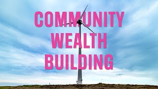
- New £75,000 community energy fund up for grabs in Cumbria, Sep 23, 2020... cumbriacrack.com
- Community fight against coal in Cumbria, Sep 23, 2020... @friends_earth
- Cumbria's first wholly community-owned hydro-electric power plant was officially opened yesterday, Jan 5, 2017... cumbriacrack.com
- One million cubic metres of waste near Sellafield housed at a site that was a mistake, admits Environment Agency, April 20, 2014... The Guardian
About Cumbria
[edit | edit source]'Past events
- June 8, 2014, Fix the Fells Volunteering Day
Campaigns
Cumbrians Opposed to a Radioactive Environment
Cumbria ( KUM-bree-ə) is a ceremonial county in North West England. It borders the Scottish council areas of Dumfries and Galloway and Scottish Borders to the north; the English ceremonial counties of Northumberland and County Durham to the east, North Yorkshire to the south-east, and Lancashire to the south; and the Irish Sea to the west. Its largest settlement is the city of Carlisle.
Cumbria is predominantly rural, with an area of 6,769 km2 (2,614 sq mi) and an estimated population of 510,680 in 2024. Carlisle is in the north of the county; the towns of Workington and Whitehaven lie on the west coast, Barrow-in-Furness on the south coast, and Penrith and Kendal in the east. For local government purposes the county comprises two unitary authority areas, Westmorland and Furness and Cumberland, the councils of which collaborate through the Cumbria Combined Authority. Cumbria was created in 1974 from the historic counties of Cumberland and Westmorland, the Furness area of Lancashire, and a small part of Yorkshire.
The interior of Cumbria contains several upland areas. Together they fringe the Vale of Eden, the wide valley of the River Eden, which runs south-east to north-west across the county and broadens into the Solway Plain near Carlisle. To the north-east are part of the Border Moors, and to the east part of the North Pennines; the latter have been designated a national landscape. South of the vale are the Orton Fells, Howgill Fells, and part of the Yorkshire Dales, which are all within the Yorkshire Dales national park. The south-west contains the Lake District, a large upland area which has been designated a national park and UNESCO World Heritage Site. It includes England's highest mountain, Scafell Pike; its longest and largest lake, Windermere; and its deepest lake, Wast Water. The county has a long coast to the west which is bordered by a plain for most of its length. The north-west coast is part of the Solway Firth, a national landscape, and the south coast includes the Cartmel and Furness peninsulas. East of the peninsulas, the county contains part of Arnside and Silverdale, another national landscape.
| Authors | Phil Green |
|---|---|
| License | CC-BY-SA-3.0 |
| Cite as | Philralph (2014–2026). "Community action/Cumbria". Appropedia. Retrieved July 15, 2026. |