
Community action/Tanzania
.jpg)
The aim of this page is to recognise, celebrate and encourage the self-empowerment of community agency networks (CANs) and community groups' activism for climate, environment and many other sustainability topics across Tanzania.
News
[edit | edit source] Where the wild things thrive: Finding and protecting nature’s climate change safe havens, theconversation.com (Dec 17, 2025)
 - Tanzanian community-led innovation wins global award for boosting conservation, news.mongabay.com (Dec 16, 2025)
- ‘Solar Mamas empower our people by giving them electricity’: the women lighting up Zanzibar, theguardian.com (Jan 15, 2025)
- Young South Africans take up sustainable agriculture for food security, climatechangenews.com (Jun 02, 2026) — Aquaponics is seeing a revival in South Africa’s schools, boosted by government support and climate concerns
- Introducing Katcha: An African Democratic Innovation Network, demnext.substack.com (Feb 19, 2026)
- One of Africa’s Most Important Water Sources Just Got Some Very Good News, insideclimatenews.org (Feb 05, 2026) — Angola’s vast highland wetlands feed rivers that deliver freshwater to millions. They just gained global recognition that could help keep it that way.
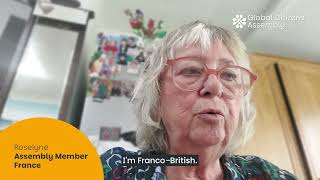
- As food shocks spread, citizens are showing more leadership than governments, climatechangenews.com (Jul 03, 2026) — People support efforts to protect forests and curb industrial food production, the results of the latest Global Citizens’ Assembly show – but politicians have been slow to act
- Trapped by floods and fearing death in the heat: the Australians taking legal action over the climate crisis, theguardian.com (Jun 22, 2026)
- ‘The sea took everything away’: how Nigeria’s ‘Happy City’ is disappearing beneath the waves, theguardian.com (Jun 18, 2026)
International events
[edit | edit source]Global or International events
 July 2026 — Plastic Free July, plasticfreejuly.org
- Jul 04, 2026 (Sat) — International Day of Cooperatives (CoopsDay), 1st Saturday of July. The celebration aims to showcase co-operatives’ role in building ‘inclusive, resilient, and sustainable communities’, coopsday.coop
- Jul 18, 2026 (Sat) — Mandela Day, global celebration 18 July annually, to honour the life and legacy of Nelson Mandela. A call to action for individuals, communities, and organisations to take time to reflect on Mandela's values and principles and to make a positive impact in their own communities, mandeladay.com
2021-2030, UN Decade on Ecosystem Restoration, International community action events
Each week 3 different short videos from across the world.
Citizens' assembly, Community action/Europe, Localism / ...This week's featured UK videos / ... read more about Cosmolocalism
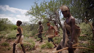
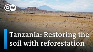
Tanzania video
[edit | edit source]
Community involvement
[edit | edit source]Daraja, aims to make positive changes to life in rural Tanzania by bringing people and government closer together
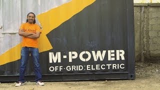
Community energy
[edit | edit source]Biodiversity
[edit | edit source]Approximately 38% of Tanzania's land area is set aside in protected areas for conservation. Tanzania has 16 national parks, plus a variety of game and forest reserves, including the Ngorongoro Conservation Area.
Tanzania is highly biodiverse and contains a wide variety of animal habitats. Tanzania has developed a Biodiversity Action Plan to address species conservation. [citation needed] W
Maps
[edit | edit source]Ramani Huria is community-based mapping project in Dar Es Salaam, Tanzania, training university students and local community members to create highly accurate maps of the most flood-prone areas of the city using OpenStreetMap.
The city of Dar es Salaam is on the coast of Tanzania and in the rainy season is vulnerable to large scale flooding. Additionally, there are no current or reliable maps which can be used by aid respondents in the event of flooding. Maps are created specifically in flood prone wards with the aim of providing information for flood resistance.
The project uses a number of mapping tools including OpenStreetMap, InaSAFE, drone imagery. W
News archive
[edit | edit source]#50MillionTrees: how young people are fighting deforestation in Tanzania, Jun 5, 2017...The Guardian
- Govt Hands Out Cash to Help Its Very Poorest Kickstart Businesses, Jul 24, 2016...@allafrica
- Off-grid Njoro Children's Library in Tanzania keeps naturally cool with compressed earth, Apr 15, 2016...Inhabitat
- Community Forests International Plants Trees and Livelihoods on Pemba Island, November 13, 2015...foodtank.com
- How Tanzania plans to light up a million homes with solar power, October 29, 2015...The Guardian
- Zanzibar's 'Solar Mamas' flip the switch on rural homes, gender roles, June 5, 2015...Public Radio International
Mobile money powers solar expansion in rural East Africa, 2014...Ashden
- Scientists: Snow on Mt. Kilimanjaro to melt in twenty years, Wikinews:Scientists: Snow on Mt. Kilimanjaro to melt in twenty years, November 3, 2009.
- 2009 SEED Award Winners, United Nations Environment Programme, May 12, 2009.
- "KOLCAFE - Smallholder coffee revenue enhancement". This initiative, involving national NGOs and a local research institution, aims to empower coffee farmers and increase coffee production by improving agronomic practices and adding value through building product processing infrastructure and selling products directly to export markets.
- Kenya, Malawi, Tanzania and Zambia: "Sunny Money - solar micro-franchising". International NGOs and community-based organizations in Kenya, Malawi, Tanzania and Zambia have created a micro-franchise named Sunny Money, which recruits, trains and supports a growing network of solar entrepreneurs in East Africa, especially deaf and disabled people, helping them build and sell solar kits to power lights, radios and mobile phones.
About Tanzania
[edit | edit source]Tanzania, officially the United Republic of Tanzania, is a country in East Africa within the African Great Lakes region. It is bordered by Uganda to the northwest, Kenya to the northeast, the Indian Ocean to the east, Mozambique and Malawi to the south, Zambia to the southwest, and Rwanda, Burundi, and the Democratic Republic of the Congo to the west. According to a 2024 estimate, Tanzania has a population of around 67.5 million, making it the most populous African country located entirely south of the equator.
Many important hominid fossils have been found in Tanzania. In the Stone and Bronze Age, prehistoric migrations into Tanzania included Southern Cushitic speakers similar to modern day Iraqw people, who moved south from present-day Ethiopia; Eastern Cushitic people who moved into Tanzania from north of Lake Turkana about 2,000 and 4,000 years ago; and the Southern Nilotes, including the Datoog, who originated from the present-day South Sudan–Ethiopia border region between 2,900 and 2,400 years ago. These movements took place at about the same time as the settlement of the Mashariki Bantu from West Africa in the Lake Victoria and Lake Tanganyika areas. In the late 19th century, the mainland came under German rule as German East Africa. This was followed by British rule after World War I when it was governed as Tanganyika, with the Zanzibar Archipelago remaining a separate colonial jurisdiction. Following their gaining respective independence in 1961 and 1963, the two entities merged in 1964 to form the United Republic of Tanzania.
Tanganyika joined the British Commonwealth, and Tanzania remains a Commonwealth country as a unified republic. Today, the country is a presidential constitutional republic with the federal capital located in Government City (Dodoma); the former capital, Dar es Salaam, retains most government offices and is the country's largest city, principal port, and leading commercial centre. For decades, Tanzania has been ruled by the Chama Cha Mapinduzi (CCM) as a de facto one-party state.
Tanzania's population comprises about 120 ethnic, linguistic, and religious groups. Christianity is the largest religion in Tanzania, with substantial Muslim and Animist minorities. Over 100 languages are spoken in Tanzania, making it the most linguistically diverse country in East Africa. The country does not have a de jure official language, although the national language is Swahili. English is used in foreign trade, in diplomacy, in higher courts, and as a medium of instruction in secondary and higher education. Arabic is widely spoken in Zanzibar, reflecting its history as a trading center dominated by Arabs.
Tanzania is mountainous and densely forested in the north-east, where Mount Kilimanjaro, the highest mountain in Africa and the highest single free-standing mountain above sea level in the world, is located. Three of the African Great Lakes are partly within Tanzania. To the north and west lie Lake Victoria, Africa's largest lake, and Lake Tanganyika, the continent's deepest lake, known for its unique species of fish. To the south lies Lake Malawi. The eastern shore is hot and humid, with the Zanzibar Archipelago just offshore. The Menai Bay Conservation Area is Zanzibar's largest marine protected area. The Kalambo Falls, located on the Kalambo River at the Zambian border, is the second-highest uninterrupted waterfall in Africa. Tanzania is one of the most visited tourist destinations for safaris. The country is an official member of the United Nations, Group of 77, African Union, East African Community, and the Non-Aligned Movement.
See also
[edit | edit source]- Topic overview and cosmolocal connections:
| Authors | Phil Green |
|---|---|
| License | CC-BY-SA-3.0 |
| Cite as | Philralph (2014–2026). "Community action/Tanzania". Appropedia. Retrieved July 13, 2026. |