
Community action/Oxford

| Map | |
|---|---|
| Location | Oxford, Oxfordshire |
| Coordinates | 51° 45' 7.25" N, 1° 15' 28.26" W |
The aim of this page is to recognise, celebrate and encourage the self-empowerment of community agency networks (CANs) and community groups' activism for climate, environment and many other sustainability topics across Oxford.
News
[edit | edit source] ‘In Delhi I can see the climate catastrophe unfolding before my eyes’, The Guardian (Nov 15, 2022)
- Oxford council backs bid to stop water firm dumping sewage in Thames, Oct 9, 2020...theguardian.com
- City Council responds to Oxford Citizens' Assembly on Climate Change and outlines £19m climate emergency budget, Dec 16, 2019...oxford.gov.uk
- ‘A share in the delight’: the people investing in the UK’s first community-owned solar battery, theguardian.com (May 08, 2026) — Oxfordshire’s Ray Valley Solar already generates clean energy for 7,000 homes, and is now crowdfunding storage to marry daylight with evening demand
- UK’s first community-owned battery site launches share offer, thenews.coop (Apr 13, 2026)
- Salt Cross: Carbon neutral village plans approved by government, BBC News (Feb 04, 2026)
- May and June heatwaves killed about 2,700 people in England and Wales, data suggests, theguardian.com (Jul 13, 2026) — Extreme heat led to 440 deaths a day during June peak, say scientists, with climate crisis ramping up temperatures
- MPs call on UK government to host televised emergency briefing on climate crisis, theguardian.com (Jul 10, 2026) — As UK swelters in another heatwave, 50-minute Chris Packham film outlines threats to security, economy and health
- Homes need more renewable energy tech – here’s how to make sure retrofits avoid creating e‑waste, theconversation.com (Jul 08, 2026)
- May and June heatwaves killed about 2,700 people in England and Wales, data suggests, theguardian.com (Jul 13, 2026) — Extreme heat led to 440 deaths a day during June peak, say scientists, with climate crisis ramping up temperatures
- Amsterdam, along with other major European cities, bans public adverts for meat and fossil fuels [BBC], Daily Alternative (May 22, 2026)
- How reindeer herds, nature and Sámi culture can thrive when forests are restored across northern Europe, theconversation.com (May 15, 2026)
- As food shocks spread, citizens are showing more leadership than governments, climatechangenews.com (Jul 03, 2026) — People support efforts to protect forests and curb industrial food production, the results of the latest Global Citizens’ Assembly show – but politicians have been slow to act
- Trapped by floods and fearing death in the heat: the Australians taking legal action over the climate crisis, theguardian.com (Jun 22, 2026)
- ‘The sea took everything away’: how Nigeria’s ‘Happy City’ is disappearing beneath the waves, theguardian.com (Jun 18, 2026)
UK and international events
[edit | edit source]UK events
 Jul 1 - 14, 2026 (Wed - Tue) — Community Energy Fortnight, communityenergyengland.org
- Jul 02, 2026 (Thu) — Cycle to Work Day, cyclescheme.co.uk
- Jul 17 - Aug 9, 2026 (Fri - Sun) — Big Butterfly Count, bigbutterflycount.butterfly-conservation.org
- Jul 19 - 25, 2026 (Sun - Sat), The theme for 2026 is JOY — Community Centre Week, octopuscommunities.org.uk
- Jul 24 - Aug 2, 2026 (Fri - Sun) — Love Parks Week, Keep Britain Tidy
Global or international events
- July 2026 — Plastic Free July, plasticfreejuly.org
- Jul 04, 2026 (Sat) — International Day of Cooperatives (CoopsDay), 1st Saturday of July. The celebration aims to showcase co-operatives’ role in building ‘inclusive, resilient, and sustainable communities’, coopsday.coop
- Jul 18, 2026 (Sat) — Mandela Day, global celebration 18 July annually, to honour the life and legacy of Nelson Mandela. A call to action for individuals, communities, and organisations to take time to reflect on Mandela's values and principles and to make a positive impact in their own communities, mandeladay.com
2021-2030, UN Decade on Ecosystem Restoration, International community action events
Each week 3 different short videos from across the UK or world.

Rural sustainability UK, Community energy UK, Community action/Argyll and Bute / ...This week's featured Global videos / ... read more about Cosmolocalism
Oxford video
[edit | edit source]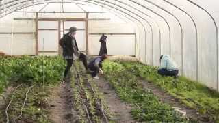
Food activism
[edit | edit source]- Abundance Oxford, not-for-profit community harvesting, redistributing & preserving group
- Cultivate Oxford
- Good Food Oxford
- Oxford Food Surplus Café
Cripley Meadow Allotment Association is managed by an annually elected committee. Oxford City Council lease the land to the association and devolve its management to the committee. Since 2004 over 160 plots have been cleared and put back into use. It is now a thriving site supporting over 200 members in growing local food and flowers.
Cripley Island Orchard has also been established. W
Towards sustainable economies
[edit | edit source]- SolidarityOxford, solidarityeconomy.coop, map of the city's solidarity economy oxford.solidarityeconomy.coop, added 20:44, 7 November 2021 (UTC)
Community resources
[edit | edit source]- Makespace Oxford, "Truly affordable workspace in central Oxford"
- SHARE Oxford- A Library of Things
Commons
[edit | edit source]Wolvercote Common is an area of grassed common land north of Port Meadow in Oxford, England.
The Wolvercote Commoners' Committee was established in 1929 to manage the common land and to preserve other amenities in the village. Along with Port Meadow and Wolvercote Green, Wolvercote Common has been a Site of Special Scientific Interest (SSSI) since 1955. In 1993, the Wolvercote Commoners' Committee resisted an attempt by Oxford City Council to take the common into its ownership.
Climate action
[edit | edit source]- Oxford Citizens Assembly on Climate Change, oxford.gov.uk, held over two weekends in September and October 2019...oxford.gov.uk. Many videos on the website.
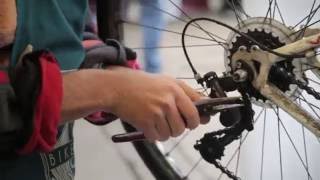
Cycling
[edit | edit source]Among cities in England and Wales, Oxford has the second highest percentage of people cycling to work. W
Biodiversity activism
[edit | edit source]The Trap Grounds (aka Trap Grounds Town Green) is a nature reserve in north Oxford, Oxfordshire, England, owned by Oxford City Council.
Environment quality
[edit | edit source]- Cleaner, Greener Oxford, Oxford City Council campaign
- OxClean, Oxford Civic Society initiative dedicated to keeping Oxford clean and tidy
- Oxford Flood Network, making a citizen-built flood detection network in Oxford, based on river levels, groundwater and local knowledge.
Open spaces
[edit | edit source]Oxford is a very green city, with several parks and nature walks within the ring road, as well as several sites just outside the ring road. In total, 28 nature reserves exist within or just outside Oxford ring road. W
The city is at the centre of the Oxford Green Belt, which is an environmental and planning policy that regulates the rural space in Oxfordshire surrounding the city, aiming to prevent urban sprawl and minimise convergence with nearby settlements. The policy has been blamed for the large rise in house prices in Oxford, making it the least affordable city in the United Kingdom outside of London; some estate agents have called for brownfield land inside the green belt to be released for new housing.
News archive
[edit | edit source]- 'We can go quicker than 2050' - Citizens assembly votes for ambitious city climate target, Oct 20, 2019...oxfordmail.co.uk
- The library of things: could borrowing everything from drills to disco balls cut waste and save money? Apr 24, 2019...The Guardian
- Oxford aims for world's first zero emissions zone with petrol car ban, Oct 12, 2017...The Guardian
- One part of Oxford seems to be getting more and more vegetarian, Jan 4, 2017...oxfordmail.co.uk
- OXONBIKE brings electric bike hire scheme to city centre, Oct 10, 2016...lowcarbonoxford.org
- Pupils to help raise awareness and tackle air quality around Oxford's schools, Jun 8, 2016...oxford.gov.uk
- 100 electric car charging stations to be installed around Oxford in world's biggest scheme, January 25, 2016...oxfordmail.co.uk
- Oxford's aspirations to host the first double decker wireless electric bus project, March 16, 2015...Oxfordshire County Council
- Oxford Council first UK authority to pass divestment motion, September 16, 2014...Fossil Free UK
- Pioneering community renewables in Oxford, July 11, 2014...The Ecologist
About Oxford
[edit | edit source]Campaigns
Past events
- Jun 17 - 25, 2017 Oxford Green Week, previously known as Low Carbon Oxford Week
- June 14, 2014 Good Food Oxford Launch Fest
Oxford ( ) is a cathedral city and non-metropolitan district in Oxfordshire, England, of which it is the county town.
The city is home to the University of Oxford, the oldest university in the English-speaking world; it has buildings in every style of English architecture since late Anglo-Saxon. Oxford's industries include motor manufacturing, education, publishing, science and information technologies. Founded in the eighth century, it was granted city status in 1542. The city is located at the confluence of the rivers Thames (known locally as the Isis) and Cherwell. It had a population of 166,034 in 2024. It lies 56 miles (90 km) north-west of London, 64 miles (103 km) south-east of Birmingham and 61 miles (98 km) north-east of Bristol.
See also
| Authors | Phil Green |
|---|---|
| License | CC-BY-SA-3.0 |
| Cite as | Philralph (2021–2025). "Community action/Oxford". Appropedia. Retrieved July 15, 2026. |