
- Iowa's Climate-Change Wisdom, November 20, 2015...[1]
Networks and sustainability initiatives[edit | edit source]
Food activism[edit | edit source]
Resources: Creating change in the food system, The role of regional food networks in Iowa, March 2012 (PDF)
Community energy[edit | edit source]
Solar power in Iowa is limited but growing, with 137 megawatts (MW) installed by the end of 2019 and 27 MW installed during that year, ranking the state 40th among U.S. states. Iowa also generated 0.23% of the state's total electricity production in 2019 from solar energy; an amount sufficient to power over 17,000 Iowa homes. The state's early position as a major wind-power provider may have limited early large-scale solar investment.
Solar power in Iowa on rooftops can provide 20% of all electricity used in Iowa.
Making up over 62% of the state's generated electricity in 2022, wind power is the largest source of electricity generation in Iowa. In 2020, over 34 billion kWh of electrical energy was generated by wind power. As of 2022, Iowa has over 12,200 megawatts (MW) of installed capacity with over 6,000 wind turbines, ranking second and third in the nation below Texas respectively.
Climate action[edit | edit source]
Sustainable transport activism[edit | edit source]
Wikipedia: Hiking trails in Iowa (category)
Cycling[edit | edit source]
The Mississippi River Trail (abbreviated MRT) is a designated bicycle and pedestrian trail that traverses the shores of the Mississippi River in the United States. The trail extends from the headwaters at Lake Itasca in Minnesota to near the mouth of the river in Venice, Louisiana. Much of the trail’s 3,000 miles (4,800 km) follows roadways used by motor vehicles, although some of the route is on multi-use trails. The segment in Minnesota has been designated as U.S. Bicycle Route 45 (USBR 45), part of the U.S. Bicycle Route System.
The Mississippi River Trail route marker is based on a 2012 design that the Federal Highway Administration (FHWA) has allowed several states, including Illinois, Kentucky, and Tennessee, to use as U.S. Bicycle Route markers. The design features a green background with a white triangle and a bicycle symbol. However, the Mississippi River Trail's marker bears the abbreviation "MRT" in place of a numeric route designation.
The portion of the Mississippi River Trail in Minnesota was designated as U.S. Bicycle Route 45 in 2013. Long-range plans call for the rest of the MRT to be designated as USBR 45, and for the southernmost segment near New Orleans to be concurrently designated as USBR 51.
By the time the Minnesota Department of Transportation (MnDOT) successfully proposed designating the MRT as USBR 45, planning for the trail was already well underway. Local trail partners did not want to spend additional funds and weaken the MRT brand by installing the USBR signs – a requirement for USBR designation – alongside the MRT signs. MnDOT secured approval from the Federal Highway Administration to display only the MRT shield for the time being.
The trail is divided into three sections: Northern, Central, and Southern. In some locations trails are along both sides of the river.
The MRT begins at Itasca State Park, near the headwaters of the river. Itasca State Park also contains more than 20 miles (32 km) of paved biking trails. After it leaves the park, the MRT winds north along the river, traversing county roads to the city of Bemidji. Here the main trail connects to a number of city and regional trails. From Bemidji, the MRT heads southeast along the Paul Bunyan Trail, a state-developed rail-trail conversion. This 100-mile-long (160 km) paved trail extends from Bemidji to Brainerd.
From Brainerd, the MRT follows county roads, some with marked bike lanes and some with paved shoulders, through the cities of Little Falls and St. Cloud. South of St. Cloud, the surroundings become more urban as the rider approaches the Twin Cities, Minneapolis and St. Paul. The route through the two cities passes the Mississippi National River and Recreation Area that includes St. Anthony Falls, Minnehaha Falls Regional Park, and Fort Snelling State Park, among other protected areas and parks. In Minneapolis, MRT segments appropriate the established Grand Rounds National Scenic Byway trails and Minnehaha Trail. South of St. Paul, the MRT passes through several smaller cities before reaching Lake Pepin. The route passes through Wabasha and Winona on its way to the Wisconsin state line.
The Wisconsin section of the MRT begins at Prescott and continues along the eastern side of the river all the way to Illinois. The section north of Prairie du Chien primarily follows the Great River Road, while the section south follows various state and county highways. The Wisconsin Department of Transportation has prepared an online publication, The Great River Road Mississippi River Trail Bicycle Map: A Guide for Cycling Along Wisconsin's Great River, which offers a detailed section by section guide of the Wisconsin route complete with road maps, services, campgrounds and route descriptions.
The trail enters Obion County from Kentucky along State Route 157 (SR 157) and then turns right onto SR 22 traveling southwesterly. The trail goes along the eastern boundary of Reelfoot National Wildlife Refuge. Near Samburg, the trail turns right onto SR 21 and follows the south shore of Reelfoot Lake. It also passes near Reelfoot Lake State Park.
The trail enters into Lake County and turns left onto Bluebank Road, right onto Wynnburg–Keefe Road, left onto Madie Church to Keefe Road, right onto Madie Thompson Road, left onto Madie Road, and right onto Gratio Road, entering the town of Ridgely, Tennessee. Through Ridgely, the trail travels along Poplar Street, Main Street, and Depot Street (Levee Road). From here, the trail travels along SR 181, also known as Great River Road.
The trail enters Dyer County and crosses over Interstate 155 (I-155). It continues south on SR 181 for several miles until it crosses over the Forked Deer River and into Lauderdale County, Tennessee. From here, the trail continues east on SR 88 and turns right onto Porter's Gap Road. Then the trail turns right onto Edith–Nankipoo Road and right onto Hobe Webb Road, traveling near the Chickasaw National Wildlife Refuge. The trail turns left onto Chisholm Lake Road, right onto Craig School Road (turning into Turkey Hill Road), and then left onto SR 19. Then the trail turns right onto Lightfoot Luckett Road then right onto SR 87, then left onto SR 371. The trail turns right onto Cooper Creek Road and then right onto U.S. Route 51 (US 51), crossing into Tipton County over the Hatchie River.
Continuing south along US 51, the trail turns right onto Leigh's Chapel Road, left onto Flat Iron Road (turning into Simmons Street), right onto Murphy Avenue (turning into Bride Road), left onto Garland Drive, and right onto Garland Detroit Road (turning into Detroit Road, then Jamestown Road, then Randolph Road), following the top ridge of the 2nd Chickasaw Bluff. Passing through the town of Randolph, Tennessee, the trail turns right onto Needham Road and right onto SR 59. The trail then turns south onto Richardson Landing road, turns right onto Pryor Road (turning into Bluff Road), and makes a left in order to stay on Bluff Road. The trail turns right onto Quito–Drummonds Road and right onto Ray Bluff Road, entering Shelby County.
The trail continues south along Ray Bluff Road (turning into New Bethel Road), right onto Bass Road, right again onto New Bethel Road, right onto West Union Road, right onto Herring Hill Road, and straight onto Riverbluff Road (turning into Bluff Road). The trail travels along the ridge of the 3rd Chickasaw Bluff and passes through Meeman-Shelby Forest State Park. In the community of Shelby Forest, Tennessee, the trail turns right onto Benjestown Road, right onto Island Forty Road (turning into Ramsey Road), and right back onto Benjestown Road. Then the trail turns left onto South Circle Road (turning into East Circle Road), right onto Northaven Drive, and right onto SR 388 (North Watkins Street), passing through the Northaven area and crossing over the Loosahatchie River into the Frayser community of Memphis.
Once in Memphis, the route turns right onto Millington Road, right onto Carrolton Road, left onto Benjestown Road, and right onto Whitney Avenue, passing by General DeWitt Spain Airport and over the Wolf River. The trail turns south onto North Mud Island Road (turning into Island Drive) and passes through the Harbortown neighborhood. Then the trail turns left onto A.W. Willis Avenue over Wolf River Harbor, right onto Front Street (passing next to the Pyramid Arena), passes under I-40 and the Hernando De Soto Bridge, turns right onto Jefferson Avenue, and left onto Riverside Drive, entering Downtown Memphis. From here, the trail continues south on Riverside Drive, passing by Mud Island, the MATA Trolley riverfront loop, and the South Bluffs neighborhood. The trail goes along the paths in Tom Lee Park and the Riverwalk Trail system in Downtown Memphis.
After this, the official trail is unclear. According to the MRT website, the trail travels under the Harahan Bridge and the Frisco Bridge, up the side of the 4th Chickasaw Bluff, and onto a sidewalk on the Memphis-Arkansas Bridge. A route following the South side of the Memphis-Arkansas bridge from E.H. Crump park has been documented. Construction has been completed on a multi-use trail for pedestrians and cyclists along the north side of the Harahan bridge.
- Great River Road
- Mississippi River Trail Map of Parks, Trails and Points of Interest - IMTrails
- National Park Service - Mississippi River Trail
Wikipedia: Cycling in Iowa (category)
Biodiversity[edit | edit source]
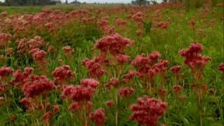
The ecology of the state of Iowa has been heavily affected by agricultural production, but remaining natural areas reflect a wide varieties of environmental niches.[2]
Whiterock Conservancy is a 501(c)(3) land trust located in west-central Iowa that stewards over 4,000 acres of contiguous land located in the Middle Raccoon River watershed, and an additional 1,000 non-contiguous land located in the Brushy and Middle Raccoon River watersheds. The Whiterock landscape almost exclusively made possible by an extraordinary planned land gift from the Garst family to Whiterock Conservancy. The landscape is a mosaic of agricultural land, wetlands, preserved prairie and oak savanna, riverine woodlands, and upland forest. The land is also home to the historic Roswell and Elizabeth Garst Farmstead, which hosted Soviet Premier Nikita Khrushchev in 1959, and is now on the National Register of Historic Places. The land is used for recreation, environmental conservation, and for the production of agricultural products, and is managed as a working landscape where cultural, environmental, agricultural, and recreational land uses are held in equal importance.
Environment quality[edit | edit source]
The environment of Iowa has been heavily affected by agricultural production since it became a U.S. state in 1846. However, there remain natural areas in Iowa that reflect a wide varieties of environmental niches.
Open spaces[edit | edit source]
The environment of Iowa has been heavily affected by agricultural production since it became a U.S. state in 1846. However, there remain natural areas in Iowa that reflect a wide varieties of environmental niches.
Citizens data initiative[edit | edit source]
Energy Data & Statistics for Iowa, from the U.S. Department of Energy
About Iowa[edit | edit source]
Iowa ( EYE-ə-wə) is a doubly landlocked state in the upper Midwestern region of the United States. It borders the Mississippi River to the east and the Missouri River and Big Sioux River to the west; Wisconsin to the northeast, Illinois to the east and southeast, Missouri to the south, Nebraska to the west, South Dakota to the northwest, and Minnesota to the north.
Iowa is the 26th largest in total area and the 31st most populous of the 50 U.S. states, with a population of 3,190,369, according to the 2020 census. The state's capital, most populous city, and largest metropolitan area fully located within the state is Des Moines. A portion of the larger Omaha, Nebraska, metropolitan area extends into three counties of southwest Iowa. Iowa has been listed as one of the safest U.S. states in which to live.
During the 18th and early 19th centuries, Iowa was a part of French Louisiana and Spanish Louisiana; its state flag is patterned after the flag of France. After the Louisiana Purchase, people laid the foundation for an agriculture-based economy in the heart of the Corn Belt.
References