
- Fort Wayne churches choosing solar power, Jun 18, 2016...[1]
Networks and sustainability initiatives[edit | edit source]
Food activism[edit | edit source]
Community energy[edit | edit source]
Wind power in Indiana was limited to a few small water-pumping windmills on farms until 2008 with construction of Indiana's first utility-scale wind power facility, Goodland (phase I) with a nameplate capacity of 130 MW. As of March of 2024, Indiana had a total of 2,743 MW of wind power capacity installed, ranking it 12th among U.S. states. Wind power was responsible for 4.8% of in-state electricity production in 2016.
Solar power in Indiana has been growing in recent years due to new technological improvements and a variety of regulatory actions and financial incentives, particularly a 30% federal tax credit for any size project.
In 2015, Indiana ranked 18th among U.S. states for installed solar power with 136 MW of photovoltaic panels. An estimated 18% of electricity in Indiana could be provided by rooftop solar panels.
The Mammoth Solar project in Northwest Indiana broke ground in October 2021, and when complete it will be the largest solar project in the United States, with more than 2.8 million panels producing more than 1 gigawatt of power.
Climate action[edit | edit source]
Earth Charter Indiana has worked to develop leadership in sustainability and climate action for almost 20 years. Its Youth Power Indiana initiative works with students in elementary through high school, and with mayors and municipal officials to develop sustainability and resiliency programs. Young people have advocated climate policy which has been adopted in seven cities: Carmel, Indianapolis, Lawrence, South Bend, Goshen, Bloomington and West Lafayette.
Indiana Project Drawdown has assembled information on hundreds of local groups in the state which are making progress on emissions reduction.
Publicly available data is available to communities and government via the Hoosier Resilience Index, an online database listing information such as "precipitation, flood plain and land use maps – for every community in the state of Indiana."
Carbon Neutral Indiana (CNI) is a non-profit organization that works with households, businesses, and academic institutions to measure, offset, and reduce their carbon footprint. Their goal is to spark a movement amongst Hoosiers to ensure Indiana becomes carbon neutral as soon as possible.
Climate change in Indiana[edit | edit source]
Climate change in Indiana encompasses the effects of climate change, attributed to man-made increases in atmospheric carbon dioxide, in the U.S. state of Indiana.
According to the United States Environmental Protection Agency, "Indiana's climate is changing. Most of the state has warmed about one degree (F) in the 20th century. Floods are becoming more frequent, and ice cover on the Great Lakes is forming later or melting sooner. In the coming decades, the state will have more extremely hot days, which may harm public health in urban areas and corn harvests in rural areas". In May 2019, The Kansas City Star noted that although it was not yet possible to say whether climate change was contributing to the increasing number of tornadoes in the region, "the band of states in the central United States ... that each spring are ravaged by hundreds of tornadoes — is not disappearing. But it seems to be expanding", resulting in a higher frequency of tornadoes in states including Indiana.
Indiana is one of the ten states that produce half of all greenhouse gas emissions in the US.
Sustainable transport activism[edit | edit source]
Wikipedia: Hiking trails in Indiana (category)
Cycling activism[edit | edit source]
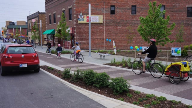

Wikipedia: Bike paths in Indiana (category)
Education for sustainability[edit | edit source]
Merry Lea Environmental Learning Center of Goshen College is located just south of Wolf Lake at Bear Lake in Noble County, Indiana, United States. Merry Lea is the largest privately held land reserve in the state of Indiana. The center serves as a field laboratory for students at Goshen College who are studying ecology, environmental education and agroecology. In addition, Merry Lea provides environmental educational experiences for elementary students in the center's service area which includes the Fort Wayne metropolitan area as well as Warsaw, Huntington, Kendallville, Goshen and Elkhart.
The facility's 1,150 acres (4.6 km2) include most of northern Indiana's ecosystems including peat bogs, swamp maple forest, upland mesic forest, old field, prairie, and lakeshore. An esker deposit with 50 ft (15 m) relief that extends for nearly half a mile (1 km) is the most striking geological feature. The center also features Rieth Village, a complex of energy efficient buildings completed in 2006 that provide housing and classrooms for college students. Rieth Village features a 10 kW wind generator mounted on a 100 ft (30 m) tower and 4.8 kW photovoltaic array.
- Merry Lea Environmental Learning Center of Goshen College, added 15:51, 3 January 2022 (UTC)
Ecological restoration[edit | edit source]
The Lilly ARBOR Project is a part of an experimental riparian floodplain reforestation and ecological restoration program, located along the White River in Indianapolis, Indiana, United States. ARBOR is an acronym for "Answers for Restoring the Bank Of the River".
Open spaces[edit | edit source]
Sycamore Land Trust is a 501(c)(3) non-profit member-supported land trust headquartered in Bloomington in the U.S. state of Indiana.
It works to preserve the disappearing natural and agricultural landscape of southern Indiana. Sycamore's service area includes 26 southern Indiana counties: Bartholomew, Brown, Clark, Crawford, Dubois, Daviess, Floyd, Gibson, Greene, Harrison, Jackson, Knox, Lawrence, Martin, Monroe, Morgan, Orange, Owen, Perry, Pike, Posey, Scott, Spencer, Vanderburgh, Warrick, and Washington.
The trust is part of the US Land Trust Alliance. In 2023, the trust has 7 full-time staff and over 100 volunteers.
Since its founding in 1990, Sycamore has protected more than 9,000 acres of land on 100 parcels. Many of the properties that Sycamore owns outright have hiking trails and are open to the general public.
Sycamore has an active and award-winning Environmental Education Program that helps people in southern Indiana build an understanding of Indiana's natural heritage and the Earth's delicately balanced living systems. Sycamore believes that nature is the ultimate educator and offers lessons that reinforce school curriculum as well as program for families and the community.
The Environmental Education program focuses on three approaches: individual teachers and classes; larger scale projects; and cooperative projects. Through classroom work, Sycamore leads outdoor discovery activities, hiking, exploring, math or science lessons, and reflective writing. Larger projects include a watershed study project on Beanblossom Creek and cooperative field days that create a dynamic learning environment. In 2023, the Environmental Education plans to work with 6,000 people.
Citizens data initiative[edit | edit source]
Energy Data & Statistics for Indiana, from the U.S. Department of Energy
News and comment[edit | edit source]
2016
Hard-Pressed Rust Belt Cities Go Green to Aid Urban Revival, May 31[2]
Greenfield: Nonprofit farm seeks to feed those in need, March 10[3]
2015
Fort Wayne: Growing home harvests, August 16[4]
About Indiana[edit | edit source]
Indiana ( IN-dee-AN-ə) is a state in the Midwestern region of the United States. It borders Lake Michigan to the northwest, Michigan to the north and northeast, Ohio to the east, the Ohio River and Kentucky to the south and southeast, and the Wabash River and Illinois to the west. Nicknamed "the Hoosier State", Indiana is the 38th-largest by area and the 17th-most populous of the 50 states. Its capital and largest city is Indianapolis. Indiana was admitted to the Union as the 19th state on December 11, 1816.
References