
Community action/Jakarta

The aim of this page is to recognise, celebrate and encourage the self-empowerment of community agency networks (CANs) and community groups' activism for climate, environment and many other sustainability topics across Jakarta. These initiatives aim to improve the quality of life in Indonesia's bustling capital through innovative local solutions.
News
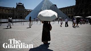
[edit | edit source] Half the world’s 100 largest cities are in high water stress areas, analysis finds, theguardian.com (Jan 22, 2026) — Beijing, New York, Los Angeles, Rio de Janeiro and Delhi among those facing extreme stress, while London, Bangkok and Jakarta classed as being highly stressed
- ‘A bus is open to everyone regardless of class’: riding the world’s biggest network, theguardian.com (Nov 30, 2023)
- Jakarta, the fastest-sinking city in the world, BBC News (Aug 13, 2018)
- In Indonesia, a schoolboy moves mountains on waste as government targets reform, news.mongabay.com (Apr 30, 2026)
- The bold model stopping deforestation in its tracks, positive.news (Oct 13, 2025) — Rainforests are powerful carbon sinks and crucial to climate stability. A pioneering effort to protect them involves providing cash to forest communities so they don’t need to accept offers from loggers
- ‘Draw the Line’ in Asia: Community organizers call for climate justice and accountability, globalvoices.org (Sep 30, 2025)
- As food shocks spread, citizens are showing more leadership than governments, climatechangenews.com (Jul 03, 2026) — People support efforts to protect forests and curb industrial food production, the results of the latest Global Citizens’ Assembly show – but politicians have been slow to act
- Trapped by floods and fearing death in the heat: the Australians taking legal action over the climate crisis, theguardian.com (Jun 22, 2026)
- ‘The sea took everything away’: how Nigeria’s ‘Happy City’ is disappearing beneath the waves, theguardian.com (Jun 18, 2026)
International events
[edit | edit source]Global or International events
 July 2026 — Plastic Free July, plasticfreejuly.org
- Jul 04, 2026 (Sat) — International Day of Cooperatives (CoopsDay), 1st Saturday of July. The celebration aims to showcase co-operatives’ role in building ‘inclusive, resilient, and sustainable communities’, coopsday.coop
- Jul 18, 2026 (Sat) — Mandela Day, global celebration 18 July annually, to honour the life and legacy of Nelson Mandela. A call to action for individuals, communities, and organisations to take time to reflect on Mandela's values and principles and to make a positive impact in their own communities, mandeladay.com
2021-2030, UN Decade on Ecosystem Restoration, International community action events
CDC videos
[edit | edit source]Each week 3 different short videos from across the world.

Citizens' assembly, Community action/Europe, Localism / ...This week's featured UK videos / ... read more about Cosmolocalism
Jakarta video
[edit | edit source]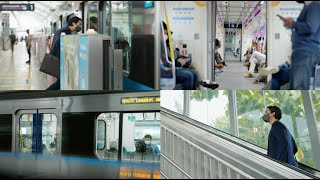
Lantan Bentala
[edit | edit source]
Lantan Bentala is a foundation concerned with environment located in Jakarta, Indonesia.
Lantan derived from ancient Minang language meaning care, nurture, protect, and defend; while Bentala derived from ancient Malay language which means earth. Yes. The Earth is our Mother. All of us came from her womb, and will be back to her when we already finish our journey here. Protecting her is the ultimate imperative for humankind to survive in this beautiful but fragile planet.
Let's join together to protect, defend and nurture our Mother Earth! You heard our Mother's call, didn't you? She needs us now more than ever in human history. Our life really depends on how we together answer that call.
Open spaces
[edit | edit source]Jakarta, officially the Special Capital Region of Jakarta, is the capital and largest city of Indonesia, with administrative status equivalent to a province. It lies on the northwestern coast of Java, borders the provinces of West Java and Banten, and faces the Java Sea to the north. Jakarta itself covers about 662 square kilometres (256 square miles), but the wider Jakarta metropolitan area—locally known as Jabodetabek—is among the largest urban agglomerations in the world by area. By population, Greater Jakarta is the most populous urban area in the world with a population of over 40 million. Jakarta is Indonesia's political, economic, and cultural centre and contains many national institutions, corporate headquarters, and the secretariat of the Association of Southeast Asian Nations (ASEAN).
Rivers
[edit | edit source]Participatory mapping for disaster preparedness
For managing risk effectively, it needs extensive data for making decisions on investments in preparedness, mitigation, and response. Until recently, detailed information on disaster situation (flooding) was hardly available at local level. A pilot project in Jakarta, led by the Province of Jakarta's Disaster Management Agency collected high-resolution data to inform flood preparedness and contingency. Later, the data, which was accessible by the community and the general public, was used in 2011/2012 Jakarta contingency emergency planning exercise. The risk information it produced was very useful for decision makers in preparedness, development and investment planning.Petabencana.id can now be consulted and it contains a flood map. Some additional info may be found at OpenStreetMap. It is an online, open-source platform, which relies on participatory mapping conducted by local communities, private and public actors who collect the detailed information about a given area and share it, meet the needs in disaster situation.
About Ciliwung
The Ciliwung (often written as Ci Liwung as the "ci" prefix simply translates as "river"; also as Tjiliwoeng in Dutch, Sundanese: ᮎᮤᮜᮤᮝᮥᮀ) is a 119-kilometre-long (74 mi) river in the northwestern region of Java where it flows through two provinces, West Java and the special region of Jakarta. The natural estuary of the Ciliwung, known as the Kali Besar ("Big River"), was an important strategic point for trade in the precolonial and colonial periods and was instrumental in the founding of the port city of Jakarta, but has been lost from a reorganization of the watercourse of the rivers around the area into canals.
The river water is murky once it reaches Jakarta because the area of its flow is a disposal area. As a result, the river is growing shallower and the flow slower. In 2014, the Audit Board of Indonesia released a four-year audit of the river and found that seventeen separate companies had been polluting its waters, submitting a report to the police.
Indonesian Ministry of Public Works and Public Housing (PUPR) has a separate Ciliwung Cisadane River Region Center (BBWSCC). DKI Jakarta Provincial Government and BBWSCC have an agreement on the normalization of some rivers in Jakarta. The DKI Provincial Government is tasked with freeing land for normalization needs to be carried out by BBWSCC. A restoration project is undertaken to widen and water flow of the river. The restoration project is divided into four sections with a total length of about 19 km, extending from Manggarai to the Jl. TB Simatupang area in South Jakarta. The Ciliwung will also be widened from the present 25 meters up to 40 – 50 meters. It is expected that the water flow will increase from the current 200 cubic meters per second to 570 cubic meters per second.
The section of the Ciliwung in Jakarta is heavily polluted. Informal settlements or slums flourished on the banks of the Ciliwung, increasing the amount of waste and reducing the surface area of the river. Some canals were completely blocked by slums and people created informal gardens inside by drying the canal. Water maintenance and ecological awareness are minimal. Other sources of pollution originate from agricultural runoff of upstream river users and industrial pollution. Flooding is a problem in the Ciliwung. With many of the original forests converted into settlements around the Puncak area, the flooding has worsened each year.
In 2012, the government of Indonesia announced a 20-year plan to clean up the Ciliwung, which kicked off with a $10 million restoration project that will include the construction of a waste processing facility in 2013 and an education centre for riverside communities. The city administration now hires over 4000 workers to regularly clean the city's rivers, canals, lakes, and coastal areas. Ex-Governor Basuki Tjahaja Purnama also plans to turn parts of the Ciliwung riverbank into a tourist site.
Sustainable transport
[edit | edit source]As a metropolitan area of about 42 million people, Jakarta has a variety of transport systems. Jakarta was awarded 2021 global Sustainable Transport Award (STA) for integrated public transportation system. However, the Jakarta public transport system remains severely underdeveloped compared to the size of the city.
The city prioritized development of road networks, which were mostly designed to accommodate private vehicles. A notable feature of Jakarta's present road system is the toll road network. Composed of an inner and outer ring road and five toll roads radiating outwards, the network provides inner as well as outer city connections. An 'odd-even' policy limits road use to cars with either odd or even-numbered registration plates on a particular day as a transitional measure to alleviate traffic congestion until the future introduction of electronic road pricing.
There are many bus terminals in the city, from where buses operate on numerous routes to connect neighborhoods within the city limit, to other areas of Greater Jakarta and to cities across the island of Java. The biggest of the bus terminal is Pulo Gebang Bus Terminal, which is arguably the largest of its kind in Southeast Asia. Main terminus for long distance train services are Gambir and Pasar Senen. Whoosh High-speed railways is connecting Jakarta to Bandung and another one is at the planning stage from Jakarta to Surabaya.
As of September 2023, Jakarta's public transport service coverage has reached 86 percent, which is targeted to increase to 95 percent. Rapid transit in Greater Jakarta consists of TransJakarta bus rapid transit, Jakarta LRT, Jakarta MRT, KRL Commuterline, Jabodebek LRT, and Soekarno-Hatta Airport Rail Link. The city administration is building transit oriented development like Dukuh Atas TOD and CSW-ASEAN TOD in several area across Jakarta to facilitate commuters to transfer between different mode of public transportation.
Previously, privately owned bus systems like Kopaja, MetroMini, Mayasari Bakti and PPD also provide important services for Jakarta commuters with numerous routes throughout the city, many of them have since been replaced by Minitrans and Metrotrans buses or Mikrotrans microbuses or absorbed into TransJakarta. Pedicabs are banned from the city for causing traffic congestion. Bajaj auto rickshaw provide local transportation in the back streets of some parts of the city. Angkot microbuses also play a major role in road transport of Jakarta. Taxicabs and ojeks (motorcycle taxis) are available in the city. As of January 2023, about 2.6 million people use public transportation daily in Jakarta.
Transjakarta (stylised in all-lowercase, often erroneously called Busway sometimes shortened as TJ, and branded as TiJe) is a bus rapid transit (BRT) system in Jakarta, Indonesia. The first BRT system in Southeast Asia commenced operations on 15 January 2004 to provide a fast public transport system to help reduce rush hour traffic. The system is considered Jakarta's premier public transit offering. The buses run in dedicated lanes (busways), and ticket prices are subsidised by the regional government.
As of September 2019, Transjakarta is currently testing electric buses, with Bundaran Senayan – Monas as its first route. Transjakarta has undertaken an ambitious plan to expand its electric bus (e-bus) fleet to 10,000 units over the decade.
Environment and livability challenges
[edit | edit source]Jakarta suffers from severe problems of environment and livability:
- Air pollution, due not only to vehicles, but a culture of burning waste, including leaves and other matter which could be composted, as well as plastics which release toxins when burned.
- Severe traffic congestion for most of the day. Traffic does not flow smoothly until after around 10pm on weekdays.
- Poor public transport.
- Jakarta is sometimes described as the world's largest city without a "metro" style rapid transit rail system.
- Trains operate in limited areas. Until recently these have been unreliable and very crowded. Recently, however, a revamped timetable in July 2011 is simplified (from 3 classes into 2, scrapping express trains) and much more frequent.
- The busway system (Trans Jakarta, similar in concept to Curitiba transportation) has developed much more slowly than planned, and has inadequate buses for the passenger load, resulting in delays and overcrowding. At many bust stops, passengers wait at open doors above the busy roadway, with no safety barrier.
- Flooding
- Subsidence of land due to extraction of groundwater
- Pollution of groundwater due to the
- Littering, which also aggravates flooding problems by blocking drains.
- Corruption - diversion of allocated funds makes solving any of the other problems much more difficult.
About Jakarta
[edit | edit source]Jakarta, officially the Special Capital Region of Jakarta, is the capital and largest city of Indonesia, with administrative status equivalent to a province. It lies on the northwestern coast of Java, borders the provinces of West Java and Banten, and faces the Java Sea to the north. Jakarta itself covers about 662 square kilometres (256 square miles), but the wider Jakarta metropolitan area—locally known as Jabodetabek—is among the largest urban agglomerations in the world by area. By population, Greater Jakarta is the most populous urban area in the world with a population of over 40 million. Jakarta is Indonesia's political, economic, and cultural centre and contains many national institutions, corporate headquarters, and the secretariat of the Association of Southeast Asian Nations (ASEAN).
| Authors | Phil Green |
|---|---|
| License | CC-BY-SA-3.0 |
| Cite as | Chriswaterguy, Philralph (2011–2026). "Community action/Jakarta". Appropedia. Retrieved July 15, 2026. |