
Community action/Bogotá
The aim of this page is to recognise, celebrate and encourage the self-empowerment of community agency networks (CANs) and community groups' activism for climate, environment and many other sustainability topics across Bogotá.
News
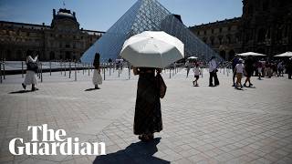
[edit | edit source] ‘The tranquility frees you’: Bogotá, the city that shuts out cars every week, theguardian.com (May 30, 2024)
- Trash and dignity: The rise of inclusive recycling projects in Latin America, globalvoices.org (Jun 12, 2026)
- Hope is contagious and science is king: 10 big lessons on ending the fossil fuel era, theguardian.com (May 01, 2026)
- Santa Marta Process Begins: Tuvalu and Ireland to Host Second Conference on Transitioning Away from Fossil Fuels in 2027 in the Pacific, fossilfueltreaty.org (Apr 29, 2026) — The First Conference on Transitioning Away from Fossil Fuels, co-hosted by Colombia and the Netherlands, concluded today marking a historic breakthrough in building international cooperation for the phase out of coal, oil and gas extraction and production. This step fundamentally shifts power toward a growing coalition of courageous nations engaged in a new international process to manage an equitable phase out of fossil fuels
- Trash and dignity: The rise of inclusive recycling projects in Latin America, globalvoices.org (Jun 12, 2026)
- Argentina’s co-operativas escolares: A case study in co-op education, thenews.coop (May 12, 2026) — In 1946, national legislation formally established the teaching of co-operativism and the creation of school co-operatives
- Across South America, canopy bridges evolve as a lifeline for tree-dwelling wildlife, news.mongabay.com (Mar 04, 2026)
- As food shocks spread, citizens are showing more leadership than governments, climatechangenews.com (Jul 03, 2026) — People support efforts to protect forests and curb industrial food production, the results of the latest Global Citizens’ Assembly show – but politicians have been slow to act
- Trapped by floods and fearing death in the heat: the Australians taking legal action over the climate crisis, theguardian.com (Jun 22, 2026)
- ‘The sea took everything away’: how Nigeria’s ‘Happy City’ is disappearing beneath the waves, theguardian.com (Jun 18, 2026)
International events
[edit | edit source]Global or International events
 July 2026 — Plastic Free July, plasticfreejuly.org
- Jul 04, 2026 (Sat) — International Day of Cooperatives (CoopsDay), 1st Saturday of July. The celebration aims to showcase co-operatives’ role in building ‘inclusive, resilient, and sustainable communities’, coopsday.coop
- Jul 18, 2026 (Sat) — Mandela Day, global celebration 18 July annually, to honour the life and legacy of Nelson Mandela. A call to action for individuals, communities, and organisations to take time to reflect on Mandela's values and principles and to make a positive impact in their own communities, mandeladay.com
2021-2030, UN Decade on Ecosystem Restoration, International community action events
CDC videos
[edit | edit source]Each week 3 different short videos from across the world.

Citizens' assembly, Community action/Europe, Localism / ...This week's featured UK videos / ... read more about Cosmolocalism
Bogotá video
[edit | edit source]
Networks and sustainability initiatives
[edit | edit source]- Neighbourhood initiatives across Bogotá
Open spaces
[edit | edit source]There are numerous parks in Bogotá, with facilities for concerts, plays, movies, storytellers, and other activities.

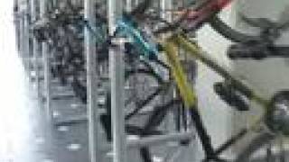
Cycling activism
[edit | edit source]Bike Paths Network
Bogotá is the city with the most extensive and comprehensive network of bike paths (Spanish: Ciclorrutas de Bogotá) in the Americas, with a total of 564 kilometers (350 mi) as of 2022. The network was initially designed and built during the administration of Superior Mayor of Bogotá Enrique Peñalosa and is one of the most extensive in the world.
The design of the network took into consideration the morphology and topography of the city. The network is integrated with the city's TransMilenio bus rapid transit system.
Ciclovía
see: Colombia, Cycling
Sustainable transport activism
[edit | edit source]TransMilenio
TransMilenio is a bus rapid transit (BRT) system that serves Bogotá, the capital of Colombia, as well as Soacha, a neighbouring city. The system opened to the public in December 2000. As of 2024, 12 corridors containing 99 bus routes totalling 114.4 km (71 mi) run throughout the city. It is part of the city's Integrated Public Transport System (Spanish: Sistema Integrado de Transporte Público; SITP), along with the urban, complimentary, and special bus services operating on neighbourhood and main streets.
TransMilenio consists of several interconnected BRT lines, with raised floor stations in the center of a main avenue, or "troncal". Passengers typically reach the stations via a bridge across the street. Typically, four lanes down the center of the street are dedicated to bus traffic, with the outer lanes allowing express buses to bypass buses stopped at a station.
As of 2025, the trunk line system was circulating 1,825 buses on average. An additional set of 876 regular buses, known as "feeders" (alimentadores), carry passengers from certain important stations to many different locations unreachable on the main route. Unlike the main TransMilenio buses, feeders operate without dedicated lanes, are not articulated, and are either green or blue (regular TransMilenio buses are red). There is no additional fare to use the feeder buses.
There are 27 bicycle parking facilities in main TransMilenio stations with 7,351 parking spaces to facilitate cyclists using the system. Eight BRT corridors were certified in 2013 to meet the BRT standard with excellence: Autonorte and Caracas received silver certifications, while Americas, Calle 80, Eldorado, NQS, and Suba received gold.
see also: TransMilenio, Controversies W
Pico y placa
Pico y placa (literally Peak and Plate, Spanish for peak [hour] and [license] plate) is a driving restriction policy aimed to mitigate traffic congestion. The scheme was initially set in place in Bogotá, Colombia in 1998 by then mayor Enrique Peñalosa to help regulate traffic during rush hours. The system restricts traffic access into a pre-established urban area for vehicles with license plate numbers ending in certain digits on pre-established days and during certain hours. Initially, the system restricted traffic between 6 and 9 am and between 5 and 8 pm Monday through Friday.
The scheme restricts both private and public use vehicles based on the last digit of the licence plate numbers. Four numbers are restricted every day for private use vehicles, and two for public transportation vehicles. The restricted digits associated to each day rotate every year. Schemes with the same name have been implemented in other Colombian cities, such as Medellín, Pereria and Cúcuta; and also in Quito, Ecuador's capital city.
News archive
[edit | edit source]2007-2020
- Bogotá expands bike lanes to curb coronavirus spread, Mar 20, 2020...smartcitiesworld.net
- Improving life in Bogota by empowering citizens to cycle, September 23, 2013...theguardian.com
- Bogotá: engineers improved upon the iconic bus rapid transit (BRT) system of Curitiba, Brazil, to create the TransMilenio, which has helped decrease air pollution, increase quality of life, and inspire similar projects in Europe, North America, and Asia...Worldwatch Institute, Cities Key to Tackling Poverty, Climate Change, January 10, 2007.
About Bogotá
[edit | edit source]Bogotá (, also UK: , US: , Spanish pronunciation: [boɣoˈta] ) is the capital and largest city of Colombia. The city is administered as the Capital District, as well as the capital of, though not politically part of, the surrounding department of Cundinamarca. Bogotá is a territorial entity of the first order, with the same administrative status as the departments of Colombia. It is the main political, economic, administrative, industrial, cultural, aeronautical, technological, scientific, medical, educational and airport center of the country and northern South America.
| Authors | Phil Green |
|---|---|
| License | CC-BY-SA-3.0 |
| Cite as | Philralph (2014–2026). "Community action/Bogotá". Appropedia. Retrieved July 12, 2026. |