


Community action/Oxfordshire

| Map | |
|---|---|
| Location | Oxfordshire, South East England |
| Coordinates | 51° 35' 27.86" N, 1° 14' 37.44" W |
The aim of this page is to recognise, celebrate and encourage the self-empowerment of community agency networks (CANs) and community groups' activism for climate, environment and many other sustainability topics across Oxfordshire.
News
 ‘A share in the delight’: the people investing in the UK’s first community-owned solar battery, theguardian.com (May 08, 2026) — Oxfordshire’s Ray Valley Solar already generates clean energy for 7,000 homes, and is now crowdfunding storage to marry daylight with evening demand
- UK’s first community-owned battery site launches share offer, thenews.coop (Apr 13, 2026)
- Salt Cross: Carbon neutral village plans approved by government, BBC News (Feb 04, 2026)
- White storks: why introducing non‑native species in rewilding projects can be a good idea, theconversation.com (Jun 05, 2026)
- Record-breaking heat and dry spring leave parts of England without water, reuters.com (May 29, 2026)
- Quarter of England at risk of water shortages (Mar 28, 2026) — less water in the system than planners are currently preparing for will have a knock-on effect on new housing developments
- National Trust asks public to join call for urgent Government action after hundreds of wildfires break out, and full extent of nature loss at Dunwich Heath emerges, nationaltrust.org.uk (Aug 07, 2026) — “The climate crisis long predicted by scientists is happening here and now. Ferocious wildfires, unprecedented temperatures and record-breaking droughts are already hitting communities and nature across the UK – they are not a distant threat. Tackling this emergency must be a cross-Government priority because it touches every aspect of our lives, our society and our economy. So we’ve launched a petition to demonstrate to Ministers the strength of public feeling on this issue." National Trust Director-General Hilary McGrady. To sign the petition, visit: nationaltrust.org.uk/wildfire-petition
- All of England's rivers and lakes polluted with chemicals, officials say, BBC News (Aug 06, 2026)
- Firefighting aircraft aren’t enough – Britain needs to build a wildfire‑resilient society that involves everyone, Komal Raj Aryal, Lecturer in Crisis and Disaster Management, Aston University, theconversation.com (Aug 06, 2026)
- Europe’s rivers are running dry, and the knock-on effects are disastrous, Yiannis Baboulias, theguardian.com (Aug 05, 2026)
- How Australia combines modern tech and Indigenous knowledge to fight wildfires, BBC News (Aug 01, 2026)
- May and June heatwaves killed about 2,700 people in England and Wales, data suggests, theguardian.com (Jul 13, 2026) — Extreme heat led to 440 deaths a day during June peak, say scientists, with climate crisis ramping up temperatures
- South Korea's president orders all-out response to heatwave, reuters.com (Aug 06, 2026)
- Young activists in the Maldives confront climate threats to their island nation, seattletimes.com (Aug 06, 2026)
- Philippines steps up solar transition as Iran war hikes energy costs, eenews.net (Aug 06, 2026)
Networks and sustainability initiatives
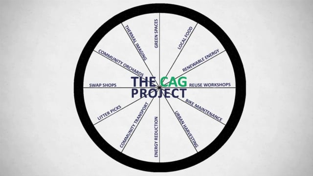
- Community Action Groups, network of local voluntary groups in Oxfordshire involved in community led climate change action.
- Earth Trust, is an environmental learning charity (not-for-profit organisation) established to promote environmental conservation through land management, education, and land science, based in Little Wittenham.
- Earth Trust hosts a full programme of events each year, including countryside management courses, taster workshops and family festivals. They are best known for their Lambing Weekends in spring, which were attended by over 8,000 people in 2016.[6]
- Earth Trust relies on the support of volunteers who carry out a range of tasks, including habitat management on their nature reserves, administration in the office, and support during education sessions and events. In 2016 the hard work of the Earth Trust Volunteers was recognised when they received The Queen's Award for Voluntary Service – the MBE for volunteer groups. W / Earth Trust Centre W, Earth Trust
CDC videos
Each week 3 different short videos from across the UK or world.


Community action/Manchester, Community action/Essex, Community action/West Sussex / ...This week's featured Global videos / ... read more about Cosmolocalism
UK and international events
UK events
 Aug 10 - 16, 2026 (Mon - Sun) — National Allotments Week, 2026 theme is “Grow to Learn.”, thenas.org.uk
Global or international events
- Aug 09, 2026 (Sun) — International Day of the World's Indigenous People, observed on 9 August each year to raise awareness and protect the rights of the world's indigenous population, un.org
- Aug 12, 2026 (Wed) — International Youth Day, awareness day designated by the United Nations taking place on Aug 12 each year, un.org
2021-2030, UN Decade on Ecosystem Restoration, International community action events
Oxfordshire video

Food activism
Community energy

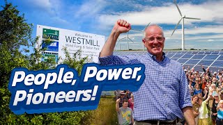
Westmill Wind Farm Co-operative Limited is a community-owned registered society that owns 100% of the Westmill Wind Farm which is an onshore wind farm near the village of Watchfield in the Vale of White Horse, England. It has five 1.3 MW wind turbines erected in a line along the disused runway of the former RAF Watchfield. The wind farm has a power output of up to 6.5 MW, projected to produce as much electricity in a year as used by more than 2,500 homes. The turbines were erected in 8 days and the first fully month of generation was March 2008. It has an open day usually in June each year.
The wind energy co-operative was established in 2004 and currently has approximately 2,200 members. The wind farm is intended to help to reduce dependence on fossil fuels whose emissions are considered to contribute to climate change. In 2007 Westmill Wind Farm Co-operative received a Schumacher Award. Westmill Wind Farm was originally developed by Adam Twine who was in the later stages assisted by Energy4All, a company founded to enable community owned renewable energy projects by Baywind Energy Co-operative.
Westmill Sustainable Energy Trust (WeSET) is a charity formed in 2010 which receives a £6,500 grant from the wind farm's revenue each year. Its objective is to encourage and promote the deployment of sustainable energy, in particular (but not exclusively) within a 25-mile radius from Westmill Wind Farm.
The community-owned Westmill Solar Park is located on an adjoining site. Westmill Woodland Burial Ground, a natural burial site, is also close to the wind farm. In 2019 the Westmill Wind and Solar Co-operatives were both awarded Fair Tax Mark accreditation.
- Low Carbon Hub, social enterprise "out to prove we can meet our energy needs in a way that's good for people and the planet". Low Carbon Hub was awarded the Ashden Award for Sustainable Communities in 2016. added 16:01, 29 July 2021 (UTC). OxfordLowCarbonHub on youtube.com, added 15:56, 15 October 2025 (UTC)
- Abingdon Hydro
- People's Power Station, online platform showing the impact this 'positive energy' is making in Oxfordshire
- Southill Community Energy
- Westmill Energy, three independent entities, the Westmill organisations believe in the power of collective action and have joined forces to share their stories with one voice. added 15:59, 26 October 2025 (UTC)
- Westmill Solar Co-operative
- Osney Lock Hydro on lowcarbonhub.org
Housing and land
- Collaborative Housing, hub and collaborative effort to support the development of a pipeline of community-led housing projects across Oxfordshire, Berkshire and Buckinghamshire. 'added 16:31, 17 December 2021 (UTC)
Citizens data initiative
- Who Owns Oxford?, project started by a group of Oxford citizens who believe that more transparency on land ownership leads to better decisions on how land could be used across the county. added 12:50, 14 April 2021 (UTC)
see also: Towards a more democratic and climate friendly way of meeting housing need across England
Arts, sport and culture
OYAP Trust, formerly the Oxfordshire Youth Arts Partnership, is a UK-based charity involved in the education of young people through participation in the arts. The trust aims to develop skills, confidence and self-esteem and give vulnerable young people access to mainstream education, arts and training opportunities. OYAP Trust works with young people to create a brighter future for communities. W
Health and wellbeing
The Sonning Common Health Walks was set up in 1996 by Dr William Bird, who is a general practitioner in Reading, Berkshire, England. The walks aim to reduce heart disease, reduce cholesterol and blood pressure, relieve depression and anxiety, reduce stress, help with weight management / obesity, and help with diabetes. Each walk is led by a leader who is a trained volunteer, who knows the route. Participants walk at their own pace but are advised to exert yourself to raise their heart rate and get them breathing faster.
Bird set up health walks from his practice in Sonning Common, Oxfordshire, and then worked with the Countryside Agency and the British Heart Foundation to expand it nationally.
Reduce, reuse, repair and recycle
Bicester Green, independent social enterprise, led by the local community. Main activities are repair and refurbishment of items, such as small electricals, wooden furniture, and bicycles. - Oxfordshire Waste Partnership
Climate action
Climate emergency centres
Sustainable transport activism
- Autonomous bus service - Milton Park to Didcot Parkway. The UK’s first fully electric autonomous bus service. mi-link.uk, added 18:11, 22 November 2025 (UTC)
Walking
The Oxford Green Belt Way is a long-distance path in Oxfordshire, England. It follows a circular route of 50 miles (80 km) through the Oxford Green Belt surrounding the city of Oxford. The route was devised in 2007 to mark the Campaign to Protect Rural England 75th anniversary and to highlight the importance of the Green Belt. On its launch each mile on the route marks one year since the designation of the greenbelts in 1956.
From the mid-point western edge to the southeast corner of Oxfordshire, via the city in the middle, runs the Thames with its flat floodplains. This river forms the historic limit with Berkshire, remaining so on some lowest reaches. The Thames Path National Trail follows the river from upper estuary to a source.
Many smaller rivers in the county feed into the Thames, such as the Thame, Windrush, Evenlode and Cherwell. Some of these have trails running along their valleys. The Oxford Canal links to the Midlands and follows the Cherwell from Banbury via Kidlington into the city of Oxford, where these join the navigable Thames. About 15% of the historically named Wilts & Berks Canal, in sporadic sections, has been restored to navigability, including the county-relevant[clarification needed] 140 metres near Abingdon-on-Thames where it could, if restored, meet the Thames. W
Footpaths in Oxfordshire, (category) W
Waterways
The Oxford Canal is a 78-mile (126 km) narrowboat canal in southern central England linking the City of Oxford with the Coventry Canal at Hawkesbury (just north of Coventry and south of Bedworth) via Banbury and Rugby. Completed in 1790, it connects to the River Thames at Oxford, and links with the Grand Union Canal, which it is combined with for 5 miles (8 km) between to the villages of Braunston and Napton-on-the-Hill.
The Wilts & Berks Canal Trust is a registered charity no. 299595, and a waterway society based in Wiltshire, England, concerned with the restoration of the Wilts & Berks Canal.
The Trust is the successor to the Wilts & Berks Canal Amenity Group (formed in 1977) and a founder member of the Wiltshire, Swindon & Oxfordshire Canal Partnership, which embraces the Trust, the local authorities for the areas through which the route of the canal passes, statutory bodies, and other interested parties. The Trust's headquarters are at Dauntsey Lock, adjacent to the canal between Chippenham and Royal Wootton Bassett.
The Trust's Aim is to protect, conserve and improve the route of the Wilts & Berks Canal, North Wilts Canal, and branches, for the benefit of the community and environment, with the ultimate goal of restoring a continuous navigable waterway linking the Kennet and Avon Canal near Melksham, the River Thames near Abingdon, and the Thames and Severn Canal near Cricklade. W
Cycling activism
- Oxfordshire Online Cycle Map, cyclingukoxfordshire.org, added 09:01, 26 July 2024 (UTC)
National Cycle Routes in or around Oxfordshire include Route 5 W, running from Reading to Holyhead, via Oxford; and Route 51 W, running broadly east-west connecting Colchester and the port of Harwich to Oxford.
Biodiversity
Berks, Bucks & Oxon Wildlife Trust
Open spaces
Parks and open spaces in Oxfordshire (category) W
The Oxford Green Belt is a green belt environmental and planning policy that regulates the rural space in Oxfordshire, within the South East region of England. It is centred on the city of Oxford, along with surrounding areas. Its core function is to control urban growth and development in and around the Oxford built-up area. It is managed by various local planning authorities, as it largely falls outside the jurisdiction of Oxford City Council.
News archive
2018-2023
- Henley Rowers and Local Community Expose Sewage Pollution of the River Thames, river-action.prowly.com (Jul 03, 2023)
- The activists taking on England’s sewage-spilling water firms – and winning, positive.news (Aug 23, 2022)
- 'UK's first tiny forest' in Witney helps urban environment, Mar 10, 2020...BBC News
- This disastrous new project will change the face of Britain, yet no debate is allowed, George Monbiot, Aug 22, 2018...The Guardian
About Oxfordshire
Oxfordshire ( OKS-fərd-shər, -sheer; abbreviated Oxon) is a ceremonial county in South East England. The county is bordered by Northamptonshire and Warwickshire to the north, Buckinghamshire to the east, Berkshire to the south, and Wiltshire and Gloucestershire to the west. The city of Oxford is the largest settlement.
The county is largely rural, with an area of 1,006 sq mi (2,605 km2) and an estimated population of 763,218 in 2024. Oxford, which is famous for its university, is near the centre of the county. Other settlements include Banbury in the north, Bicester in the north-east, Abingdon-on-Thames and Didcot in the south, and Witney in the west. For local government purposes Oxfordshire is a non-metropolitan county with five districts. The part of the county south of the River Thames, largely corresponding to the Vale of White Horse district, was historically part of Berkshire.
The lowlands in the centre of the county are crossed by the River Thames and its tributaries, the valleys of which are separated by low hills. The south contains parts of the Berkshire Downs and Chiltern Hills, and the north-west includes part of the Cotswolds; all three regions are Areas of Outstanding Natural Beauty. The county's highest point is White Horse Hill (261 metres/856 ft), part of the Berkshire Downs.
Near you
| Authors | Phil Green |
|---|---|
| License | CC-BY-SA-3.0 |
| Cite as | Philralph (2014–2026). "Community action/Oxfordshire". Appropedia. Retrieved August 12, 2026. |