
Community action/Dartford

The aim of this page is to recognise, celebrate and encourage the self-empowerment of community agency networks (CANs) and community groups' activism for climate, environment and many other sustainability topics across Dartford.
News
[edit | edit source]- Plans for £3.5bn theme park on Kent marsh dismay conservationists...theguardian.com, Oct 21, 2020.
Video
[edit | edit source]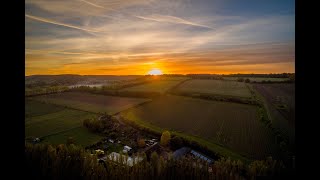


Community involvement
[edit | edit source]Dartford also has a youth council called the Dartford Youth Council (DYC) which comprises members of the youth representing local secondary schools, youth groups (such as Scouts). They discuss important issues relating to the youth of Dartford, such as mental health, to staying fit and how they can help and combat those issues. They attend a monthly meeting, at the Civic Centre. They have represented Dartford's youth in several events. Every November, members attend and represent Dartford Youth Council in the annual Dartford Remembrance Parade.
Visions
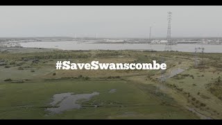
[edit | edit source]- Vision for Swanscombe Peninsula: The Save Swanscombe Peninsula SSSI community group gathered local opinions to find out what people want to see at Swanscombe Peninsula. cdn.buglife.org.uk, November 2022
Health and wellbeing
[edit | edit source]Ecology Island, northkentmind.co.uk
Sustainable transport
[edit | edit source]The waymarked path Darent Valley Path is 19 miles (31 km) long, following the River Darent from the banks of the River Thames at Dartford through the Kent Downs Area of Outstanding Natural Beauty to the Greensand Hills above Sevenoaks. It runs through the villages of Shoreham and Otford.
The route is well served by public transport making it ideal to break into manageable walks. Railway stations are situated at Sevenoaks, Bat & Ball, Otford, Eynsford, Farningham Road, Dunton Green and Dartford, and there are many bus routes along the route.
The route is also used by National Cycle Network Route 125, which follows the same route as the footpath.
Maps
Map of the route using OpenStreetMap data - Highlighted map of Darent Valley Footpath
Environment quality
[edit | edit source]- Dartford Clean Air on facebook.com
- Dartford Litterpickers on facebook.com
Open spaces
[edit | edit source]Central Park is a formal park in the town centre, used for various community events. It comprises 26 acres (110,000 m2) of land. W
Community river action
[edit | edit source]- Darent Nature Partnership, added 14:48, 4 June 2024 (UTC)
About Dartford
[edit | edit source]Campaigns
- Save Swanscombe Peninsula, added 17:32, 2 February 2022 (UTC)
- Save Swanscombe Marshes, buglife.org.uk, added 09:05, 24 December 2021 (UTC) - London Resort – a fact check buglife.org.uk, added 15:42, 24 September 2021 (UTC)
Dartford is the principal town in the Borough of Dartford, Kent, England. It is located 18 mi (29 km) south-east of Central London and is situated adjacent to the London Borough of Bexley to its west. To its north, across the Thames Estuary, is Thurrock in Essex, which can be reached via the Dartford Crossing. To its east lies the Borough of Gravesham and to the south the district of Sevenoaks. It had a population of 51,240 in 2018.
The town centre lies in a valley through which the River Darent flows and where the old road from London to Dover crossed: hence the name, which derives from Darent + ford. Dartford became a market town in medieval times and, although today it is principally a commuter town for Greater London, it has a long history of religious, industrial and cultural importance. It is an important rail hub; the main through-road now by-passes the town itself.
Near you
[edit | edit source]See also
[edit | edit source]- Towards a more democratic and climate friendly way of meeting housing need across England
- London and South East England
- Saving water in South East England
| Authors | Phil Green |
|---|---|
| License | CC-BY-SA-3.0 |
| Cite as | Philralph (2022–2025). "Community action/Dartford". Appropedia. Retrieved July 15, 2026. |