There are now multiple mature general Open Source GIS data-serving platforms such as GeoServer and MapServer, as well as capable desktop GIS applications such as Quantum GIS (QGIS) and GRASS GIS. The excellent OSGeo organisation's website maintains a useful listing of these, as well as links to individual projects.
In recent years though, several open source extensions to GIS platforms such as these, and also free-to-access web GIS mapping platforms like Google Maps, have developed to allow analysis and evaluation of the effectiveness of a public transport network, in line with new knowledge about public transport best practice such as Integrated Multimodal Network Planning. These kinds of tools are a particular form of Transport informatics.
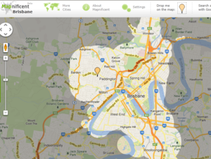
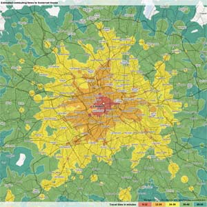
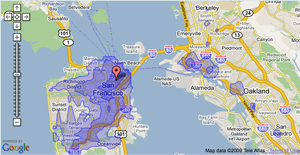
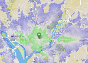
Many of these allow various forms of visual display and analysis such as in the form of Travel Time Maps. This supports a better visual evaluation and communication of the 'geography of mobility and accessibility' provided to public transport users under a given scenario. These could well be included in Indicator frameworks as an important aspect of assessing a city's provision of urban services to residents.
Relationship of informatics tools to datasets and data standards[edit | edit source]
Of course to use the tools, users need to either gain access to, or assemble, relevant geo-spatial data such as street networks, and/or public transport timetables. Again, some positive directions have occurred here through increasing efforts to standardise relevant data formats such as GTFS for public transport, and the OpenStreetMap project to create an open-access collaboratively developed global street network database.
Notably from a Community Informatics perspective, several of the tools originated or had significant input from civil society non-profit organizations in their development, and their open source nature means that groups with sufficient expertise can utilise them.
Informatics tools in relation to transportation modelling[edit | edit source]
Conceptually, such tools are different from full-scale transport simulation models - in that they support understanding and analysis of current transport networks or future scenarios, but don't include dynamics simulation of how current situations could evolve based on past behaviour. However in the medium-long term they should be able to be complementary to such models, as discussed in the Transportation modeling reform page.
Tools Surveyed for Review in Relation to Public Transport Network Redesign project[edit | edit source]
These particular tools were chosen for a review in the 3rd quarter of 2013 as part of the OSSTIP work package, OSSTIP/WP2- Transport Informatics tools review.
Other tools[edit | edit source]
That also look promising, but don't have their own evaluation/summary page yet:
- GTFS Explore Tool (See a partial description at the OpenPlans website, it has the capability to calculate several indicators from the US "Transit Capacity Quality Level of Service Manual" (TCQLSM)).
- GeoTrellis Transit - see Information Page, and API Documentation and link to demo instance at Philadephia, and source code on Github.
- Not available under one of the standard FOSS licenses, but for educational use: RTran, by Peter Rickwood, a (deliberately) simplified 4-step style transport analysis support package, for educational and research purposes.
- https://github.com/vasile/transit-map and https://github.com/vasile/GTFS-viz, useful for creating a really nice visualisation of animated moving trains from a GTFS dataset, see http://simcity.vasile.ch/sbb/
- As part of the Urban Data Science Toolkit, a consortium of researchers and developers in the US are developing a range of open source tools. One that looks relevant to transport analysis is Pandana, a tool to perform accessibility queries on OpenStreetMap data based on the Pandas Python stats toolkit.
Proprietary tools[edit | edit source]
(note:- possibly should be spun-off to their own page)
- Remix - https://www.remix.com/ - a web-service based tool for network planning and analysis - focused on supporting (for a fee) practicing transport planners.
See also[edit | edit source]
- General Transit Feed Specification
- Transport modeling reform
- OSSTIP: Open Source Sustainable Transport Informatics Platform
- Integrated multimodal network planning
- Public transport data APIs
- OpenStreetMap
External Links[edit | edit source]
- There is a nice short discussion of different Open Source Tools relevant to participatory transport planning over at http://openplanningtools.org/ParticipatoryPlanning/Software
- http://bit.ly/leverage-gtfs is an excellent resource developed by Aaron Antrim of www.trilliumtransit.com about the GTFS open data standard, and how it can be used to support public transport planning, operations, and research.
- Proposal for an 'Open Transportation Technology' StackExchange site - as of Feb 2014, unfortunately closed due to lack of commitment. May be restarted or relaunched as another site, see this thread on the transit developers mailing list.
- "PlannerStack" - developing since 2014, an approach for a framework+ecosystem for integrating multiple tools about travel information, in relation to Open Data. See http://web.archive.org/web/20190806043857/http://www.plannerstack.org:80/
