


Category:Maps
| Content | 35 pages
1 subcategories
4 files |
|---|---|
| Main page | Help:Maps |
| Top page | Queen's Applied Sustainability/Lab protocols/A transition from ArcGIS to open source GIS softwares (1,343) |
| Impact | 5,271 page views (analytics) |
Maps are a key planning tool in sustainability and international development.
Pages in category "Maps"
The following 35 pages are in this category, out of 35 total.
C
- Citizen Action Network/Africa, Asia and Oceania
- Citizen Action Network/Europe
- Citizen Action Network/Latin America
- Citizen Action Network/Near you
- Citizen Action Network/North America
- Citizen Action Network/Rest of UK
- Citizen Action Network/Scotland
- Citizen Action Network/Scotland/support
- Citizen Action Network/South West England
- Citizen Action Network/Support map
- Citizen Action Network/United Kingdom
- Commercial softwares to extract features from aerial photos
- Community action/Maps for
- Community gardens map
F
M
Q
Media in category "Maps"
The following 4 files are in this category, out of 4 total.
-
 Community heat map.jpg 1,024 × 808; 124 KB
-
 Mapknitter-example.png 1,203 × 715; 1.24 MB
-
 Mississippi-meander-fisk-banner.jpg 1,500 × 908; 2.19 MB
-
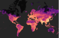 Populationworld.png 691 × 450; 376 KB


