No higher resolution available.
Wind_MAp.png (663 × 534 pixels, file size: 199 KB, MIME type: image/png)
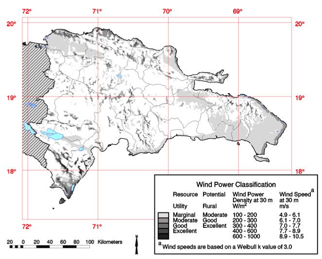
Dominican Republic wind measurements.
Elliot, Dennis L. "Dominican Republic: Most Favorable Wind Resource Areas." Map. Dominican Republic Wind Energy Resource Atlas Development. National Renewable Energy Laboratory. Print.
File history
Click on a date/time to view the file as it appeared at that time.
| Date/Time | Thumbnail | Dimensions | User | Comment | |
|---|---|---|---|---|---|
| current | 14:08, 8 June 2011 | | 663 × 534 (199 KB) | Tre18 (talk | contribs) | |
| revert | 14:03, 8 June 2011 |  | 673 × 547 (204 KB) | Tre18 (talk | contribs) | Dominican Republic wind measurments |
You cannot overwrite this file.
File usage
The following page uses this file: