Original file (1,425 × 625 pixels, file size: 52 KB, MIME type: image/png)
Summary
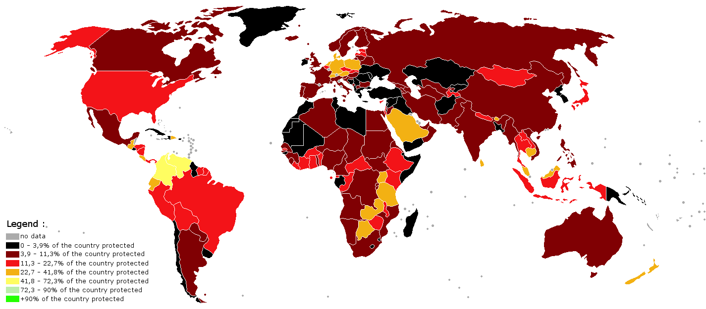
World map indicating the percentage of the country under protection. The map was made using the BlankMap-World-V6 and the data from 2005 AD from this map made by Kyle Dietrich. Note that the map does use much gap difference between the colors; perhaps a better map can be made in time using this data
It should finally also be mentioned that not all regions have equal amounts of biodiversity and old-growth forest regions, and so having a larger percentage of the country protected is more important with certain countries (those that lie within [en.wikipedia.org/wiki/Biodiversity_hotspot biodiversity hotspot regions]. Also, land that is in private hands but is not modified in any way (such as with REDD land) is not calculated in.
Licensing
File history
Click on a date/time to view the file as it appeared at that time.
| Date/Time | Thumbnail | Dimensions | User | Comment | |
|---|---|---|---|---|---|
| current | 14:58, 31 January 2014 | | 1,425 × 625 (52 KB) | KVDP (talk | contribs) | World map indicating the percentage of the country under protection. The map was made using the [http://commons.wikimedia.org/wiki/File:BlankMap-World-v6.png BlankMap-World-V6] and the data from 2005 AD from [https://sge.lclark.edu/wp/wp-content/upload... |
You cannot overwrite this file.
File usage
The following file is a duplicate of this file (more details):
- File:Protected areas by percentage per country.png from Wikimedia Commons
There are no pages that use this file.