Original file (1,425 × 625 pixels, file size: 91 KB, MIME type: image/png)
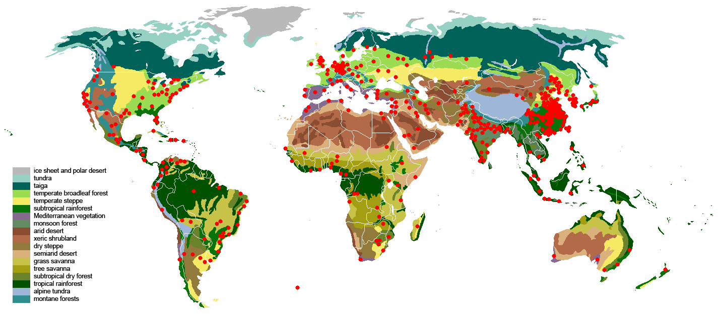
Map showing the urbanization within biomes. The map was made using following maps:
The map clearly shows that many cities allready exist in forest areas, despite that these areas are unsuitable to house people and produce food. An even worse fact is that they are continuing to grow, requiring entire forests to be cut down to make room for the increased urbanization.
Meanwhile, much less populated/biodiversity rich zones (ie Mongolia, ...) that are suitable to produce food (fertile grasslands, allowing the keeping of animals for food as well as the planting of crops) remain unused.
Moving parts of the people, for example to grasslands/steppes, savannas, ... which have a far lower biodiversity, and also have richer soil might as such be very beneficial, for economy/people and planet. At present however, this seems unrealistical due to restrictions of people's movements (across the borders of countries), invoked by the governments of the different countries (especially the need of permits to be able to stay/work is a huge problem).
It should be noted that the current map is rather rough; a more detailed map of the forests can be seen here and the beginning urbanization can be seen in more detail here
File history
Click on a date/time to view the file as it appeared at that time.
| Date/Time | Thumbnail | Dimensions | User | Comment | |
|---|---|---|---|---|---|
| current | 10:59, 12 January 2014 | | 1,425 × 625 (91 KB) | KVDP (talk | contribs) | Map showing the urbanization within biomes. The map was made using following maps: * [https://commons.wikimedia.org/wiki/File:2006megacities.PNG 2006megacities.png] * [http://commons.wikimedia.org/wiki/File:Vegetation.png Vegetation.png] The map clear... |
You cannot overwrite this file.
File usage
The following page uses this file: