
File:Tolocar Activities Map.png
Size of this preview: 800 × 533 pixels. Other resolution: 4,961 × 3,307 pixels.
Original file (4,961 × 3,307 pixels, file size: 1.36 MB, MIME type: image/png)
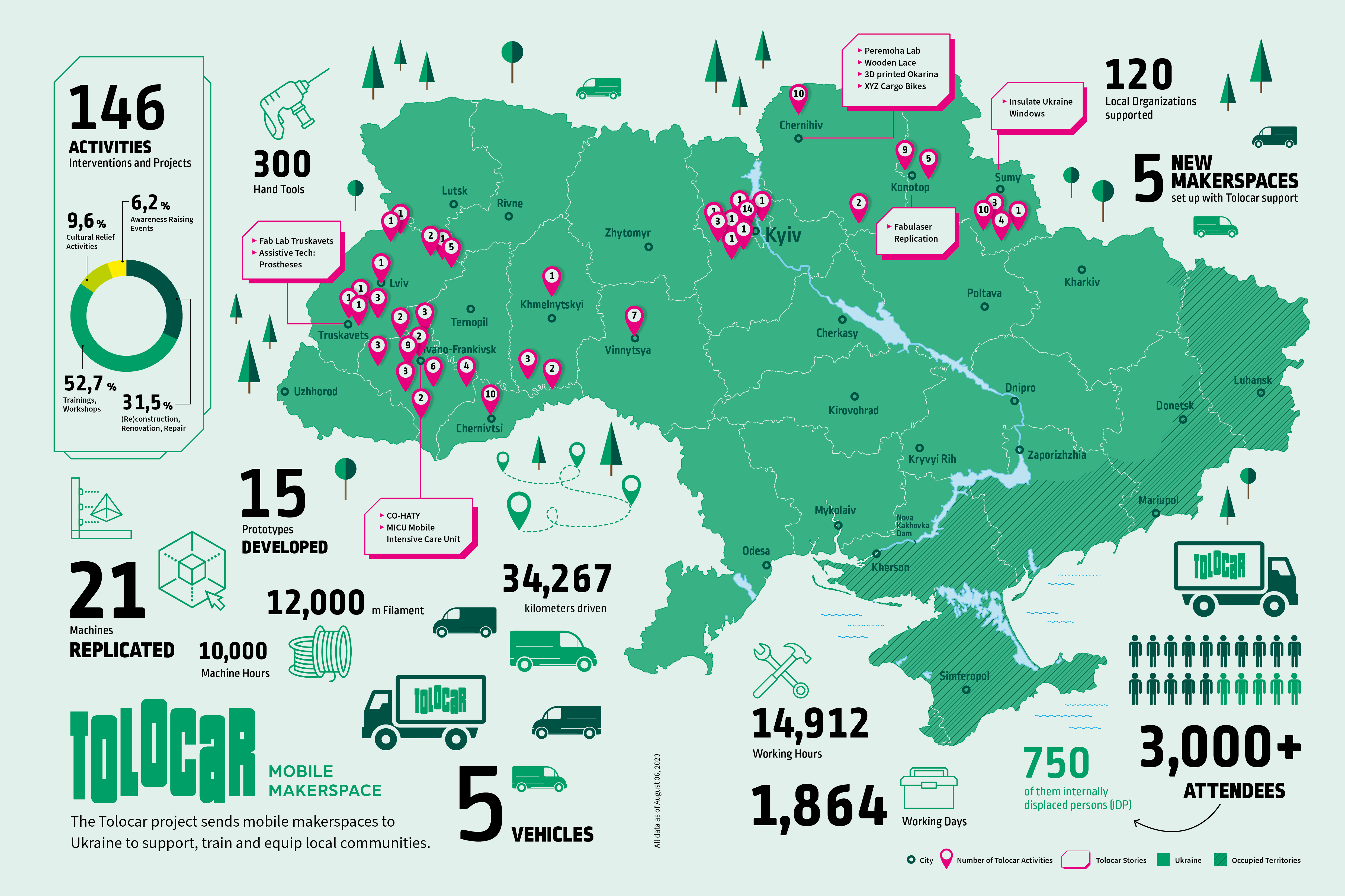
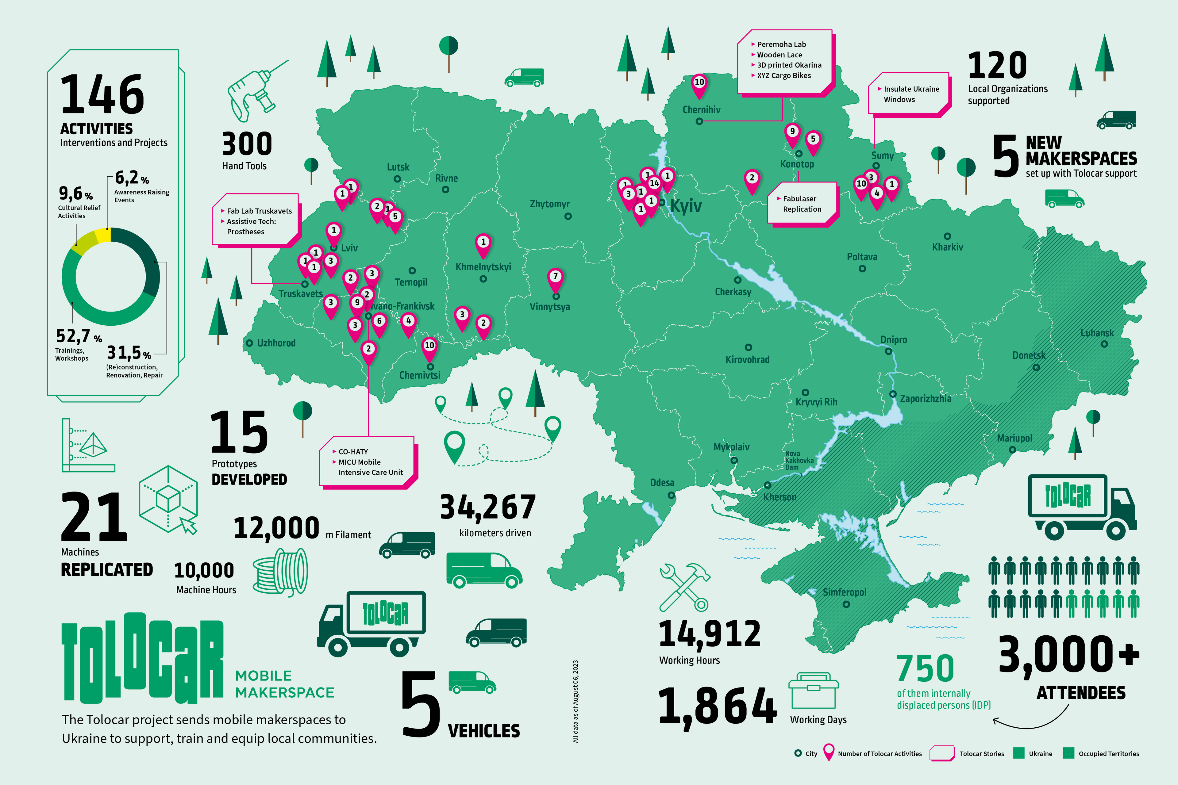
A map of the Tolocar activities until August 6, 2022.
Please note: The map is intended for informational purposes only and in no way constitute recognition of oundaries and territories under international law. We accept no responsibility for the map being entirely up to date, correct or complete. Liability for any damage, direct or indirect, resulting from their use is denied.
| Date created | January 17, 2024 |
|---|---|
| Author | Adriane Krakowski atelierandacht.de with input from the Tolocar project |
| Date uploaded | January 17, 2024 |
| Uploader | Victoria Wenzelmann |
| Source | playbook.tolocar.org |
| License | CC-BY-SA-4.0 |
File history
Click on a date/time to view the file as it appeared at that time.
| Date/Time | Thumbnail | Dimensions | User | Comment | |
|---|---|---|---|---|---|
| current | 14:47, 17 January 2024 | | 4,961 × 3,307 (1.36 MB) | Myamy (talk | contribs) | Uploaded a work by Adriane Krakowski, atelierandacht.de, with input from the Tolocar project from playbook.tolocar.org with UploadWizard |
You cannot overwrite this file.
File usage
The following 6 pages use this file: