Original file (1,425 × 625 pixels, file size: 57 KB, MIME type: image/png)
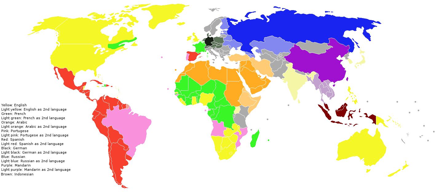
A world map indicating the the countries where the largest world languages are spoken. The map was based on an image in the book "Het menselijk ras" by Linda Gamlin, as well as an image in "Wolters Algemene Wereldatlas". Also included in the map are languages where these main world languages are well known and/or used as a second language. The map is intented as a map for travel purposes, indicating the locations travellers can visit when they have mastered or know (a) certain world language(s). The map thus intents to reduce the amount of languages to learn for world travel, meaning that as little as possible languages are included, and alternative main world languages are used wherever possible. The map could in a later version perhaps be improved in this respect further. An example of the simplification was Indian, Korean and Japanese; this was taken out and replaced by english, ... Some countries may still need to be given a secondairy language. Perhaps another major language needs to be added (not sure about Farsi)
File history
Click on a date/time to view the file as it appeared at that time.
| Date/Time | Thumbnail | Dimensions | User | Comment | |
|---|---|---|---|---|---|
| current | 09:23, 14 December 2010 | | 1,425 × 625 (57 KB) | KVDP (talk | contribs) | A world map indicating the the countries where the largest world languages are spoken. The map was based on an image in the book "Het menselijk ras" by Linda Gamlin, aswell as an image in "Wolters Algemene Wereldatlas". Also included in the map are langua |
You cannot overwrite this file.
File usage
The following file is a duplicate of this file (more details):
- File:Main world languages.png from Wikimedia Commons
The following page uses this file: