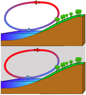
Wind is the flow of air on a large scale. It is the result of the uneven heating of the Earth by the sun and the fact that temperatures are invariably trying to reach an equilibrium (heat is always moving to a cooler area). The wind energy is the kinetic energy of the air in motion.
On Earth, wind is relatively mild - astronomers have discovered that on other planets, winds can reach thousands of kilometers per hour. This is one of the ways in which Earth's exceptional conditions make life possible for us, and remind us of the care we need to take of this unique planet.
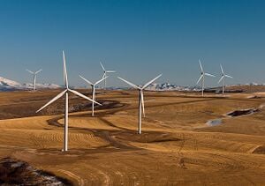
With this current state of our environment, we now need to be utilizing more renewable energies such as wind. Wind turbines can be placed in farmlands and other open fields that have no obstructions or all structures around them.
Wind energy levels[edit | edit source]
The available wind energy or power density varies heavily depending on the location on earth, as well as the altitude above the soil. There are several classifications, and ways of determining the wind energy. For example, there is the Beaufort scale and the US NREL wind power density classification.[1]
-
Wind as a result of unequal solar radiation
-
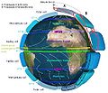
Global winds map
Beaufort scale[edit | edit source]
| Beaufort number | Description | Wind speed | Wave height | Sea conditions | Land conditions |
|---|---|---|---|---|---|
| 0 | Calm | < 1 km/h | 0 m | Flat. | Calm. Smoke rises vertically. |
| < 1 mph | |||||
| < 1 kn | 0 ft | ||||
| < 0.3 m/s | |||||
| 1 | Light air | 1.1–5.5 km/h | 0–0.2 m | Ripples without crests. | Smoke drift indicates wind direction and wind vanes cease moving. |
| 1–3 mph | |||||
| 1–2 kn | 0–1 ft | ||||
| 0.3–1.5 m/s | |||||
| 2 | Light breeze | 5.6–11 km/h | 0.2–0.5 m | Small wavelets. Crests of glassy appearance, not breaking | Wind felt on exposed skin. Leaves rustle and wind vanes begin to move. |
| 4–7 mph | |||||
| 3–6 kn | 1–2 ft | ||||
| 1.6–3.4 m/s | |||||
| 3 | Gentle breeze | 12–19 km/h | 0.5–1 m | Large wavelets. Crests begin to break; scattered whitecaps | Leaves and small twigs constantly moving, light flags extended. |
| 8–12 mph | |||||
| 7–10 kn | 2–3.5 ft | ||||
| 3.4–5.4 m/s | |||||
| 4 | Moderate breeze | 20–28 km/h | 1–2 m | Small waves with breaking crests. Fairly frequent whitecaps. | Dust and loose paper raised. Small branches begin to move. |
| 13–17 mph | |||||
| 11–15 kn | 3.5–6 ft | ||||
| 5.5–7.9 m/s | |||||
| 5 | Fresh breeze | 29–38 km/h | 2–3 m | Moderate waves of some length. Many whitecaps. Small amounts of spray. | Branches of a moderate size move. Small trees in leaf begin to sway. |
| 18–24 mph | |||||
| 16–20 kn | 6–9 ft | ||||
| 8.0–10.7 m/s | |||||
| 6 | Strong breeze | 39–49 km/h | 3–4 m | Long waves begin to form. White foam crests are very frequent. Some airborne spray is present. | Large branches in motion. Whistling heard in overhead wires. Umbrella use becomes difficult. Empty plastic garbage cans tip over. |
| 25–30 mph | |||||
| 21–26 kn | 9–13 ft | ||||
| 10.8–13.8 m/s | |||||
| 7 | High wind, Moderate gale, Near gale |
50–61 km/h | 4–5.5 m | Sea heaps up. Some foam from breaking waves is blown into streaks along wind direction. Moderate amounts of airborne spray. | Whole trees in motion. Effort needed to walk against the wind. |
| 31–38 mph | |||||
| 27–33 kn | 13–19 ft | ||||
| 13.9–17.1 m/s | |||||
| 8 | Gale, Fresh gale |
62–74 km/h | 5.5–7.5 m | Moderately high waves with breaking crests forming spindrift. Well-marked streaks of foam are blown along wind direction. Considerable airborne spray. | Some twigs broken from trees. Cars veer on road. Progress on foot is seriously impeded. |
| 39–46 mph | |||||
| 34–40 kn | 18–25 ft | ||||
| 17.2–20.7 m/s | |||||
| 9 | Strong gale | 75–88 km/h | 7–10 m | High waves whose crests sometimes roll over. Dense foam is blown along wind direction. Large amounts of airborne spray may begin to reduce visibility. | Some branches break off trees, and some small trees blow over. Construction/temporary signs and barricades blow over. |
| 47–54 mph | |||||
| 41–47 kn | 23–32 ft | ||||
| 20.8–24.4 m/s | |||||
| 10 | Storm,[2] Whole gale |
89–102 km/h | 9–12.5 m | Very high waves with overhanging crests. Large patches of foam from wave crests give the sea a white appearance. Considerable tumbling of waves with heavy impact. Large amounts of airborne spray reduce visibility. | Trees are broken off or uprooted, saplings bent and deformed. Poorly attached asphalt shingles and shingles in poor condition peel off roofs. |
| 55–63 mph | |||||
| 48–55 kn | 29–41 ft | ||||
| 24.5–28.4 m/s | |||||
| 11 | Violent storm | 103–117 km/h | 11.5–16 m | Exceptionally high waves. Very large patches of foam, driven before the wind, cover much of the sea surface. Very large amounts of airborne spray severely reduce visibility. | Widespread damage to vegetation. Many roofing surfaces are damaged; asphalt tiles that have curled up and/or fractured due to age may break away completely. |
| 64–72 mph | |||||
| 56–63 kn | 37–52 ft | ||||
| 28.5–32.6 m/s | |||||
| 12 | Hurricane[2] | ≥ 118 km/h | ≥ 14 m | Huge waves. Sea is completely white with foam and spray. Air is filled with driving spray, greatly reducing visibility. | Very widespread damage to vegetation. Some windows may break; mobile homes and poorly constructed sheds and barns are damaged. Debris may be hurled about. |
| ≥ 73 mph | |||||
| ≥ 64 kn | ≥ 46 ft | ||||
| ≥ 32.7 m/s |
US NREL wind power density classification[edit | edit source]
The US NREL wind power density classification separates the wind energy into classes from 1 to 7. Wind speeds for class 1 are 9.8 mph or less on average while the average for a class 7 is 21.1 mph or even more. Each class has a specific amount of watts per square meter (ie wind power classes 3: 300–400 W/m2 at 50 m altitude; wind power class 7: 800–2000 W/m2 at 50 m altitude). For effective power production, at least class 2 winds (11.5 mph average speed) are required.
Each class also has wind energy levels depending on the altitude (this makes sense as wind energy levels increase heavily with the altitude).
Determining the local wind energy levels[edit | edit source]
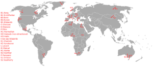
Although it is possible to determine the local wind energy level yourself, global maps are available which instantly provide you a good idea of the wind energy at a specific location and altitude. The advantage of this is that a lot of time can be saved (measurements need to be taken over a long period of time) and there is also no risk of miscalculation. Using common sense (ie on a unobstructed location,...), we can determine a suitable location within an area that is marked on the map as high in wind power.
Determining a suitable location within a region[edit | edit source]


A suitable location for a wind energy harvester within a region that has high wind energy can be found easily by means of utilizing common sense. Besides the obvious choosing of a location that is free of wind breaks, obstructions, additional wind energy can be obtained near shore and mountains. When installing a wind turbine you should have an area with out tall buildings or structures as it will have an affect on the turbines efficiency to produce electricity. The turbine should be at a high point on the property and away from large buildings. The average home uses about 9,400 Kilowatt-hours per year and turbines for the house are rated at about 5-15 kW.
There are two different structures of turbine one horizontal and the other a vertical axis. Horizontal axis turbines need to be facing the direction of the wind while vertical axis can face any direction but requires more ground space then horizontal. Most turbines require little maintenance and have a life span of about 20 years although it varies. This is a great way to lower your energy bill by harnessing free energy year round. Although the electricity produced is intermittent because it depends on direction and speed of the wind your only cost will be instillation and parts so they are still a viable option for large scale renewable energy projects or home instillations to lower your family's non-rewnable energy consumption.
Choosing a wind energy harvester depending on the local conditions[edit | edit source]
On lower altitudes above the soil, VAWT's (vertical axis wind turbines) are more efficient than HAWTs and although you should first try to place your energy harvester as high as possible (and use a VAWT), one should use a VAWT for the lower altitudes.
How they Work[edit | edit source]
A turbine is a device in which work is done by the fluid on a set of rotating blades. This results in a pressure drop from the inlet to the outlet of the turbine. This device can also produce some heat which gets emitted to the surrounding environment. This heat transfer is often very small and not noticeable.
Positive W(dot)=m(dot)*(h2-h1)
h=enthalpies
Uses[edit | edit source]
In an appropriate context; the following uses are possible:
- Conversion to electricity: Some great benefits of wind energy are that it's virtually free (once you buy the equipment) and there's no on site pollution. The disadvantages include the fact it's not a continuing source (the speed varies and many times it is insufficient to generate electricity) and it typically requires about one acre of land.
- Transportation: Wind can also be used as is to propel vehicles such as sail boats and/or hybrids thereof. Other vehicles that make use of the wind include (but are not limited to) sailing ice boats, kite buggies, hot air balloons and kite skis.
- Wastewater treatment: Some modern waste water and sewage treatment plants are aerated by wind currents without the need for electrically powered blowers. These save around 0.5 tonnes of carbon dioxide emissions per house per year.[verification needed]
Notes and references[edit | edit source]
- ↑ Wind power density classes
- ↑ 2.0 2.1 The names "storm" and "hurricane" on the Beaufort scale refer only to wind strength, and do not necessarily mean that other severe weather (for instance, a thunderstorm or tropical cyclone) is present. To avoid confusion, strong wind warnings will often speak of e.g. "hurricane-force winds".
External links[edit | edit source]
- Wikipedia:Wind atlas
- WindTurbines.net: "A Social Network for the Wind Turbine Community" (appears to be a commercially oriented social network).
- Wind Powered Sewage Treatment Plants and Septic Tank Conversions:
- http://www.residentialwindturbines.org/ The page of the original article writer
- Embark Community Energy Project Wiki - Australian focused, designed for groups aiming to set up renewable energy projects, esp. wind - some good content covering issues like governance, running public meetings, dealing with opposition.
- Wind forums at Permies.com

