
 The plan to create a ‘nature recovery site’ in every English county, positive.news (Mar 27, 2023)
Networks and sustainability initiatives[edit | edit source]
- Transition Glastonbury
- Transition Portishead
- West Somerset Together on facebook
Climate action[edit | edit source]
- Somerset CAN, Somerset Climate action Network, Somerset net carbon neutral by 2030, added 11:57, 13 September 2021 (UTC)
Biodiversity[edit | edit source]
In 2009, the Wildfowl and Wetlands Trust, The RSPB and the Pensthorpe Conservation Trust, with funding from Viridor Credits, began a partnership project to re-establish a breeding population of cranes at a new wetland site. A rearing facility or "crane school" was set up at WWT Slimbridge; this consists of a 1-acre (4,000 m2) marsh garden designed to rear crane chicks between 2010 and 2014 in as close to a wild environment as possible. A pre-release enclosure was also constructed on the Somerset Levels. Although the cranes are hand-reared, all humans having contact with the birds wear special grey cover-all smocks, complete with hoods, and feed the cranes using plaster cast crane heads mounted onto litter picker handles. Approximately 20 cranes are reared and released each year. The first cranes were released in 2010 with annual releases planned up until 2014. The cranes are released in Somerset, on the Somerset Levels and Moors, where the project is also working with farmers and landowners to create suitable breeding areas for the birds. A pair of cranes from the project laid the first egg in 2013.
- The Great Crane Project
- Somerset Wetlands National Nature Reserve, information from gov.uk, published 19 May 2022
- Somerset Beekeepers' Association
- Somerset Wildlife Trust
- Yatton and Congresbury Wildlife Action Group* Wikipedia:Category:Nature reserves in Somerset (category)
Open spaces[edit | edit source]
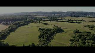
Somerset is a rural county of rolling hills, the Blackdown Hills, Mendip Hills, Quantock Hills and Exmoor National Park, and large flat expanses of land including the Somerset Levels.
- saveyourgreenbelt.co.uk, added 15:08, 25 September 2023 (UTC)
The county contains several-miles-wide sections of the Avon green belt area, which is primarily in place to prevent urban sprawl from the Bristol and Bath built up areas encroaching into the rural areas of North Somerset, Bath and North East Somerset, and Mendip districts in the county, as well as maintaining surrounding countryside. It stretches from the coastline between the towns of Portishead and Clevedon, extending eastwards past Nailsea, around the Bristol conurbation, and through to the city of Bath. The green belt border intersects with the Mendip Hills Area of Outstanding Natural Beauty (AONB) along its south boundary, and meets the Cotswolds AONB by its eastern extent along the Wiltshire county border, creating an extended area protected from inappropriate development.
Cycling activism[edit | edit source]
The county has one of the first National cycle routes created in Britain 3, 4 and 24 provide cyclists with ways to minimise contact with motor traffic. The Bristol & Bath Railway Path is a 15-mile off-road cycleway, following an old railway track that forms part of Route 4. The path consists of a 3-m-wide tarmacked surface, and was used for 2.4 million trips in 2007, increasing by 10% per year.[90] Route 24, otherwise known as the Colliers Way, currently runs from Dundas Aqueduct to Frome via Radstock. W
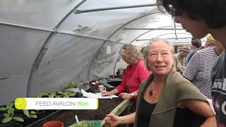
Food activism[edit | edit source]
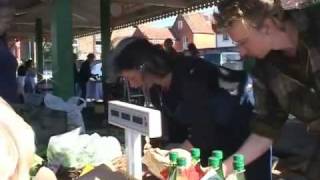
Glastonbury Farmers Market - The Community Farm, Chew Magna - Incredible Edible Somerset - Somerset Community Food, grass-roots charity in Somerset which aims to re-connect people with the social, health and environmental effects of growing, buying, preparing and eating local food - Somerset Country Markets - Somerset Farmers' Markets - Somerset Local Food Direct
Health and wellbeing[edit | edit source]
Rural sustainability[edit | edit source]
Sustainable transport activism[edit | edit source]
Long-distance footpaths in the county include: Coleridge Way, Limestone Link, Macmillan Way West, Mendip Way, Monarch's Way, Quantock Greenway, River Parrett Trail, Two Tunnels Greenway and West Deane Way. The South West Coast Path National Trail has its starting point at Minehead. W
- Wikipedia:Category:Footpaths in Somerset (category)
Towards sustainable economies[edit | edit source]
- Onion collective, added 19:29, 19 December 2020 (UTC)
News and comment[edit | edit source]
2022
- With its digital community mapping, fungus-driven mill, and reuse of coastal buildings, the Onion Collective is a vibrant CAN, The Daily Alternative (Jun 14, 2022)
- Britain’s first wetland ‘super reserve’ offers boost to nature-based solutions to climate change, The Conversation (Jun 07, 2022)
2018
Stream Farm – A New Model for New Entrants, Dec 21[1]
Ecological Land Cooperative purchases site in South Somerset to create new small farms, Oct[2] The Ecological Land Cooperative works to create affordable ecological smallholdings for new entrants to farming – those who would ordinarily be unable to afford a house in the countryside yet who wish to earn a living through farming.
Resources[edit | edit source]
Past events[edit | edit source]

2014
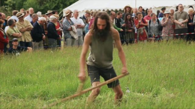
June 15 Green Scythe Fair
Campaigns[edit | edit source]
- Frack Free Somerset
- The Strawberry Line, A traffic-free route from the Mendips to the sea
About Somerset[edit | edit source]
Somerset ( SUM-ər-sit, -set; archaically Somersetshire SUM-ər-sit-sheer, -set-, -shər) is a ceremonial county in South West England. It is bordered by the Bristol Channel, Gloucestershire, and Bristol to the north, Wiltshire to the east and the north-east, Dorset to the south-east, and Devon to the south-west. The largest settlement is the city of Bath, and the county town is Taunton.
Near you[edit | edit source]
Bath community action - Frome community action
References