
The project "Profiling of communities and mapping of solutions related to the access and use of water in the coastal zone of the Department of La Libertad" is an investigation directed by the Acceleration Laboratory of the United Nations Development Program (UNDP), executed by TECHO El Salvador to identify grassroots solutions that coastal communities in the department of La Libertad are implementing at the intersection of access, water quality and livelihoods during the months of May to June 2021.
Contents
Goals of the project
- Identify grassroots solutions that communities are implementing at the intersection of access, water quality, and livelihoods.
- Collect relevant information about the communities to establish a baseline and to generate hypotheses for the design of a portfolio of experiments related to the theme of water and its relationship with the livelihoods of the coastal communities of La Libertad.
- Create a community data return model in content and format that is relevant and useful for community leaders in seeking funds, lobbying for resources before municipal and central governments, etc. using dynamic displays or any appropriate format for the identified target audiences.
Geographic coverage

 5
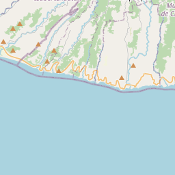
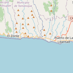
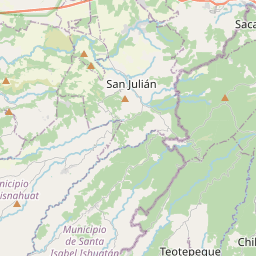
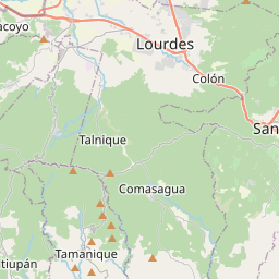
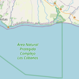
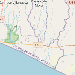
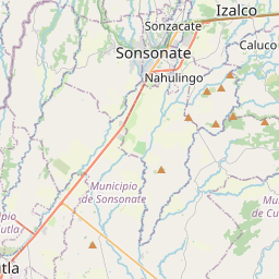
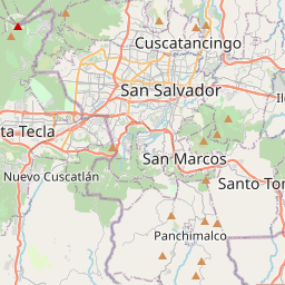
5The geographical scope of the project includes intervention in six communities, located in five coastal areas of the department of La Libertad, El Salvador.
The six selected communities are located on a path of almost 25 meters in length, along the Litoral highway, in the department of La Libertad. This area is cataloged, by the Salvadoran government from 2019 to 2024, as "Surf City", which includes a set of beaches and tourist attractions. The identified communities, being coastal, have community dynamics and ways of life directly related to water, consequently, they are also affected, positively and negatively, by it.
The six communities identified and selected
| Zone | Community | Information collected |
|---|---|---|
| The Majahual | El Majahual Beach | El Majahual Community Profile Community map Current situation of access to water Mapping of solutions |
| the sunzal | El Sunzal Beach | Community Profile: El Sunzal Community map Current situation of access to water Mapping of solutions |
| conchalius | Conchalio de la Rosa Beach | Community Profile: Conchalio Community map Current situation of access to water Mapping of solutions |
| Liberty Harbor | River Sea | Community profile: Rio Mar Community map Current situation of access to water Mapping of solutions |
| San Diego | San Diego mouth | Community Profile: Bocana de San Diego Community map Current situation of access to water Mapping of solutions |
| The Zonte | The Zonte | Community Profile: El Zonte Community map Current situation of access to water Mapping of solutions |
Methodological strategy

TECHO 's work model is characterized by openness and insertion in the settlements, promoting from the beginning the organization, participation and co-responsibility of the community, involving the residents, community referents and other influential actors in their processes. Generating commitment and understanding of the community in joint work with TECHO .
In this way, information gathering activities are promoted, which in turn generate a rapprochement between volunteer groups and members of the Community with the aim of creating awareness of the reality in which thousands of families in El Salvador live.
Through TECHO 's Information Gathering Strategy , an organized process of gathering information was established.
This strategy has as objectives:
- Know the reality of homes and the Community, to contribute to the correct decision-making of the Community and TECHO .
- Strengthen community identity through self-recognition of their characteristics, capacities, needs and interests.
- Follow up on the work with the Community, to develop initiatives optimally and correctly. Promoting an informed dialogue with the community, government institutions or other relevant organizations.
Integrating the Information Gathering methodology (ELI) with the Solution Mapping methodology, methodological instruments were developed, both qualitative and quantitative, which guaranteed the decoding of community experiences, in terms of the intersection of access and quality of information. water and livelihoods; Likewise, a database with key information from each community was built.
Community Characterization and Profiling

Initially, after selecting the communities to intervene, the first approaches were made with the municipality and civil society organizations to begin the initial information gathering processes. During this stage, four activities were carried out: first, coordination with boards of directors; second, organization of the research team (composed of TECHO volunteers ); third, application of characterization and profiling instruments; and finally, systematization and processing of community data.
In the first moment, the Settlements Characterization tool was built . This is a qualitative and quantitative instrument whose objective is to examine the main characteristics of each community and relevant information, such as:
- General demographic data
- Geographic location
- community history
- access to land
- living place
- Access to water and sanitation
- community infrastructure
- Around
- Community capacities identity, community organization, community participation, articulation with networks, and self-management.
With the information obtained during this moment, the community profiles of the 6 selected communities were built, where the consolidation of the key information of each settlement is presented, ordered by headings, which will allow future interventions and projects adapted to the particular needs of each community.
Solution mapping

This second moment aims to carry out a deeper exploration of the grassroots solutions, which are currently being implemented by communities at the intersection of access, uses, water quality and livelihoods. This visualization of solutions and initiatives begins within the sectors and passages of each community, seeking to generate significant contact with the residents of the area, and thus, identify community innovations on the use, collection, collection, and treatment of waste. water, and its social innovators. If in the first moment general information was collected from each settlement, this second moment focuses attention on access and quality of water, and the responses that families give to this situation.
For the documentation of these community solutions or innovations found, a Community Solutions Mapping instrument was built , which collected valuable information (description, use, materials, etc.) of these initiatives and their creators.
Community Data Return
In the third moment, after the systematization and analysis of all the community data (characterization, mapping of solutions, etc.), an activity is carried out to return the data to the community leaders. The purpose of this activity is that through the information obtained, the communities have the opportunity to make use of this knowledge for future projects, and that they are in accordance with the particular needs of each area.
The delivery of community information will be in a non-traditional, creative and useful format that seeks the best use of information by community leaders, and that is practical for the uses that they themselves deem convenient.
This activity is carried out in a community assembly with the representatives of the board of directors, and the main committees that make up the community. The information is delivered, and a space for feedback on the research process is carried out.
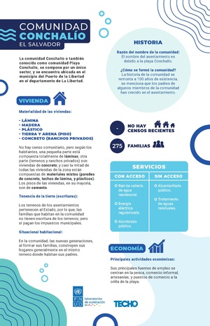
The consolidated of this community information was returned to the six communities through a "community flip chart", this resource was chosen for the following reasons:
- It visually reflects the community reality by making use of graphics and images.
- Due to its size it is easy to mobilize, it can be used during a community assembly or in another space with local actors or institutions.
- The nature of the flipchart allows leadership to add new information and/or update existing information.
- The creative and simple presentation of community information allows leaders to appropriate the data of their communities, and use it for future projects or requests for funds.
- It represents a visual incentive for the boards of directors to continue processes of information surveys or more organized community censuses.
In addition, the flipchart responded to the need of the communities to have a document that contains the history of the community, is creative, practical and useful, and can, at the same time, be taken as a reference during emergencies.
Findings
The perception of drinking water places it as a vital liquid, necessary and indispensable for life, but in the absence of quality drinking water, communities and specifically families have sought their own ways of providing themselves with water for consumption, where The purchase of drinking water from water distribution trucks predominates, from which water bundles are commonly purchased because they have a lower cost. The following were identified in the six communities as the main ways of obtaining drinking water:


Source: Estimates made by members of the El Majahual, El Sunzal, Conchalio, Bocana de San Diego, El Zonte and Río Mar communities during the months of May to June 2021.

The purchase of drinking water is through bundles of bags. They are prioritized in this presentation because the families consider that this way the waste of water is reduced and costs are reduced. The information shown in the following figure highlights the magnitude of the funds allocated by family and community on a monthly basis:
Community innovations

Based on the information collected during the community visits, more than solutions have been found, behaviors that respond to situations of access, purification and storage of water.
These most common behaviors and/or community solutions are grouped into: Construction of wells with a pump, construction of wells without a pump, rainwater collection, water filtration through cloth handkerchiefs, water purification by different means, water storage in reused containers, purchase of water from water distribution companies, purchase of water from other communities, etc. There is no exact data on the frequency of these solutions, since more than one solution is present in all communities.
Below are the main findings regarding the innovations or solutions found in the six communities:
- The lack of a constant flow of water in the houses has led to the construction of freshwater and saltwater wells to supply different commercial and household activities.
- The collection of rainwater for storage in the rainy season allows carrying out some activities of the families, generally stored in different containers such as crates or barrels, being very useful and a common alternative for communities where access to residential water is limited. irregular. Some purification methods are used with this water, such as those provided by the health units with "Puriagua".
- The adaptation of refrigerators, have been a response for some families, who do not have a sink or a space inside their houses to store water, in this way they are adapted to serve as sinks and as washing for family and commercial activities.
Conclusions

Regarding the dynamics of the communities in terms of interaction, uses, livelihoods, behaviors and responses to threats, the following conclusions can be mentioned:
- Most of the communities have residential water projects, however, it is used only for domestic use, since it is not suitable for human consumption.
- In times of high or irregular tide, as well as in winter, the floods caused by the wave cycles become an imminent threat to the houses closest to the seashore, totally affecting community and tourist dynamics.
- The importance of water sources for the development of productive, economic and commercial activities of families on the beaches where the communities are established, directly affects the visit of tourists.
- The expansion of the main highway will directly affect the dynamics of the community, due to the displacement of homes and places of commerce that will need to be relocated.
- The cleaning of the beaches requires complementary dynamics, which depend on large machinery to displace debris from drains and mouths, therefore, some suffer flooding due to lack of maintenance of these spaces by the institutions in charge.