
Size of this preview: 800 × 351 pixels. Other resolution: 1,425 × 625 pixels.
Original file (1,425 × 625 pixels, file size: 158 KB, MIME type: image/png)
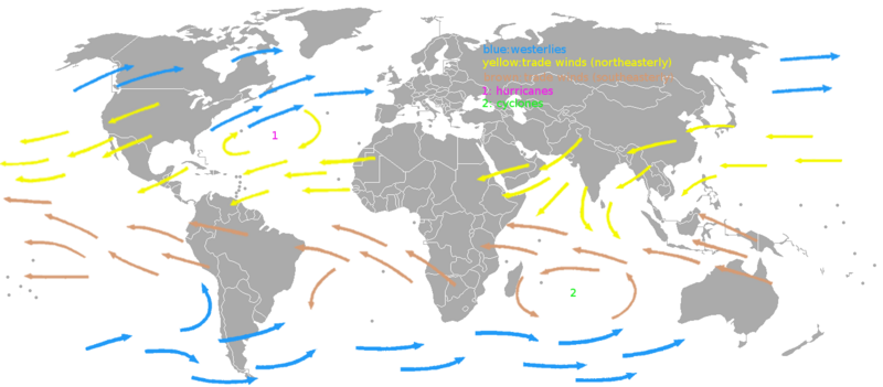
A map showing the prevaling winds on earth. The image was made based on an image in the book "Het handboek voor de zeiler" by H.C. Herreshoff.
File history
Click on a date/time to view the file as it appeared at that time.
| Date/Time | Thumbnail | Dimensions | User | Comment | |
|---|---|---|---|---|---|
| current | 12:45, 21 June 2011 | | 1,425 × 625 (158 KB) | KVDP (talk | contribs) | A map showing the prevaling winds on earth. The image was made based on an image in the book "Het handboek voor de zeiler" by H.C. Herreshoff. |
You cannot overwrite this file.
File usage
The following page uses this file: