
- Funding for Citizen Innovators, Sep, 2016...[1]
Networks and sustainability initiatives[edit | edit source]
- Low-Impact Living Initiative (based in Buckinghamshire), dedicated to helping protect the global environment by promoting sustainable alternatives to various aspects of everyday life. Lili have produced a number of information sheets which are available as PDFs.
- MK:Smart, bringing together data, enterprise and communities to transform energy, transport and water use in Milton Keynes. "Have you got a great idea for our city? We want your innovative ideas and you to help develop these ideas into citizen-led projects. If you have an idea or want to have your say on other people's ideas visit www.ourmk.org"
- Transition MK
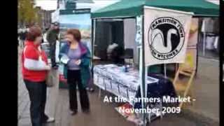
- Transition Town High Wycombe
- Citizens:mk, a growing alliance of diverse community groups – churches, mosques, schools and community associations – working together for a better Milton Keynes.
- MK Peace and Justice Network
Biodiversity[edit | edit source]
Berks, Bucks & Oxon Wildlife Trust
Community energy[edit | edit source]
CAPE, Community Action Platform for Energy project will develop an interactive website designed to assess energy use for individuals and communities in Milton Keynes - Wolverton Community Energy, community owned energy hub rooted in historical Wolverton, a fragment of Victorian history in the heart of Milton Keynes.
Community and voluntary action[edit | edit source]
Community Action: MK answers enquiries for and about the voluntary and community sector in Milton Keynes. "We also provide information about all aspects of running a voluntary or community group, and can signpost you to other support and information. Community Action: MK also provides information and support about the city's growth, and will be looking to support the new communities moving into the city."
Cycling activism[edit | edit source]
The Milton Keynes redway system (locally known as redways) is an over 200 miles (320 kilometres) network of shared use paths for cyclists and pedestrians in Milton Keynes, Buckinghamshire, England. It is generally surfaced with red tarmac, and criss-crosses most of the city.
Some of these redways run next to the grid roads and local roads, with underpasses or bridges where they intersect major roads. Others run through park land and along the floodplain of the Great Ouse and its tributaries.
Construction of the redway commenced in the 1970s with the start of the construction of the "new city". By 1980 it was the largest urban cycleway system in the UK with 22 miles (35.4 km) in use.
Housing and land[edit | edit source]
- Collaborative Housing, hub and collaborative effort to support the development of a pipeline of community-led housing projects across Oxfordshire, Berkshire and Buckinghamshire. 'added 16:31, 17 December 2021 (UTC)
see also: Towards a more democratic and climate friendly way of meeting housing need across England
Sustainable transport activism[edit | edit source]
A large part of the Chiltern Hills, an Area of Outstanding Natural Beauty, runs through the south of the county and attracts many walkers and cyclists from London. W
Waterways[edit | edit source]
The Grand Union Canal runs through the county from Milton Keynes down to Marsworth, passing in and out of Bedfordshire on the way. After this it leaves and enters Hertfordshire. At Marsworth two branches separated, one to Aylesbury and one to Wendover. The Aylesbury branch remains active to this day, whilst the Wendover arm was closed over a century ago. However it is now being restored by a volunteer trust who have reopened it as far as Little Tring. It is presently being restored back to Aston Clinton (see trust website). W
- Aylesbury Canal Society, W
- Wendover Arm Trust restoring the Wendover Arm of the Grand Union Canal
Walking[edit | edit source]
Footpaths in Buckinghamshire, (category) W
News and comment[edit | edit source]
2015
Local environmental group Transition MK celebrate MK's commitment to low carbon living! November 30[2]
- Local environmental group, Transition MK, are celebrating two successful events which aimed to raise local people's awareness of climate change and encourage residents of Milton Keynes to take action to show their support for more sustainable living.
Maps[edit | edit source]
About[edit | edit source]
Buckinghamshire (, abbreviated Bucks) is a ceremonial county in South East England and one of the home counties. It is bordered by Northamptonshire to the north, Bedfordshire to the north-east, Hertfordshire to the east, Greater London to the south-east, Berkshire to the south, and Oxfordshire to the west. The largest settlement is the city of Milton Keynes, and the county town is Aylesbury.
The county has an area of 1,874 km2 (724 sq mi) and had a population of 840,138 at the 2021 census. Besides Milton Keynes, which is in the north-east, the largest settlements are in the southern half of the county and include Aylesbury, High Wycombe, and Chesham. For local government purposes Buckinghamshire comprises two unitary authority areas, Buckinghamshire and Milton Keynes. The historic county had slightly different borders, and included the towns of Slough and Eton.
The Chiltern Hills, an Area of Outstanding Natural Beauty, occupy the south of the county and contain its highest point, Haddington Hill (267 m (876 ft)). The Chilterns are the source of the River Ouzel, which flows across the lowland Vale of Aylesbury in the north of the county and through Milton Keynes before meeting the River Great Ouse at Newport Pagnell. The Thames forms part of the county's southern boundary.
Notable service amenities in the county are Pinewood Film Studios, Dorney rowing lake and part of Silverstone race track on the Northamptonshire border. Many national companies have head offices or major centres in Milton Keynes. Heavy industry and quarrying is limited, with agriculture predominating after service industries.
See also[edit | edit source]
References