
The aim of this page is to recognise, celebrate and encourage the self-empowerment of community agency networks (CANs) and community groups' activism for climate, environment and many other sustainability topics across the West Midlands.
 'Climate change goal will be met by 2030' says Telford and Wrekin Council concerning its target for its operations to become carbon neutral by 2030, BBC News (Sep 13, 2024)
 - ‘Building something better’: the UK residents retrofitting their homes amid the climate crisis, theguardian.com (Aug 03, 2024) — From weekly skills-sharing to rewilding streets, communities are working to improve the planet while bolstering the health of people
- ‘This May Day is a Celebration of Work and Innovation’, Dave Proudlove, thestokemodel.com (May 01, 2024)
Video gallery[edit | edit source]


Networks and sustainability initiatives[edit | edit source]
- Action 21
- Herefordshire New Leaf, small not-for-profit co-operative & exempt charity working with people around the county to develop ways of saving energy and living more sustainably.
- Transition Evesham Vale
- Whittington & Fisherwick Environment Group
- Transition Shipston
- Transition Stourbridge
- Transition Stratford
- Transition Malvern Hills
- Transition town Leamington
- West Midlands Green Communities Network, Sustainability West Midlands
- Worcester Roots Foundation, youth-led environmental volunteering charity, which aims to develop young people's skills whilst promoting and raising awareness of sustainability issues to the community as a whole.
Localism[edit | edit source]
- Supporting community business in the West Midlands, powertochange.org.uk, added 11:42, 13 November 2021 (UTC)
- It's Our County, an independent local party just for Herefordshire
- Localise West Midlands
Community resources[edit | edit source]
Community energy[edit | edit source]
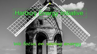
- Harbury Energy Initiative, a village low carbon group, added 14:55, 23 February 2021 (UTC)
- Chase Community Solar
- Community Energy Warwickshire
- Southern Staffordshire Community Energy
Land activism[edit | edit source]
Fordhall Farm is an organic farm of 128 acres, in Market Drayton in north Shropshire, England. It is owned by an industrial and provident society, the Fordhall Community Land Initiative (FCLI), whose aim is to use the farm for community benefit. The farm became a cause célèbre in 2005, when a campaign to raise funds for FCLI to purchase the land gained national press attention.
- Fordhall Organic Farm, "Proud to be community owned", added 16:38, 21 October 2022 (UTC)
Community and voluntary action[edit | edit source]
Community Action Malvern, "Our biggest remit is reducing social isolation for older and disabled people in Malvern", added 08:39, 3 February 2022 (UTC)
Climate action[edit | edit source]
- zerocarbonlichfield on twitter, Staffordshire
see also Community energy above
Ethical consumerism[edit | edit source]
Fairtrade in Solihull, information from solihull.gov.uk
Sustainable transport activism[edit | edit source]
- Malvern Hills Car clubs
- Network West Midlands, partnership promoting increased public transport use
- Sustainable Travel, information from Network West Midlands
The West Midlands Metro is a light-rail/tram system in the county of West Midlands, England. The network has 33 stops with a total of 14 miles (23 km) of track; it currently consists of a single route, Line 1, which operates between the cities of Birmingham and Wolverhampton via the towns of Bilston, West Bromwich and Wednesbury, on a mixture of former railway lines and urban on-street running. The system is owned by the public body Transport for West Midlands, and operated by Midland Metro Limited, a company wholly owned by the West Midlands Combined Authority.
During August 1995, a 25-year contract for the design, construction, operation and maintenance of Line 1 was awarded to the Altram consortium; construction commenced three months later. It was launched on 30 May 1999 as Midland Metro, partly using the disused Birmingham Snow Hill to Wolverhampton Low Level Line. During 2006, Ansaldo and John Laing Group both withdrew from the consortium, thus day-to-day operation of the Metro was taken over by the remaining partner, National Express. In October 2018, the National Express concession ended and the system was taken over by Transport for West Midlands, the transport arm of the West Midlands Combined Authority (WMCA).
The line originally terminated at Birmingham Snow Hill station at the edge of the city centre, but following an extension opened in December 2015 it now serves the central core of Birmingham, including the principal regional mainline station, Birmingham New Street. Following further extensions the line now terminates at Edgbaston Village since 2022. At the other end of the line, an extension to Wolverhampton station was opened on 17 September 2023. The Metro was originally operated by a fleet of 16 AnsaldoBreda T-69 trams; these were replaced during the 2010s by a newer fleet of 42 CAF Urbos 3.
Construction of a new branch line from Wednesbury to Brierley Hill was approved in March 2019, started in February 2020 and was intended to be completed for the 2022 Commonwealth Games, but has been severely delayed; it is currently scheduled to be completed at least to Dudley by 2025. An additional branch line running to Birmingham's Eastside via Curzon Street – the region's planned High Speed 2 terminus – and terminating at Digbeth is also under construction as of 2024. There are also proposals to expand this branch further towards Chelmsley Wood (Solihull) and out to Birmingham Airport.
maps
- Walking Maps in Worcestershire, worcestershire.gov.uk
Cycling activism[edit | edit source]
maps
- Cycle Map, mappa-mercia.org
- Cycling Maps in Worcestershire, worcestershire.gov.uk
Biodiversity[edit | edit source]
- Worcester Environmental Group, Worcester Environmental Group on youtube.com, added 15:47, 4 March 2024 (UTC)
- Wyre Community Land Trust, added 10:33, 14 January 2022 (UTC)
- Staffordshire Wildlife Trust, added 16:04, 19 February 2021 (UTC)
- Wildlife Trust for Birmingham and the Black Country
- Worcestershire Wildlife Trust
Open spaces[edit | edit source]
The region contains five Areas of Outstanding Natural Beauty (AONBs), including all of the Shropshire Hills, Malvern Hills and Cannock Chase, and parts of the Wye Valley and Cotswolds. The Peak District national park also stretches into the northern corner of Staffordshire. W
Rivers and Streams[edit | edit source]
- Love your River - the Herefordshire Yazor Brooks Restoration Project, Herefordshire Wildlife Trust, herefordshirewt.org
see also: Community river action UK
Trees, woodland and forest[edit | edit source]
The National Forest is an environmental project in central England run by The National Forest Company. From the 1990s, 200 square miles (520 km2) of north Leicestershire, south Derbyshire and southeast Staffordshire have been planted in an attempt to blend ancient woodland with newly planted areas to create a new national forest. It stretches from the western outskirts of Leicester in the east to Burton upon Trent in the west, and is planned to link the ancient forests of Needwood and Charnwood.
In January 2018 the UK government unveiled plans to create a new English Northern Forest extending from Liverpool to Hull. It will shadow the path of the east-west M62 motorway.
- National Forest, Video channel on youtube.com, added 11:02, 16 December 2023 (UTC)
The Forest of Mercia lies within the northernmost boundary of the more ancient and well-known Forest of Arden which covered the area when it formed part of the Kingdom of Mercia, and is one of twelve community forests established close to major towns and cities across England. It covers an area of 92 square miles (23,000 hectares), and is focused around the town of Cannock in South Staffordshire.
Wyre Forest is a large, semi-natural (partially unmanaged) woodland and forest measuring 26.34 square kilometres (10.17 sq mi) which straddles the borders of Worcestershire and Shropshire, England. Knowles Mill, a former corn mill owned by the National Trust lies within the forest.
Arts, sport and culture[edit | edit source]
- Wellington H2A promote arts and heritage in the town through a range of events. W
Food activism[edit | edit source]
Food Co-op, Worcester Roots Foundation - Malvern Hills Food Alliance
Social inclusion[edit | edit source]
The region, from studies of multiple deprivation, shows similarities with Yorkshire and the Humber, and is more deprived than the neighbouring East Midlands. From the Indices of deprivation 2007, it can be seen that, in common with Northern England, the region has more Lower Area Super Output Areas in the 20% most deprived districts than in the 20% least deprived districts. The region's most deprived council districts, in descending order, are Birmingham (10th highest in England), Sandwell (14th), Stoke-on-Trent (16th), Wolverhampton (28th), Walsall (45th), Coventry (61st), and Dudley (100th).
The least deprived districts in 2007 (before Shropshire became a unitary authority in 2009) were Bromsgrove, South Staffordshire, Warwick, Wychavon, and Lichfield. At county level, the least deprived areas, in descending order, were Warwickshire, Worcestershire, Solihull, Staffordshire, and Shropshire.
In March 2011 the region had the second highest overall unemployment claimant count in England at 4.7%, second to North East England. The highest in the region was Wolverhampton at 7.7%, the joint second highest (with Manchester) unemployment rate in England. Next is Sandwell with 7.1%, Birmingham with 7.0%, and Walsall with 6.4%. The lowest rate in the region is the district of Stratford-on-Avon, with 1.6% – one of the lowest unemployment rates in England W
Citizens data initiative[edit | edit source]
About West Midlands[edit | edit source]
The West Midlands is one of nine official regions of England at the first level of International Territorial Level for statistical purposes. It covers the western half of the area known traditionally as the Midlands. The region consists of the counties of Herefordshire, Shropshire, Staffordshire, Warwickshire, West Midlands and Worcestershire. The region has seven cities: Birmingham, Coventry, Hereford, Lichfield, Stoke-on-Trent, Wolverhampton and Worcester.
The West Midlands region is geographically diverse, from the urban central areas of the West Midlands conurbation to the rural counties of Herefordshire, Shropshire and Worcestershire which border Wales. The region is landlocked; however, the longest river in the UK, the River Severn, traverses the region south-eastwards, flowing through the county towns of Shrewsbury and Worcester, and the Ironbridge Gorge, a UNESCO World Heritage Site. Staffordshire is home to the industrialised Potteries conurbation, including the city of Stoke-on-Trent and the Staffordshire Moorlands area, which borders the south-eastern Peak District National Park near Leek. The region also encompasses five Areas of Outstanding Natural Beauty: the Wye Valley, Shropshire Hills, Cannock Chase, Malvern Hills and parts of the Cotswolds. Warwickshire is home to the towns of Stratford upon Avon, birthplace of writer William Shakespeare; Rugby, the birthplace of Rugby football; and Nuneaton, birthplace to author George Eliot.
Near you[edit | edit source]
External links
- Sustainability information from Stafford Borough Council
References