 Size of this JPG preview of this PDF file: 337 × 599 pixels. |

Original file (2,250 × 4,000 pixels, file size: 5.04 MB, MIME type: application/pdf, 3 pages)
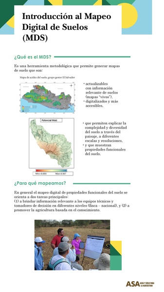
Este recurso ha sido proporcionado por ASA. En él se muestran datos relevantes acerca de la práctoca del Mapeo Digital de Suelos (MDS).
File history
Click on a date/time to view the file as it appeared at that time.
| Date/Time | Thumbnail | Dimensions | User | Comment | |
|---|---|---|---|---|---|
| current | 22:27, 3 January 2024 |  | 2,250 × 4,000, 3 pages (5.04 MB) | Paola Moreno (talk | contribs) | Uploaded a work by Agua y Suelo para la Agricultura (ASA) from https://asa.crs.org/wp-content/uploads/2020/10/Mapeo-digital.pdf with UploadWizard |
You cannot overwrite this file.
File usage
The following 2 pages use this file: