 ‘Darwin’s oak’ to be felled to make way for Shrewsbury bypass, theguardian.com (Nov 01, 2023)
Networks and sustainability initiatives
- Green Shropshire Xchange
- Newport 21, Action for a greener Newport Shropshire
Community resources
Live Well Telford, [1], all age online community directory
Open spaces
The Shropshire Hills National Landscape is a designated Area of Outstanding Natural Beauty (AONB) in Shropshire, England. It is located in the south of the county, extending to its border with Wales. Designated in 1958, the area encompasses 802 square kilometres (310 sq mi) of land primarily in south-west Shropshire, taking its name from the upland region of the Shropshire Hills. The A49 road and Welsh Marches Railway Line bisect the area north–south, passing through or near Shrewsbury, Church Stretton, Craven Arms and Ludlow.
Community energy
Lightfoot Energy Service, Community Interest Company based in Bishops Castle
Food activism
- Fordhall Organic Farm and Community Land Initiative
- Shropshire Food Poverty Alliance, consortium of organizations committed to working together to tackle food poverty in Shropshire. added 16:25, 9 April 2021 (UTC)
- Shrewsbury Food Hub added 16:25, 9 April 2021 (UTC)
- Slow Food Ludlow Marches
Localism
Reduce, reuse, repair and recycle
Telford Repair Cafe, livewell.telford.gov.uk
Sustainable transport activism
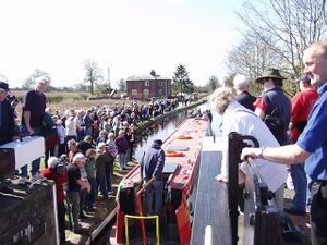
Three British Waterways canals run through Shropshire: the Shropshire Union Canal (from north of Adderley to near Knighton), the Llangollen Canal (from Chirk Aqueduct to Grindley Brook) and the Montgomery Canal (from its beginning at Frankton Junction to Llanymynech). In addition, the Shrewsbury and Newport Canal potentially could be restored in the future.[1]
Trees, woodland and forest
About Shropshire
Shropshire (; historically Salop and abbreviated Shrops) is a ceremonial county in the West Midlands of England, on the Welsh border. It is bordered by Wrexham County Borough and Cheshire to the north, Staffordshire to the east, Worcestershire to the south-east, Herefordshire to the south and Powys to the west. The largest settlement is Telford, and Shrewsbury is the county town.
The county has an area of 3,487 km2 (1,346 square miles) and a population of 498,073. Telford (155,570), in the east of the county, and Shrewsbury (76,782), in the centre, are the only large towns. Shropshire is otherwise rural, containing market towns such as Oswestry (15,613), Bridgnorth (12,212) and Newport (11,387). For local government purposes the county comprises two unitary authority areas: Shropshire, and Telford and Wrekin.
Shropshire is one of England's most rural and sparsely populated counties, with a population density of 136/km2 (350/sq mi).
References


