The aim of this page is to recognise, celebrate and encourage the self-empowerment of community action networks (CANs) and community groups across Rhode Island.

- Rhode Island Gears Up For First Electricity From Block Island Wind Farm, Oct 27, 2016...[1]
Events[edit | edit source]
Community energy[edit | edit source]
Wikipedia:Solar power in Rhode Island
Cycling activism[edit | edit source]
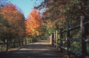
Bicycle paths: The East Bay Bike Path stretches from Providence to Bristol along the eastern shore of Narragansett Bay, while the Blackstone River Bikeway will eventually link Providence and Worcester. In 2011, Rhode Island completed work on a marked on-road bicycle path through Pawtucket and Providence, connecting the East Bay Bike Path with the Blackstone River Bikeway, completing a 33.5 miles (53.9 km) bicycle route through the eastern side of the state. The William C. O'Neill Bike Path (commonly known as the South County Bike Path) is a 6-mile path through South Kingstown and Narragansett. The 14-mile Washington Secondary Bike Path stretches from Cranston to Coventry, and the 2-mile Ten Mile River Greenway path runs through East Providence and Pawtucket.[2]
Food activism[edit | edit source]
Southside Community Land Trust, a 501(c)(3) non-profit organization with a mission to provide access to land, education and other resources necessary for people in the Greater Providence area to grow food in environmentally sustainable ways as a means to creating a food system where locally produced, affordable and nutritious food is available to all. It was established in 1981. W
Sustainable transport activism[edit | edit source]
Towards sustainable economies[edit | edit source]
Providence
In the Providence Bay Area, the Fertile Underground Natural Cooperative is working to get a catering truck on the road. This truck will take food from farms and supermarkets and offer the raw, natural ingredients for free, while selling the prepared food. The goal of this project is to reach places that have limited access to fresh food and provide cooking demonstrations using seasonal produce.[3]
Citizens data initiative[edit | edit source]
Energy & Environmental Data for Rhode Island
About Rhode Island[edit | edit source]
Rhode Island ( ROHD) is a state in the New England region of the Northeastern United States. It borders Connecticut to its west; Massachusetts to its north and east; and the Atlantic Ocean to its south via Rhode Island Sound and Block Island Sound; and shares a small maritime border with New York, east of Long Island. Rhode Island is the smallest U.S. state by area and the seventh-least populous, with slightly fewer than 1.1 million residents as of 2020; but it has grown at every decennial count since 1790 and is the second-most densely populated state, after New Jersey. The state takes its name from the eponymous island, though nearly all its land area is on the mainland. Providence is its capital and most populous city.
References