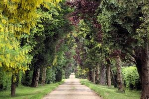
Bedfordshire (; abbreviated Beds) is a ceremonial county in the East of England. It is bordered by Northamptonshire to the north, Cambridgeshire to the north-east, Hertfordshire to the south and the south-east, and Buckinghamshire to the west. The largest settlement is Luton (225,262), and Bedford is the county town.
The county has an area of 1,235 km2 (477 sq mi) and had a population of 704,736 at the 2021 census. Its other towns include Leighton Buzzard, Dunstable, Biggleswade, Houghton Regis, and Flitwick. Much of the county is rural. For local government purposes, Bedfordshire comprises three unitary authority areas: Bedford, Central Bedfordshire, and Luton.
The county's highest point is 243 m (797 ft) on Dunstable Downs in the Chilterns.
Biodiversity
The Wildlife Trust for Bedfordshire, Cambridgeshire and Northamptonshire (WTBCN) is a registered charity which manages 126 nature reserves covering 3,945 hectares (15.23 square miles). It has over 35,000 members, and 95% of people in Bedfordshire, Cambridgeshire and Northamptonshire live within five miles of a reserve. In the year to 31 March 2016 it employed 105 people and had an income of £5.1 million. It aims to conserve wildlife, inspire people to take action for wildlife, offer advice and share knowledge. The WTBCN is one of 36 wildlife trusts covering England, and 46 covering the whole of the United Kingdom.
Trees, woodland and forest
The Forest of Marston Vale is an evolving community forest in Marston Vale, which runs south west from the towns of Bedford and Kempston in Bedfordshire, England towards the M1 motorway. It is operated by a registered charity called the Forest of Marston Vale Trust.
The vale is traditionally a brickmaking area, but brickmaking industry has been running down since the 1970s. It has left a large amount of spoiled countryside containing several large empty pits some of which have now been converted into lakes. The Forest of Marston Vale is one of twelve of community forest projects in the United Kingdom. It was initiated by the Countryside Agency and the Forestry Commission, in partnership with Bedfordshire County Council, Mid Bedfordshire District Council, and Bedford Borough Council. The total area covered is 61 square miles (158 km2), but most of this land is in private ownership. There are incentives for landowners to plant trees, and the target for community forests in general is to reach 30% tree cover.
The principal public open space in the Forest is Marston Vale is the Millennium Country Park which covers 2.5 km2 (1 mile2) and was opened in 2000. The park features several lakes including the large Stewartby Lake and extensive wetlands. There is a visitor centre called the Forest Centre, which has a Lakeside Cafe, shop, toilets and bike rental. According to the official website the park attracts around a quarter of a million visitors a year. There are plans to create a larger park of over 3 square miles (7.8 km2) to the east of Bedford, which will be called Bedford River Valley Park.
On 26 January 2018, the UK Environmental Agency granted a permit to Covanta Energy Limited to operate what will be the UK's largest waste incinerator, next to the Forest. The effect of this development remains to be seen.
Cycling activism
The Cycling Campaign for North Bedfordshire - Cycle Bedford - CTC Bedfordshire - BRCC, Bedfordshire Road Cycling Club - iCycle - wikipedia:Cycling Campaign for North Bedfordshire promotes and encourages the use of the Bedford Green Wheel
Food activism
Incredible Edible Dunstable on facebook
Sustainable transport activism
Wikipedia: Bedford Green Wheel: a project to build on the existing network of traffic free paths and quiet routes for cyclists and walkers. This network will run around Bedford, England, and includes 'spokes' linking into the town centre. The network will link parks, nature reserves, countryside and homes. This project is part of Bedford Borough Council's Green Infrastructure Plan 2009.
Waterways: The River Great Ouse links Bedfordshire to the Fenland waterways. As of 2004 there are plans by the Bedford & Milton Keynes Waterway Trust to construct a canal linking the Great Ouse at Bedford to the Grand Union Canal at Milton Keynes, 14 miles (23 km) distant.[1]
News and comment
2015
Bedfordshire joins Glasgow in fossil fuel commitment, January 20[2]
2012
The way ahead for funding parks and green spaces?[3] December 4
Resources
External links
Wikipedia: Bedfordshire