
Size of this preview: 800 × 462 pixels. Other resolution: 1,123 × 648 pixels.
Original file (1,123 × 648 pixels, file size: 217 KB, MIME type: image/png)
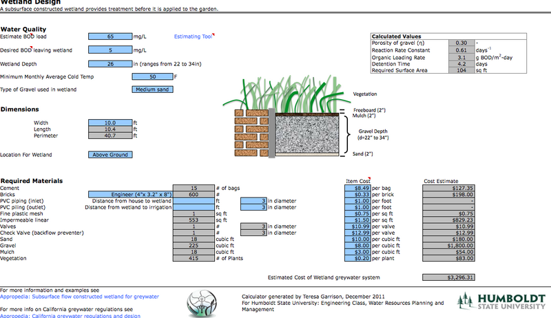
Computer snapshot of the wetland portion of the residential subsurface wetland calculator. Here is the actual File:SSFGreywaterCalculator.xls.
File history
Click on a date/time to view the file as it appeared at that time.
| Date/Time | Thumbnail | Dimensions | User | Comment | |
|---|---|---|---|---|---|
| current | 17:43, 6 December 2011 | | 1,123 × 648 (217 KB) | Tbgarrison (talk | contribs) | Computer snapshot of the wetland portion of the residential subsurface wetland calculator. |
You cannot overwrite this file.
File usage
The following 2 pages use this file: