Original file (1,425 × 625 pixels, file size: 38 KB, MIME type: image/png)
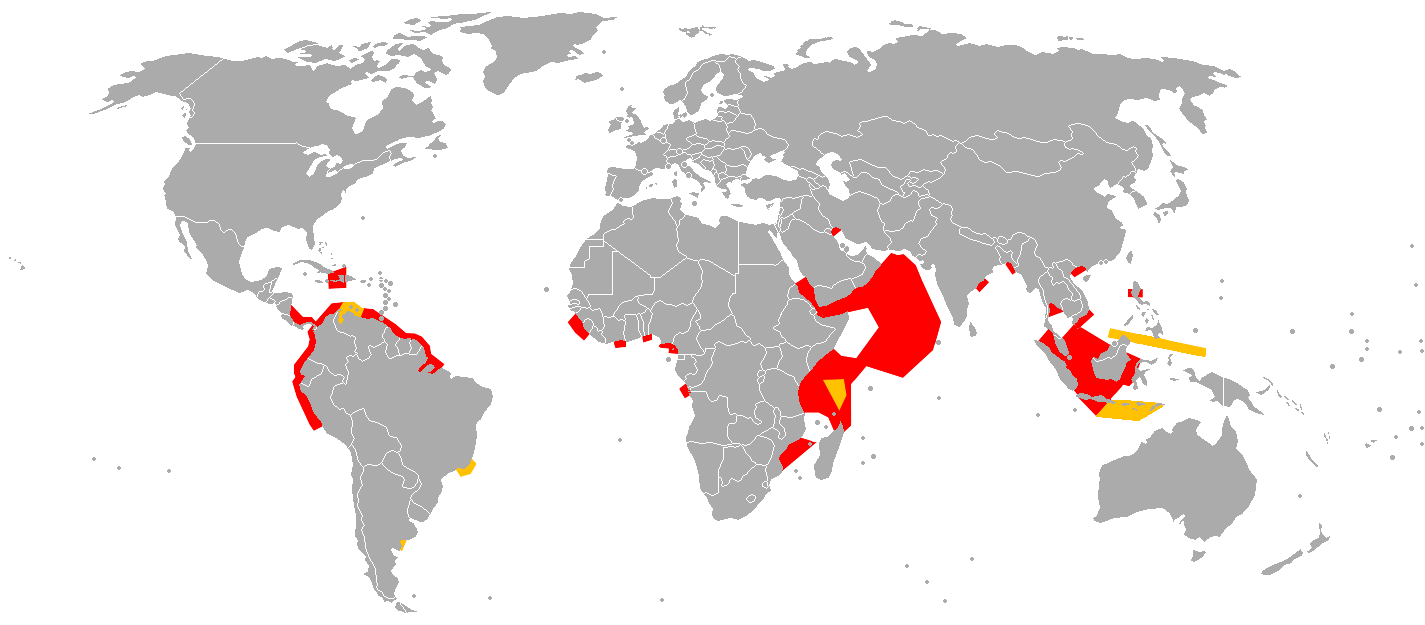
Simplified map of regions considered to be contemporary pirate hotbeds. The map was based on the IMB Piracy map 2010 (http://www.icc-ccs.org/index.php?option=com_fabrik&view=visualization&controller=visualization.googlemap&Itemid=219 ) and on the IMB Piracy map 2005 (http://news.bbc.co.uk/2/hi/africa/4415196.stm ) Giving that the regions of operation appear to shift, the map was simplified so as to give a better general overview (some isolated cases were discarded, most up-to date hotbeds were taken for specific regions). Also, a somewhat wider area was taken to reduce the margin of error.
File history
Click on a date/time to view the file as it appeared at that time.
| Date/Time | Thumbnail | Dimensions | User | Comment | |
|---|---|---|---|---|---|
| current | 10:04, 6 June 2011 | | 1,425 × 625 (38 KB) | KVDP (talk | contribs) | Simplified map of regions considered to be contemporary pirate hotbeds. The map was based on the IMB Piracy map 2010 (http://www.icc-ccs.org/index.php?option=com_fabrik&view=visualization&controller=visualization.googlemap&Itemid=219 ) and on the IMB Pira |
You cannot overwrite this file.
File usage
The following page uses this file: