Size of this preview: 430 × 600 pixels. Other resolution: 700 × 976 pixels.
Original file (700 × 976 pixels, file size: 281 KB, MIME type: image/jpeg)
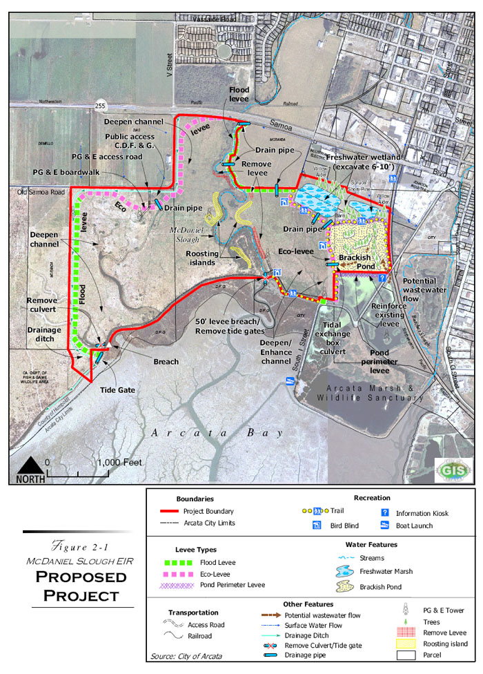
This map, courtesy of the City of Arcata, shows the different levees, drains, trails, ponds, and other features to be implemented in order to make this project a success. Please click on the image for a better view.
File history
Click on a date/time to view the file as it appeared at that time.
| Date/Time | Thumbnail | Dimensions | User | Comment | |
|---|---|---|---|---|---|
| current | 22:54, 17 April 2008 | | 700 × 976 (281 KB) | Ramacito (talk | contribs) |
You cannot overwrite this file.
File usage
The following page uses this file: