- Community group builds plans for genuinely affordable housing, Nov 2, 2017...[1]
Networks and sustainability initiatives[edit | edit source]
- Muswell Hill Sustainability Group
- Sustainable Haringey, Sustainable Haringey Network blog
- Transition Finsbury Park
Climate action[edit | edit source]
Haringey 40:20, Haringey Carbon Commission, Haringey has committed to reduce CO2 emissions by 40 per cent by 2020.
Open spaces[edit | edit source]
wikipedia:Haringey parks and open spaces
Community involvement[edit | edit source]
Our Tottenham, planning and regeneration by the community, for the community.
Communities online[edit | edit source]
Cycling[edit | edit source]
The Parkland Walk is a 3.1-mile (5.0 km) linear green pedestrian and cycle route in London, which follows the course of the railway line that used to run between Finsbury Park and Alexandra Palace, through Stroud Green, Crouch End, Highgate and Muswell Hill. It is often mistakenly described as 4.5 miles long, but even taking in the gap between the two sections it still only totals 3.1 miles (5.0 km). The route follows the bridges and cuttings of the line, but avoids the closed surface section of Highgate station and its adjoining tunnels, which are closed to walkers for safety reasons. The walk is almost all in Haringey, but a short stretch between Crouch Hill and Crouch End Hill is in Islington and this section incorporates Crouch Hill Park.
The walk is a local nature reserve and a Site of Metropolitan Importance for Nature Conservation. It was declared a local nature reserve in 1990 and is London's longest such reserve. Between Finsbury Park and Highgate, the path forms part of the Capital Ring strategic walking route.
Food activism[edit | edit source]
food from the sky, non for profit collaboration between Thornton's Budgens and Positive Earth Project, a permaculture community garden/workshop/event space on the roof of the Crouch End's store - The Meadow's Project, The Shepherd's Cot Meadow
Reduce, reuse, repair and recycle[edit | edit source]
Sustainable transport activism[edit | edit source]
The Lea Valley Walk is a 50-mile (80 km) long-distance path located between Leagrave, the source of the River Lea near Luton, and the Thames, at Limehouse Basin, Limehouse, east London. From its source much of the walk is rural. At Hertford the path follows the towpath of the River Lee Navigation, and it becomes increasingly urbanised as it approaches London. The walk was opened in 1993 and is waymarked throughout using a swan logo.
News and comment[edit | edit source]
2017
2016
Haringey moves millions out of fossil fuels, January 25[2]
2015
UK's first non-profit hotel will offer community space and a home away from home for artists, Oct 23[3]
2012
Why Haringey should be the next venue for global climate talks, December 3[4]
Flowerpots not bollards: residents reclaim streets in corner of Haringey, July 4[5]
Resources[edit | edit source]
Video[edit | edit source]
Past events[edit | edit source]
2014
September 6 Haringey 40:20 Green Fair
About Haringey[edit | edit source]
The London Borough of Haringey ( HARR-ing-gay, same as Harringay) is a London borough in north London, classified by some definitions as part of Inner London, and by others as part of Outer London. It was created in 1965 by the amalgamation of three former boroughs. It shares borders with six other London boroughs. Clockwise from the north, they are: Enfield, Waltham Forest, Hackney, Islington, Camden, and Barnet.
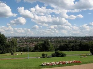
Haringey covers an area of more than 11 square miles (28.5 km2). Some of the more familiar local landmarks include Alexandra Palace, Bruce Castle, Jacksons Lane, Highpoint I and II, and Tottenham Hotspur Football Club. The borough has extreme contrasts: areas in the west, such as Highgate, Muswell Hill and Crouch End are among the most prosperous in the country; in the east of the borough, such as in Tottenham or Wood Green, some wards are classified as being among the most deprived 10% in the country. Haringey is also a borough of contrasts geographically. From the wooded high ground around Highgate and Muswell Hill, at 426.5 feet (130.0 m), the land falls sharply away to the flat, open low-lying land beside the River Lea in the east. The borough includes large areas of green space, which make up more than 25% of its total area.
References


