No higher resolution available.
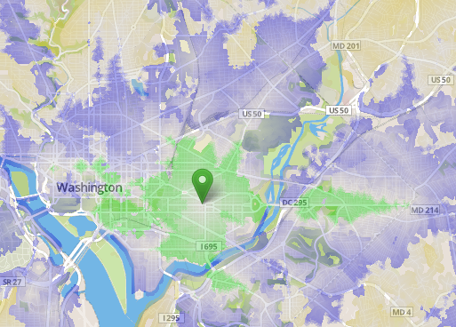
DcTime2.png (513 × 368 pixels, file size: 262 KB, MIME type: image/png)
"Travel times from a point in central Washington, DC. Each color bands represents 30 minutes." generated using OpenTripPlanner software.
File history
Click on a date/time to view the file as it appeared at that time.
| Date/Time | Thumbnail | Dimensions | User | Comment | |
|---|---|---|---|---|---|
| current | 05:03, 21 April 2013 | | 513 × 368 (262 KB) | PatSunter (talk | contribs) | "Travel times from a point in central Washington, DC. Each color bands represents 30 minutes." generated using OpenTripPlanner software. Source: http://opentripplanner.com/2012/07/visualizing-urban-accessibility-with-opentripplanner-analyst |
You cannot overwrite this file.
File usage
The following 2 pages use this file: