
Size of this preview: 800 × 527 pixels. Other resolution: 1,512 × 996 pixels.
Original file (1,512 × 996 pixels, file size: 1.44 MB, MIME type: image/png)
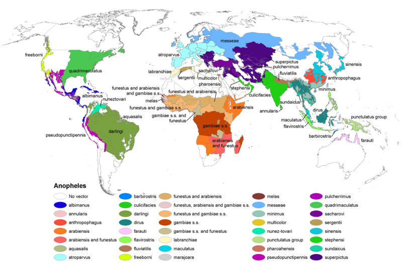
Anopheles mosquito range map. Map made by Centers for Disease Control and Prevention, part of the United States Department of Health and Human Services. The map was taken from http://commons.wikimedia.org/wiki/File:Anopheles-range-map.png
File history
Click on a date/time to view the file as it appeared at that time.
| Date/Time | Thumbnail | Dimensions | User | Comment | |
|---|---|---|---|---|---|
| current | 15:00, 24 May 2013 | | 1,512 × 996 (1.44 MB) | KVDP (talk | contribs) | Anopheles mosquito range map. Map made by Centers for Disease Control and Prevention, part of the United States Department of Health and Human Services. The map was taken from http://commons.wikimedia.org/wiki/File:Anopheles-range-map.png |
You cannot overwrite this file.
File usage
The following file is a duplicate of this file (more details):
- File:Anopheles-range-map.png from Wikimedia Commons
The following page uses this file: