 ‘A game-changer’: the 9,000 acre project reclaiming the Fens for nature, theguardian.com (Nov 04, 2023)
  Pumping hot: inside Britain’s first heat pump village, positive.news (Jul 12, 2023)
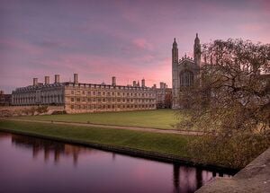
Cambridgeshire is a county in the East of England, bordering Lincolnshire to the north, Norfolk to the north-east, Suffolk to the east, Essex and Hertfordshire to the south, and Bedfordshire and Northamptonshire to the west. The city of Cambridge is the county town. W
Climate action[edit | edit source]
Biodiversity[edit | edit source]
The Wildlife Trust for Bedfordshire, Cambridgeshire and Northamptonshire (WTBCN) is a registered charity which manages 126 nature reserves covering 3,945 hectares (15.23 square miles). It has over 35,000 members, and 95% of people in Bedfordshire, Cambridgeshire and Northamptonshire live within five miles of a reserve. In the year to 31 March 2016 it employed 105 people and had an income of £5.1 million. It aims to conserve wildlife, inspire people to take action for wildlife, offer advice and share knowledge. The WTBCN is one of 36 wildlife trusts covering England, and 46 covering the whole of the United Kingdom.
- Wildlife Trust for Bedfordshire, Cambridgeshire and Northamptonshire
- Nature reserves in Cambridgeshire (category) W
Open spaces[edit | edit source]
Cambridgeshire contains all its green belt around the city of Cambridge, extending to places such as Waterbeach, Lode, Duxford, Little & Great Abington and other communities a few miles away in nearby districts, to afford a protection from the conurbation. It was first drawn up in the 1950s.
Communities online[edit | edit source]
Cambridgeshire.net community directory - South Cambridge
Cycling activism[edit | edit source]
National Cycle Routes in and around Cambridgeshire include: Route 11: connecting Harlow in Essex to King's Lynn in Norfolk, via Cambridge W; Route 12: incomplete but when fully constructed it will run from Enfield Lock (London) to Grimsby (Lincolnshire) via Peterborough W; and Route 51: connecting Colchester and the port of Harwich to Oxford via Cambridge W
Sustainable transport activism[edit | edit source]
Walking: Footpaths in Cambridgeshire (category) W
Video[edit | edit source]
- Open Eco Homes on cambridgecarbonfootprint.org, "free home energy advice and information hub which has inspired thousands of Cambridgeshire residents to improve their home energy efficiency over the last 14 years." added 13:07, 18 November 2023 (UTC)
News and comment[edit | edit source]
2019
Sleepy Cambridgeshire village invites Swedish climate experts to help tackle climate emergency, Oct 30[1]
Mind over natter: the English town with a big mental health plan, Sep 11[2]
Cambridgeshire organisation launches radical response to climate emergency, Jun 13[3]
Need to sign on? You'll have to walk 24 miles to the jobcentre, Jan 7[4]
2018
This disastrous new project will change the face of Britain, yet no debate is allowed, George Monbiot, Aug 22[5]
2017
South Cambs repair cafés hailed a success, Jan 15[6]
Soham solar power farm produces electricity for first time, Jan 2[7]
Near you[edit | edit source]
Cambridge community action - Peterborough community action
External links[edit | edit source]
Cambridgeshire W
